13 m away
Hohe Villerspitze via Villergrubn

An adventures route with easy alpine climbing through a picturesque part of the stubai alps.
Severe Hiking
- Distance
- 9 km
- Ascent
- 1.3 km
- Descent
- 1.3 km
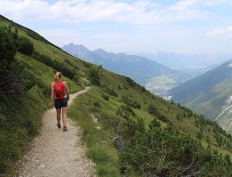
A classic there-and-back hike to a dramatic peak
Hiking Severe

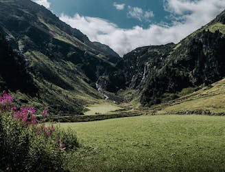
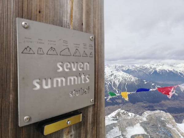
Probably the least known of the Stubai 7 summits, the Rinnensptize should really see much more traffic. It's a beautiful peak and is perched right in the middle of some spectacular glaciated summits.
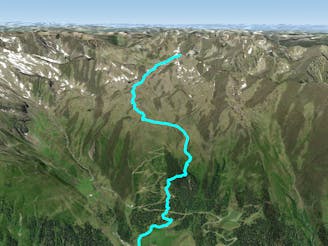
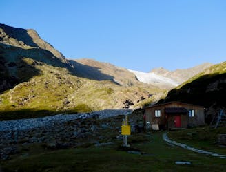
From Oberissalm follow the well signposted hiking path for around 1hr15minutes to arrive at the Franz-Senn Hütte. The hike to the Franz-Senn Hütte is initially quite strenuous but soon eases off and the second half of it is mainly a pleasant traverse.
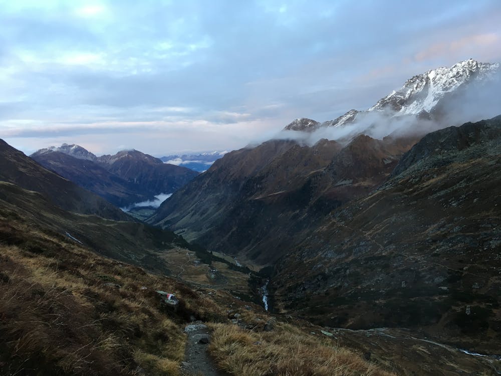
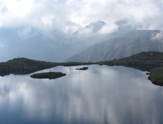
After taking some refreshment at the hut head due north and then follow an unrelenting path that climbs up into increasingly wild-feeling mountain terrain. Eventually the path leads to a slightly flatter area beneath and east of the Rinnensee lake. From the flat area onwards the path is much rockier and passes through a series of boulder fields. The Rinnensee itself is stunning and looks appealing to swim in...The reality may be less enjoyable than the prospect of it!
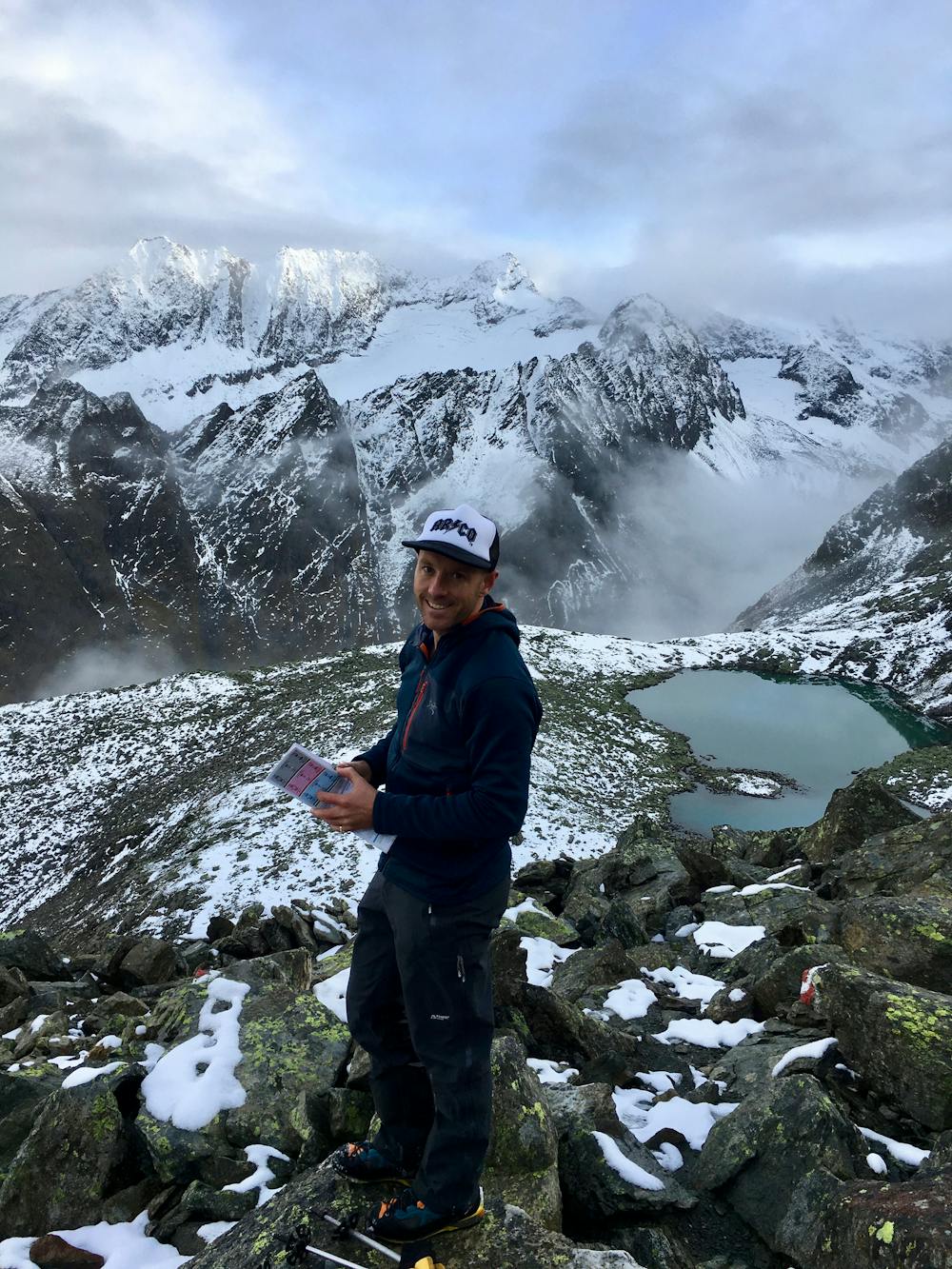
Once above the lake the path gets steeper and steeper through ever rockier terrain. The path crests the Rinnenspitze's north ridge about 50 metres from the summit and all that is left is a fun scramble to the top. There is a pretty major drop on either side of the ridge so whilst there's nothing technical, it's well advised to keep concentrating all the way to the summit!
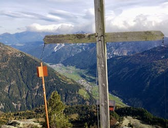
The view down to the Lisenser Ferner glacier and the peaks surrounding it is fantastic, and the Rinnenspitze also offers a great panorama across the many peaks that can be climbed (or ski toured) from the Franz Senn Hütte.
Having soaked it all in, return via the ascent route all the way down to Oberissalm.
Severe
Hiking challenging trails where simple scrambling, with the occasional use of the hands, is a distinct possibility. The trails are often filled with all manner of obstacles both small and large, and the hills are very steep. Obstacles and challenges are often unexpected and can be unpredictable.

Some trail sections have exposed ledges or steep ascents/descents where falling could cause serious injury.
Little chance of being seen or helped in case of an accident.
13 m away
An adventures route with easy alpine climbing through a picturesque part of the stubai alps.
Severe Hiking
3.7 km away

This route is made for everyone who loves easy ridge hiking.
Difficult Hiking
4.9 km away
Summit a peak in the heart of the Stubaital and visit one of the area's best mountain huts
Severe Hiking
7.6 km away
Sunny hike up to a picturesque summit passing a fabulous mountain lake.
Moderate Hiking
7.9 km away
A family friendly hike to a traditional hut alongside the Längental stream.
Easy Hiking
8.7 km away
A great day hike on its own or the first part of an epic 3 day adventure.
Moderate Hiking
9.3 km away
A family hike with scenic views into the higher mountains.
Easy Hiking
9.7 km away
Hiking round to one of the most beautiful mountain lakes in the Austrian alps.
Difficult Hiking
9.9 km away
A wonderful, mid-length, circular hike with impressive scenery through the dramatic peaks of the Stubai Valley.
Difficult Hiking
9 routes · Alpine Climbing · Hiking

25 routes · Hiking
3 routes · Mountain Biking · Hiking
7 routes · Hiking