438 m away
Geisleger

A classic Albona long wide open run finishing in the town of Stuben.
Moderate Freeride Skiing
- Distance
- 3.9 km
- Ascent
- 50 m
- Descent
- 1 km
Another classic at the Albona with an abundance of options.
Also in Tirol, Austria
Freeride Skiing Difficult

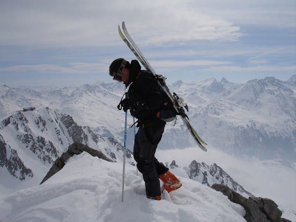
Leaving the Albona Bahn lookers right towards Albonagratstube. Once you reach the hut, turn 180 degrees (looking south), the peak you face is the Moroikopf. It has two peaks, one on the left (east, one on the right (west). You need skins from here. If the track is well set it can be done as a boot pack. I have seen people do it, but it looks painful. The ascent takes some 30-40 minutes with the first patch being fairly flat until you reach the bottom of the pyramid. From here zig-zag up often following tracks until you reach the peak.
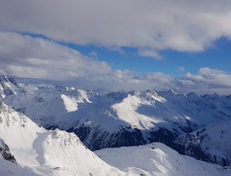
The classic descent first goes South-West and gradually tilts West over wide open spaces. The sprinkled boulders become less frequent once you reach the meadows.
As you ski down further, you see the valley of the Albonabach, a creek flowing through the valley we follow all the way to Langen. There is a short patch where we need to navigate a small rock-band with a mini waterfall. Route finding is obvious, but - depending on the snow conditions - might require some side-stepping. Below we reach the beautiful lower part of the valley taking us all the way to Langen, spitting us out below the road. The bus stop (from where we get back to Stuben) is lookers right slightly up the road. Excluding a patch skiers left and directly right of the waterfall, the entire face is rideable.
The upper part has plenty of alternatives. In solid snow conditions, you can turn skiers right fairly early on and drop over a ridge towards Kaltenberghuette: https://fatmap.com/routeid/2761816/kaltenbachhutte?fmid=cp At times the rigde has little snow due to wind blowing it away. Once below the ridge, just go straight. Stay lookers right of the cliffs to get down to the valley leading to Langen.
Difficult
Serious gradient of 30-38 degrees where a real risk of slipping exists.

In case of a fall, death is highly likely.

Away from help but easily accessed.
438 m away
A classic Albona long wide open run finishing in the town of Stuben.
Moderate Freeride Skiing
672 m away

An Arlberg classic run for experienced skiers and riders.
Difficult Freeride Skiing
1.5 km away

A great run in powder and spring snow.
Difficult Freeride Skiing
3.6 km away

An enjoyable south facing run over St.Christoph.
Moderate Freeride Skiing
4.2 km away

Superb long run with often deep powder.
Difficult Freeride Skiing
4.8 km away
Freeride tour for skiers & split-boarders
Difficult Freeride Skiing
4.8 km away

Challenging terrain for the experienced on leeside slopes.
Severe Freeride Skiing
5.6 km away

A superb wide open run with great views. A classic Zurs freeride.
Difficult Freeride Skiing
5.7 km away

A nice moderate open run down to Zurs-worth the traverse.
Moderate Freeride Skiing
5.9 km away

A good run for dry powder in the Zurs front country.
Moderate Freeride Skiing
10 routes · Freeride Skiing