175 m away
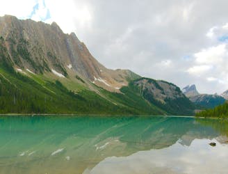
Lake O'Hara Shoreline Loop
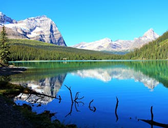
Simple loop around the lake, but with extraordinary views.
Easy Hiking
- Distance
- 2.7 km
- Ascent
- 53 m
- Descent
- 53 m
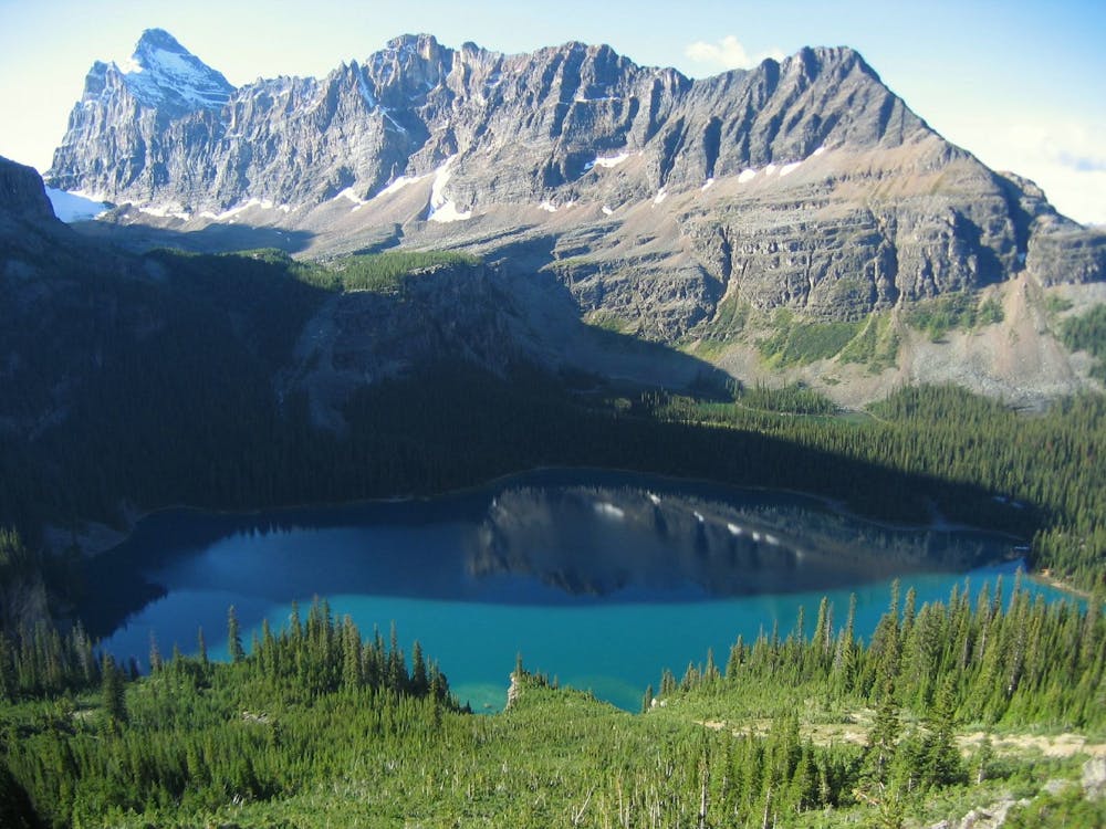
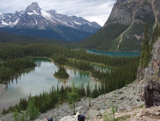
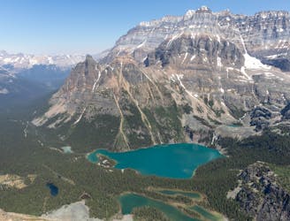
An epic day hike almost entirely above treeline, connecting proud overlooks and smaller lakes above Lake O'Hara.
Hiking Severe

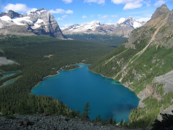
Widely regarded as one of the best day hikes in the region, this challenging circuit is loaded with scenery every step of the way. With glacial lakes tucked in secluded valleys, commanding views from elevated ledges, and sky-high peaks all around, the experience is truly worth the work.

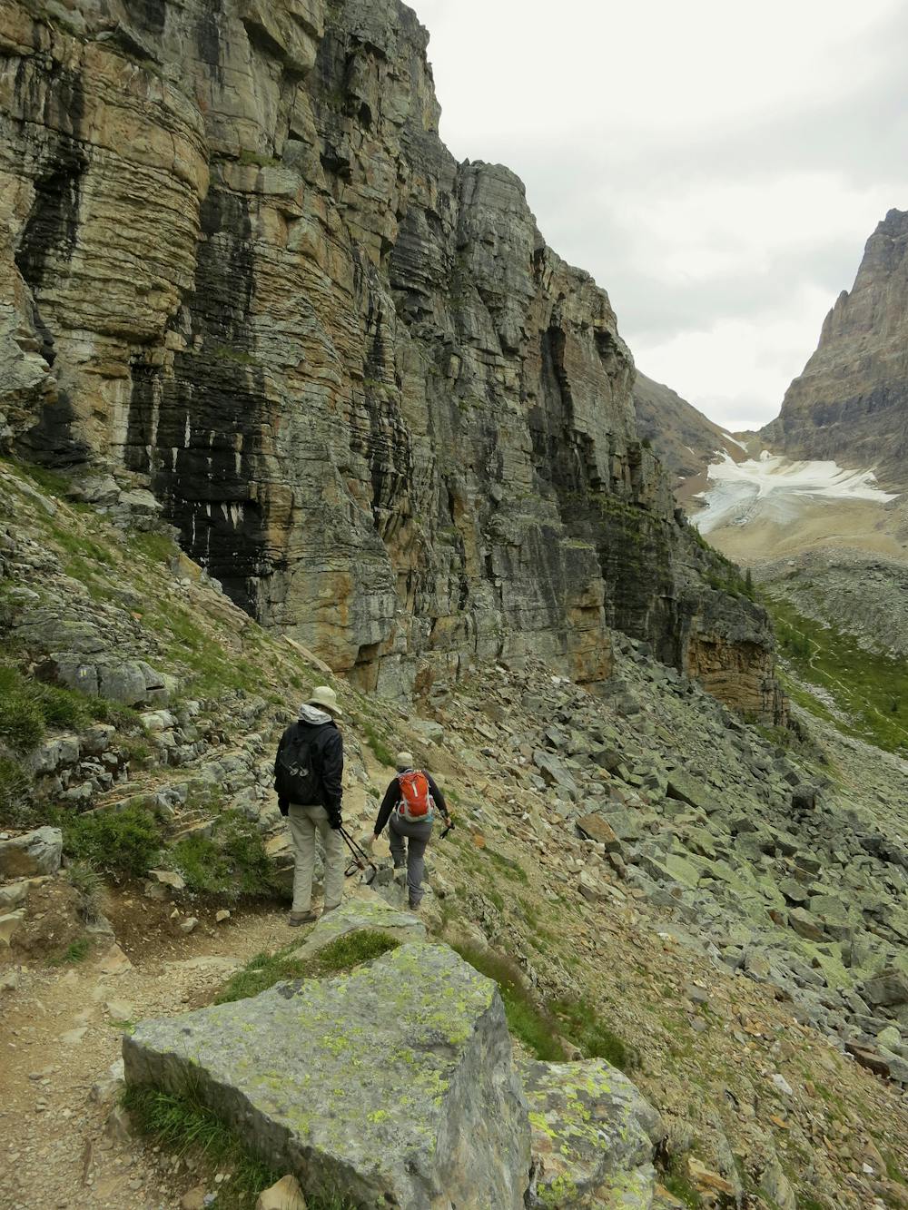
The first difficulty is getting to Lake O’Hara, which requires a bus reservation or walking the 11-km dirt road. Then comes a grueling uphill hike to start the circuit. You can complete it in either direction, but most people choose to knock out the 500-meter climb to Wiwaxy Gap first. This makes the rest of the hike feel mostly downhill.
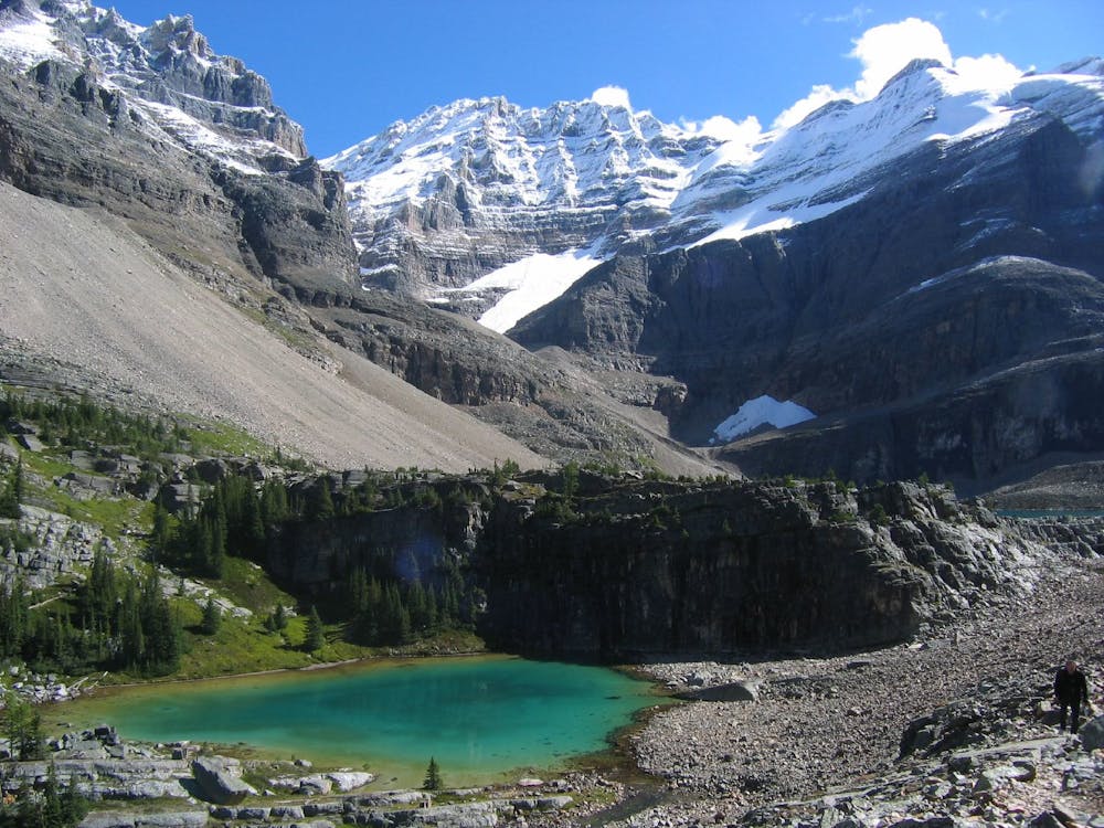
For the rest of the hike from Wiwaxy Gap, you’ll share the terrain with the mountain goats as the route follows a series of ledges across scree-strewn slopes and gullies, and you’ll use your hands in places for stability. Where navigation gets tricky, look closely for blue-and-yellow paint markings on rocks. As you work your way around the perimeter of the basin, smaller valleys with their own lakes, like Lake Oesa and then Hungabee Lake, provide some reprieve to the difficult hiking.
There are multiple opportunities to bail from the alpine route and descend to Lake O’Hara, in case you find yourself short on time or energy. The side trails are marked by signs and visible on the map. Most people find the hiking on this circuit to be slower than expected, but that’s not so bad if you think of it as extra time to relish the surroundings. Just be sure to get an early start if you don’t want to finish in the dark. Camping is not allowed anywhere along the circuit, except for the designated campground at Lake O’Hara. Other overnight options are the Lake O’Hara Lodge or the Elizabeth Parker Hut. All require reservations, so plan ahead.
Sources: https://www.pc.gc.ca/en/pn-np/bc/yoho/activ/randonnee-hike/ohara/visit https://www.pc.gc.ca/en/pn-np/bc/yoho/activ/randonnee-hike/ohara/sentiers-trails https://modernhiker.com/hike/lake-ohara-alpine-circuit/ https://adventurephd.com/hiking-lake-ohara-alpine-circuit-trail/
Severe
Hiking challenging trails where simple scrambling, with the occasional use of the hands, is a distinct possibility. The trails are often filled with all manner of obstacles both small and large, and the hills are very steep. Obstacles and challenges are often unexpected and can be unpredictable.

Some trail sections have exposed ledges or steep ascents/descents where falling could cause serious injury.
Little chance of being seen or helped in case of an accident.
175 m away
Simple loop around the lake, but with extraordinary views.
Easy Hiking
175 m away
The most direct route to the single best viewpoint over Lake O'Hara.
Difficult Hiking
595 m away
One of the more challenging routes at Lake O'Hara with no shortage of amazing views.
Extreme Hiking
9.3 km away
A mountainside view of surrounding peaks and two expansive river valleys.
Difficult Hiking
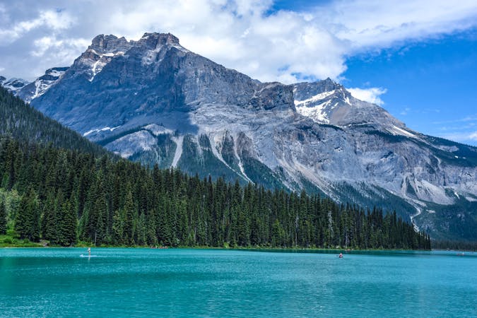
9.3 km away
Forest hike to a lake in a valley surrounded by peaks and streaked by avalanche paths.
Moderate Hiking
4 routes · Hiking
4 routes · Hiking
7 routes · Hiking
5 routes · Hiking
4 routes · Hiking