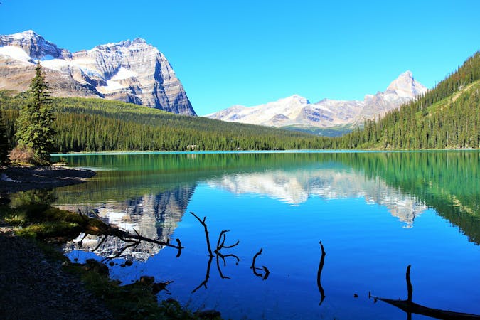
Lake O'Hara Shoreline Loop
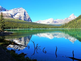
Simple loop around the lake, but with extraordinary views.
Easy Hiking
- Distance
- 2.7 km
- Ascent
- 53 m
- Descent
- 53 m
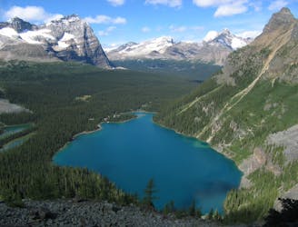
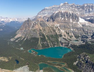
The most direct route to the single best viewpoint over Lake O'Hara.
Hiking Difficult

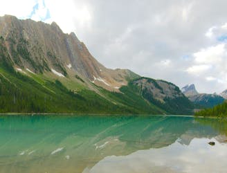
If you don’t have time for the full Lake O’Hara Alpine Circuit, or if you just want the quickest hike to an epic photo location, here it is. Opabin Prospect is a rock ledge jutting out to a jaw-dropping view over Lake O’Hara and its neighbor lakes. It just might be the ultimate selfie spot (but mind the cliff edge!). Opabin Prospect has become somewhat well-known thanks to social media, but its remoteness ensures that you won’t share it with too many people at once.
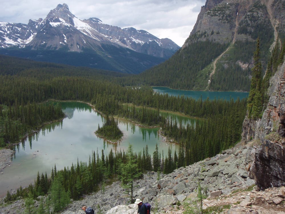
There are multiple ways to reach Opabin Prospect, but the most direct route is what’s mapped here. From the Lake O’Hara Lodge area, start along the lakeshore trail and continue onto West Opabin Trail. It makes a slight climb through the forest to find the shore of a smaller lake, which is one that you’ll soon see from high above. The work comes just after this lake, when the trail climbs steeply to the Opabin Plateau. It’s short but strenuous, and once on top, you’ll find relief in a relatively flat walk to the viewpoint. Before you know it, you’ll emerge from the trees and onto the cliff top.
The simplest return is to go back the way you came, but with extra time and energy you might follow the Circuit Trail to explore several small lakes atop the plateau. You can also complete a longer loop with another trail to return to the O’Hara lakeshore.
Sources: https://funlifecrisis.com/hiking-guide-lake-ohara/ https://travelwiththesmile.com/blog/lake-ohara-hiking-camping-guide/
Difficult
Hiking trails where obstacles such as rocks or roots are prevalent. Some obstacles can require care to step over or around. At times, the trail can be worn and eroded. The grade of the trail is generally quite steep, and can often lead to strenuous hiking.

Some trail sections have exposed ledges or steep ascents/descents where falling could cause serious injury.

Away from help but easily accessed.
Simple loop around the lake, but with extraordinary views.
Easy Hiking
175 m away
An epic day hike almost entirely above treeline, connecting proud overlooks and smaller lakes above Lake O'Hara.
Severe Hiking
767 m away
One of the more challenging routes at Lake O'Hara with no shortage of amazing views.
Extreme Hiking
9.4 km away
A mountainside view of surrounding peaks and two expansive river valleys.
Difficult Hiking
9.4 km away
Forest hike to a lake in a valley surrounded by peaks and streaked by avalanche paths.
Moderate Hiking
4 routes · Hiking

4 routes · Hiking
7 routes · Hiking
5 routes · Hiking
4 routes · Hiking