853 m away
Tour du Mont Blanc: Merlet to Bellevue

While one of the less interesting sections of the TMB, this stretch still offers a few hidden trail gems.
Moderate Hiking
- Distance
- 13 km
- Ascent
- 1 km
- Descent
- 723 m
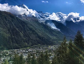
A pleasant hike with views of the Mont Blanc Massif
Hiking Moderate

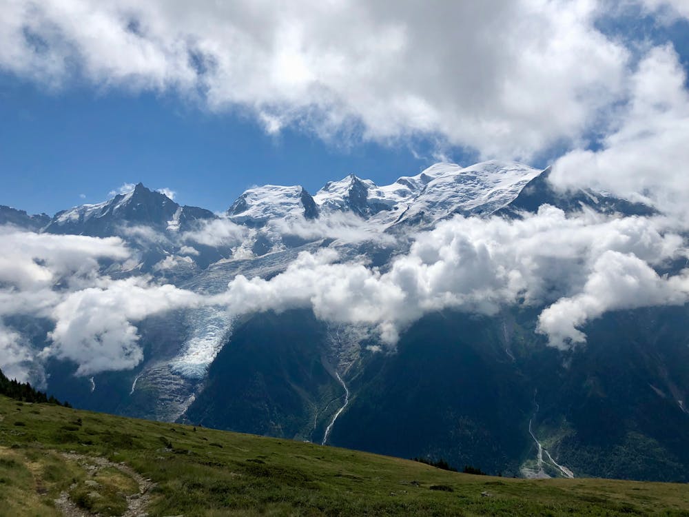
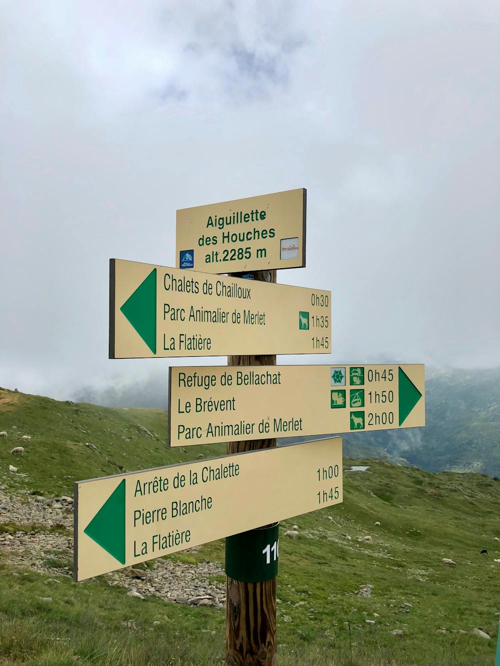
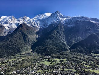
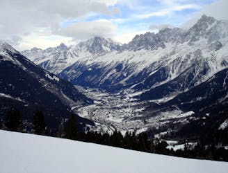
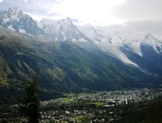
The normal starting point to reach the Aiguillette des Houches is from the parking lot “Chemin de Merlet,” located around 500 meters above Les Houches, and offers the advantage of not having to hike too far before reaching incredible views of the famous Mont Blanc Massif on the opposite side of the Chamonix Valley. However, it is also possible to hike up from the bottom of the valley if desired. An overall pleasant hike, it provides with easy terrain, different kinds of vegetation, and a great view at the top!
The hike in total ascends more than 800 meters, but still, the path is pretty friendly. This means there can be people of all ages on the trail, hiking at different paces—from hikers with heavy loads on a longer trip, to trail runners with a small pack.
After parking the car at the parking lot, the path starts off on a forest trail up through the trees. Be aware of roots and rocks on this first part. Further up, passing the tree line, the trail leads on through grassy and open terrain. Here, the stunning views appear! Located at 1930 m.a.s.l. there is a small hut offering snacks and drinks to purchase by cash.
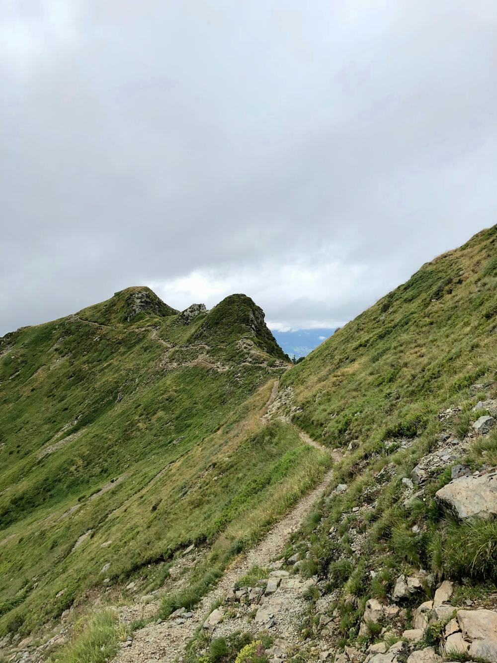
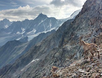
Upon reaching the top, additional views of the northern mountain peaks emerge, including the massive rock wall of Tête á l’ ne, 2804 m.a.s.l. From this point, it is possible to continue along the ridge to prolong the experience and keep on taking in the beautiful natural surrounding.
To return to your car, take the same path back down.
Moderate
Hiking along trails with some uneven terrain and small hills. Small rocks and roots may be present.

The trail contains some obstacles such as outcroppings and rock which could cause injury.

Close to help in case of emergency.
853 m away
While one of the less interesting sections of the TMB, this stretch still offers a few hidden trail gems.
Moderate Hiking
1.1 km away
Easy hike to the statue du Christ-Roi.
Moderate Hiking
2.1 km away
A challenging loop showcasing the diversity of the Mont Blanc mountain range.
Severe Hiking
3.2 km away
A famous hike which was the starting point for Jacques Balmat and Michel Paccard when they made the first ascent of Mont Blanc in 1786.
Difficult Hiking
3.7 km away

Day 1: A gentle downhill day on the sun-kissed south-facing slopes of the Brévent peak.
Moderate Hiking
3.7 km away

Circumnavigate the iconic Mont Blanc massif on this epic multi-day route.
Severe Hiking
4.4 km away
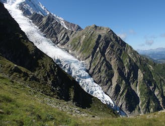
Day 2: An excellent day taking in a huge variety of views, from alpine meadows to hanging glaciers and rocky ridges.
Difficult Hiking
4.6 km away

Escape the crowds at Lac Blanc by hiking to Lac Cornu instead.
Severe Hiking
5.1 km away
A short and pleasant hike up to a picturesque little mountain hut.
Moderate Hiking
5.4 km away
A classic loop around the Chamonix Valley.
Moderate Hiking

6 routes · Hiking

14 routes · Hiking

5 routes · Hiking

12 routes · Hiking