1 km away
Christ-Roi
Easy hike to the statue du Christ-Roi.
Moderate Hiking
- Distance
- 2.4 km
- Ascent
- 197 m
- Descent
- 197 m
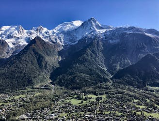
A challenging loop showcasing the diversity of the Mont Blanc mountain range.
Hiking Severe

This route takes you on a loop from the center of Les Houches to the Tête Rousse Hut, giving you the chance to see climbers up close on their Mont Blanc attempt.
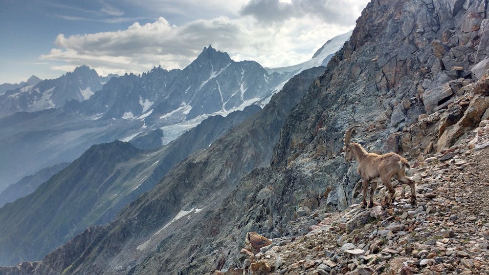
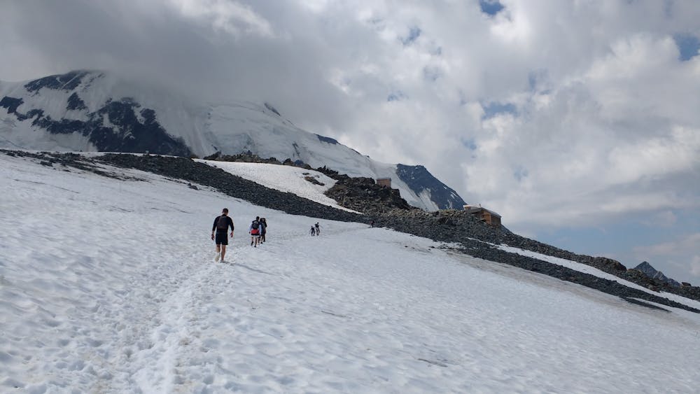
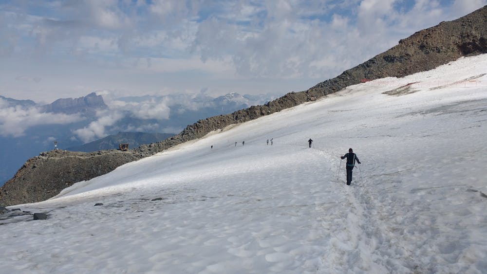
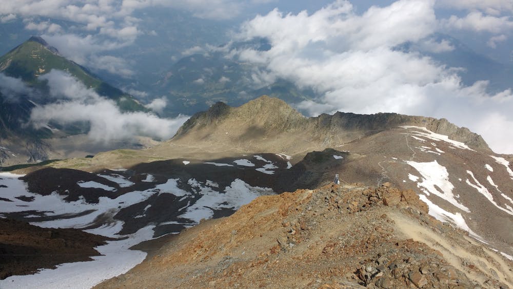
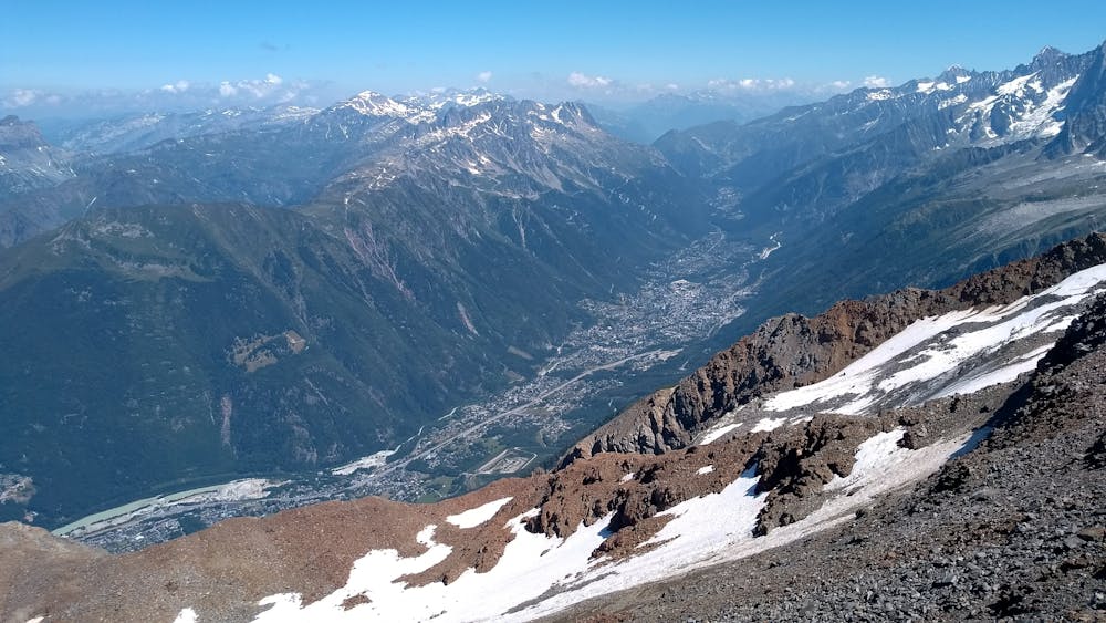
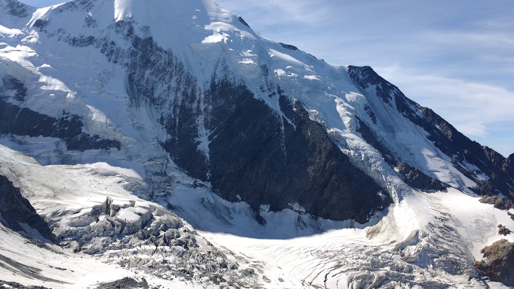
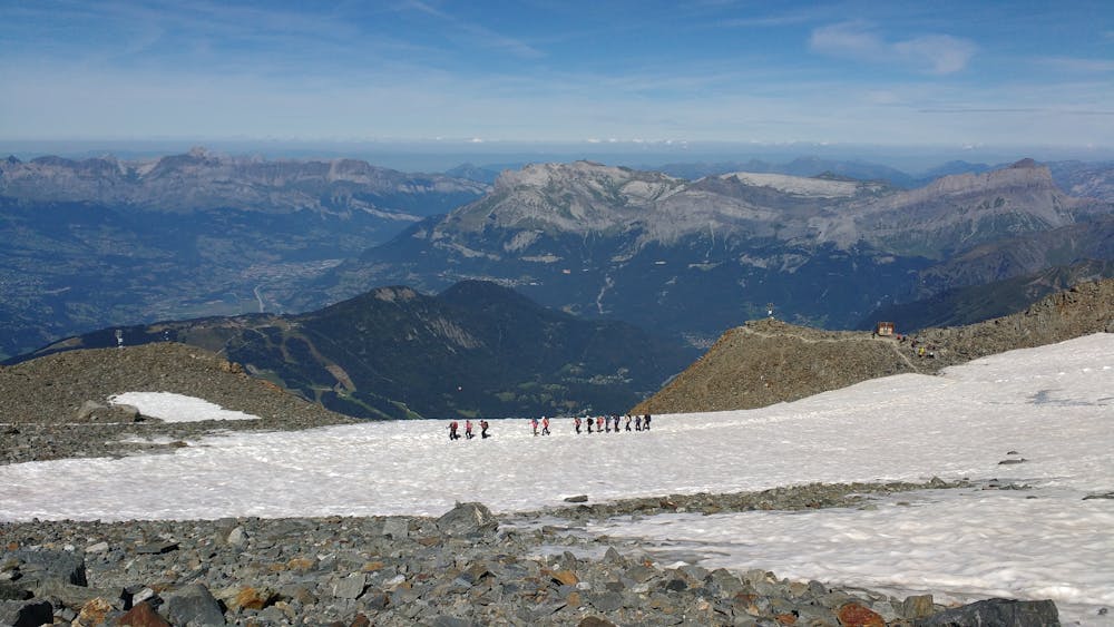
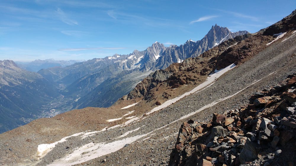
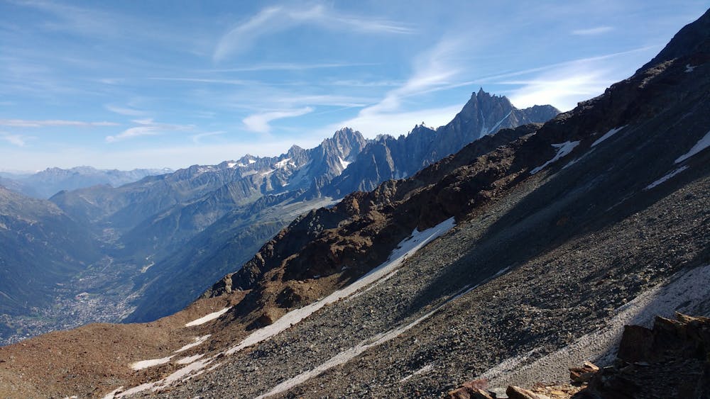
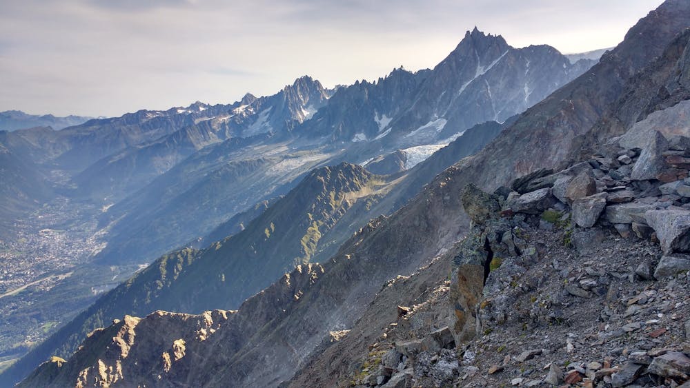
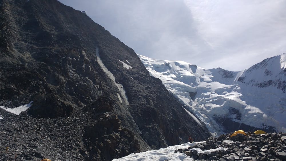
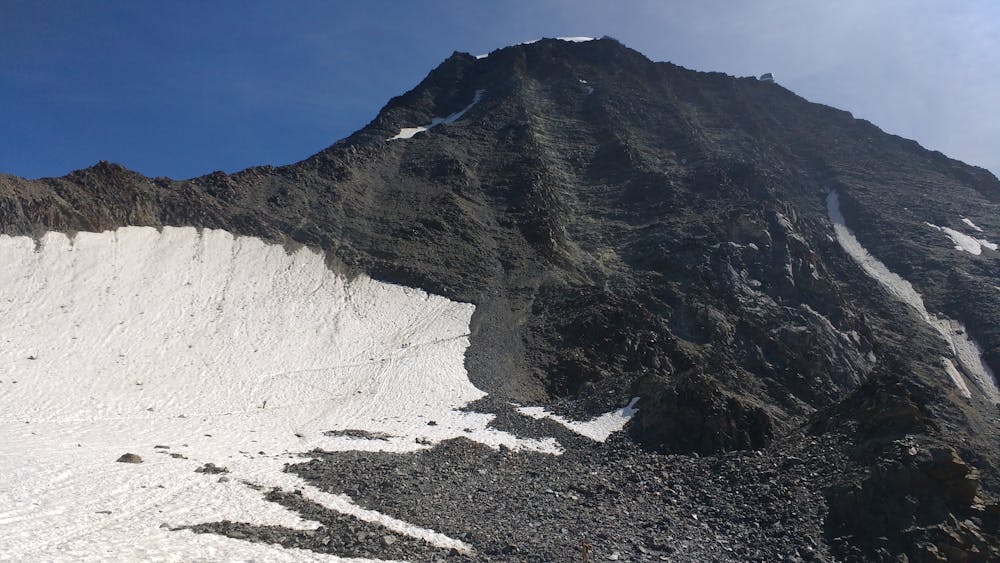
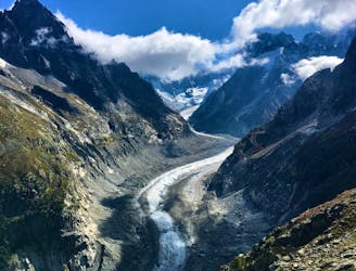
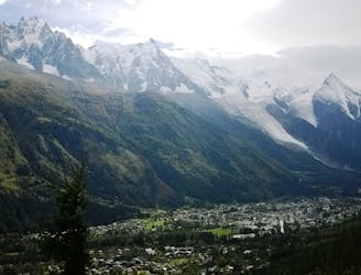
Going up, you will take the "Chemin des Rognes," a recently rehabilitated trail that provides a quieter (but more technical) alternative to the classic Nid d'Aigle route. Enjoy the calm and the amazing view of the Chamonix Valley, because once you reach the Baraque des Rognes at 2800m, expect bigger crowds. At Tête Rousse, watch as climbers tackle the infamous Couloir du Goûter and enjoy the view of the surrounding peaks and glaciers. Keep following the trail on the way to Bellevue
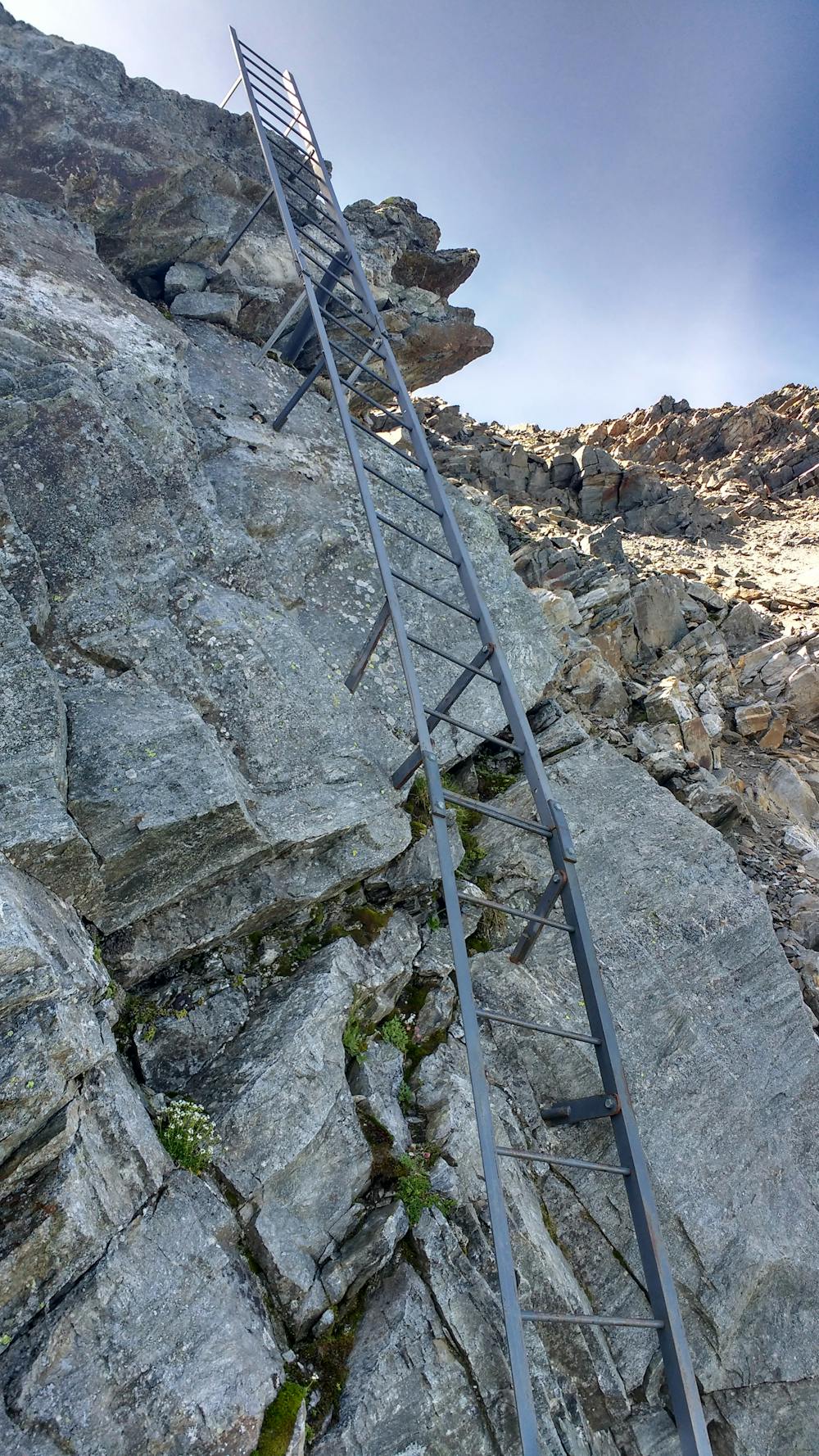
When you're ready for the climb down, retrace your steps before taking the trail down to the Nid d'Aigle hut, where you'll have the opportunity to get closer to the Bionnassay Glacier. From there, just after a steep bit with some ladders, the trail becomes easier until Bellevue, where the final descent towards Les Houches starts.
A number of alternative routes are available; here you'll follow the old route used by the TDS trail race.
Severe
Hiking challenging trails where simple scrambling, with the occasional use of the hands, is a distinct possibility. The trails are often filled with all manner of obstacles both small and large, and the hills are very steep. Obstacles and challenges are often unexpected and can be unpredictable.

Some trail sections are extremely exposed where falling will almost certainly result in serious injury or death.

Away from help but easily accessed.
1 km away
Easy hike to the statue du Christ-Roi.
Moderate Hiking
2.1 km away
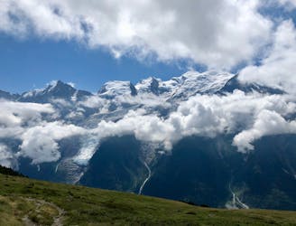
A pleasant hike with views of the Mont Blanc Massif
Moderate Hiking
2.2 km away
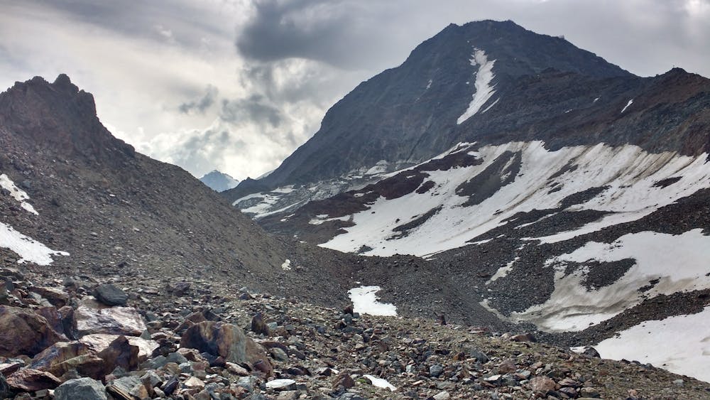
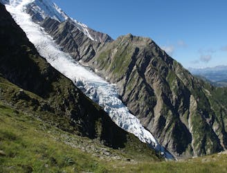
Day 2: An excellent day taking in a huge variety of views, from alpine meadows to hanging glaciers and rocky ridges.
Difficult Hiking
2.9 km away

While one of the less interesting sections of the TMB, this stretch still offers a few hidden trail gems.
Moderate Hiking
4 km away
A famous hike which was the starting point for Jacques Balmat and Michel Paccard when they made the first ascent of Mont Blanc in 1786.
Difficult Hiking
5.8 km away

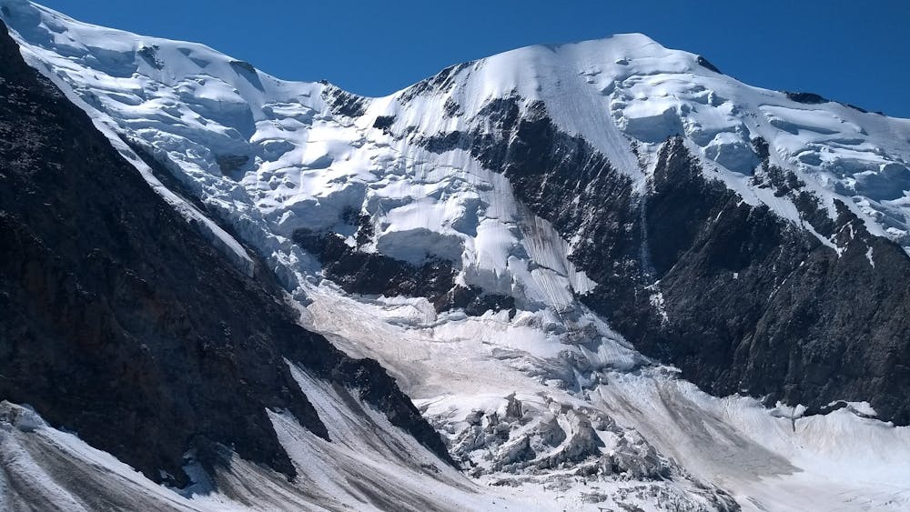
Circumnavigate the iconic Mont Blanc massif on this epic multi-day route.
Severe Hiking
5.8 km away

Day 1: A gentle downhill day on the sun-kissed south-facing slopes of the Brévent peak.
Moderate Hiking
6.7 km away

Escape the crowds at Lac Blanc by hiking to Lac Cornu instead.
Severe Hiking
6.9 km away
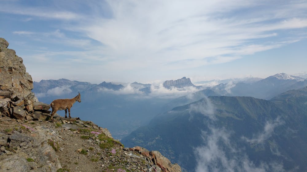
Packed with incredible views—likely the best bang-for-your-buck hike in Chamonix!
Difficult Hiking
7 km away
A short and pleasant hike up to a picturesque little mountain hut.
Moderate Hiking

6 routes · Hiking

14 routes · Hiking

5 routes · Hiking

12 routes · Hiking

10 routes · Hiking