615 m away
La Jonction
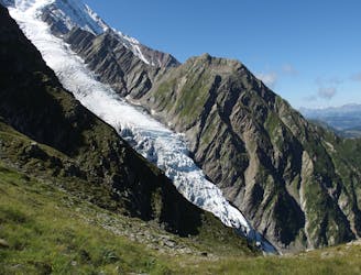
A famous hike which was the starting point for Jacques Balmat and Michel Paccard when they made the first ascent of Mont Blanc in 1786.
Difficult Hiking
- Distance
- 12 km
- Ascent
- 1.3 km
- Descent
- 1.3 km
One of the most famous hikes in the Alps!
Hiking Moderate

La Jonction is the ultimate trail that hikers dream of. A tough climb to get the adrenalin pumping, sprinkled with historical significance and an epic view.
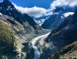
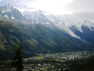
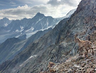
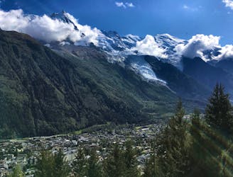
La Jonction (The Junction) is one of the classics of the Mont Blanc Massif and the Chamonix Valley. This itinerary offers a staggering view of the Aiguille du Midi, the Dôme du Gôuter as well as the Aiguilles Rouges. La Jonction constitutes an exceptional site as it gives close view towards two glaciers from where you can observe their seracs and crevasses in an enchanting environment. The high elevation gain represents the sole difficulty of the hike.
From the car park, take the trail going inside the forest, sign “La Jonction”.
Moderate
Hiking along trails with some uneven terrain and small hills. Small rocks and roots may be present.
615 m away
A famous hike which was the starting point for Jacques Balmat and Michel Paccard when they made the first ascent of Mont Blanc in 1786.
Difficult Hiking
2.1 km away

While one of the less interesting sections of the TMB, this stretch still offers a few hidden trail gems.
Moderate Hiking
2.7 km away
A pleasant hike with views of the Mont Blanc Massif
Moderate Hiking
3.2 km away
Packed with incredible views—likely the best bang-for-your-buck hike in Chamonix!
Difficult Hiking
3.3 km away
Easy hike to the statue du Christ-Roi.
Moderate Hiking
3.6 km away
A short and pleasant hike up to a picturesque little mountain hut.
Moderate Hiking
3.8 km away
A challenging loop showcasing the diversity of the Mont Blanc mountain range.
Severe Hiking
3.9 km away

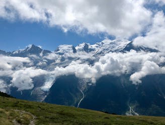
Circumnavigate the iconic Mont Blanc massif on this epic multi-day route.
Severe Hiking
3.9 km away

Day 1: A gentle downhill day on the sun-kissed south-facing slopes of the Brévent peak.
Moderate Hiking
4.1 km away
A classic loop around the Chamonix Valley.
Moderate Hiking

6 routes · Hiking

14 routes · Hiking

5 routes · Hiking

12 routes · Hiking

10 routes · Hiking