1 m away
Pylones

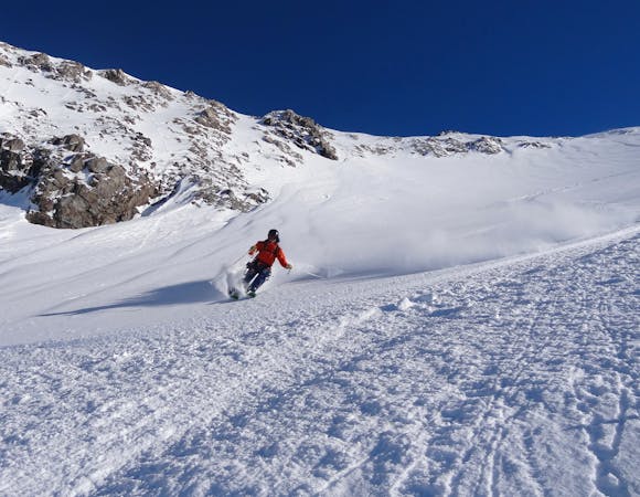
Frequent moguls on this line under the lift pylons
Difficult Freeride Skiing
- Distance
- 2.8 km
- Ascent
- 38 m
- Descent
- 1 km
A relatively straight forward run down the lower slopes
Freeride Skiing Difficult

More of a sector than a line, The Clairieres area is relatively straight forward ski from the mid-station of La Grave. You can choose between North Easterly and more Easterly terrain, but due to the lower altitude and exposition it can heat up very quickly. From the mid-station, you can ski parallel to the cables for a short while before picking up the main bowl, or head further skiers right straight from the lift. Make sure you pick up the long traverse back to the lift through the forest or you'll be walking.
Difficult
Serious gradient of 30-38 degrees where a real risk of slipping exists.

As well as the slope itself, there are some obstacles (such as rock outcrops) which could aggravate injury.
Away from help but easily accessed.
1 m away
Frequent moguls on this line under the lift pylons
Difficult Freeride Skiing
20 m away

A fun line through the trees
Difficult Freeride Skiing
55 m away

A short hike gives access to some good skiing
Difficult Freeride Skiing
1.1 km away

A wild adventure and 800m long couloir
Severe Freeride Skiing
1.6 km away

A good introduction to couloir skiing
Difficult Freeride Skiing
1.7 km away

One of the best known La Grave Couloirs - a classic
Severe Freeride Skiing
2.2 km away

Classic La Grave couloir skiing
Severe Freeride Skiing
2.2 km away

A variation on the classic Grand Couloir
Severe Freeride Skiing
2.4 km away

Another steeper, more serious variant of the Trifides couloirs
Extreme Freeride Skiing
2.4 km away

A direct variation on the La Grave classic
Difficult Freeride Skiing
5 routes · Freeride Skiing

15 routes · Freeride Skiing · Ski Touring