777 m away
Couloir du Lac

A good introduction to couloir skiing
Difficult Freeride Skiing
- Distance
- 292 m
- Ascent
- 0 m
- Descent
- 183 m
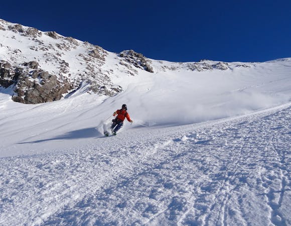
A wild adventure and 800m long couloir
Freeride Skiing Severe

A great adventure away from from the lift served area, down an 800m long, steep, narrow couloir. The route ends at the village of Les Freaux and you will need to hitch back to La Grave or arrange transport to avoid a long walk back. Start down the classic Chancel route or the couloirs above the lake. After the lake, head straight down towards the forest and towards two narrow gullies - take the left hand one. The couloir is relatively mellow at the start but narrows and gets much steeper. Head slightly skiers right in to the forest towards the bottom to stay on the right ride of the couloir. Use the bridge over the Romanche towards the village of Les Freaux. Warning - the bottom of the couloir can often be filled with avalanche debris. The right hand couloir can also sometimes be skied but is often a waterfall - check before you go.
Severe
Steep skiing at 38-45 degrees. This requires very good technique and the risk of falling has serious consequences.

As well as the slope itself, there are some obstacles (such as rock outcrops) which could aggravate injury.

Little chance of being seen or helped in case of an accident.
777 m away
A good introduction to couloir skiing
Difficult Freeride Skiing
1 km away

A short hike gives access to some good skiing
Difficult Freeride Skiing
1 km away

A fun line through the trees
Difficult Freeride Skiing
1.1 km away

A relatively straight forward run down the lower slopes
Difficult Freeride Skiing
1.1 km away

Frequent moguls on this line under the lift pylons
Difficult Freeride Skiing
1.2 km away

One of the best known La Grave Couloirs - a classic
Severe Freeride Skiing
1.6 km away

Classic La Grave couloir skiing
Severe Freeride Skiing
2 km away

A variation on the classic Grand Couloir
Severe Freeride Skiing
2.1 km away

A direct variation on the La Grave classic
Difficult Freeride Skiing
2.1 km away

Another steeper, more serious variant of the Trifides couloirs
Extreme Freeride Skiing
5 routes · Freeride Skiing

15 routes · Freeride Skiing · Ski Touring