1 m away
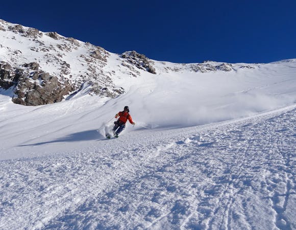
Clarieres

A relatively straight forward run down the lower slopes
Difficult Freeride Skiing
- Distance
- 1.9 km
- Ascent
- 0 m
- Descent
- 649 m
Frequent moguls on this line under the lift pylons
Freeride Skiing Difficult

The most direct route home - quite steep and often very mogulled. From the mid-station, follow the line of the cable car pylons. Just after crossing the traverse line from Chancel head skiers right (away from the pylons) to avoid some steep drops. Continue down to P1 or all the way to La Grave.
Whilst this is one of La Grave's less wild runs, it is still steep and when icy, an encounter with a pylon could be ugly.
Difficult
Serious gradient of 30-38 degrees where a real risk of slipping exists.

Exposure is limited to that of the slope itself. Getting hurt is still likely if the slope is steep and/or the snow is hard.
Close to help in case of emergency.
1 m away
A relatively straight forward run down the lower slopes
Difficult Freeride Skiing
20 m away

A fun line through the trees
Difficult Freeride Skiing
56 m away

A short hike gives access to some good skiing
Difficult Freeride Skiing
1.1 km away

A wild adventure and 800m long couloir
Severe Freeride Skiing
1.6 km away

A good introduction to couloir skiing
Difficult Freeride Skiing
1.7 km away

One of the best known La Grave Couloirs - a classic
Severe Freeride Skiing
2.2 km away

Classic La Grave couloir skiing
Severe Freeride Skiing
2.3 km away

A variation on the classic Grand Couloir
Severe Freeride Skiing
2.4 km away

Another steeper, more serious variant of the Trifides couloirs
Extreme Freeride Skiing
2.4 km away

A direct variation on the La Grave classic
Difficult Freeride Skiing
5 routes · Freeride Skiing

15 routes · Freeride Skiing · Ski Touring