630 m away
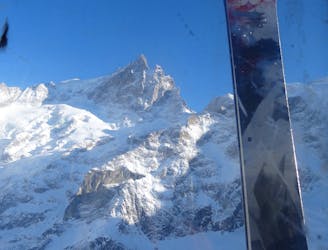
Banana Couloir

One of the best known La Grave Couloirs - a classic
Severe Freeride Skiing
- Distance
- 1.1 km
- Ascent
- 5 m
- Descent
- 376 m
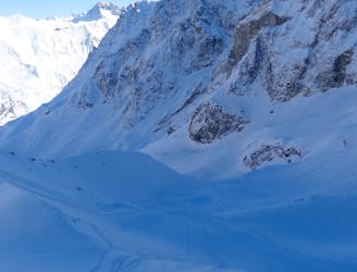
A good introduction to couloir skiing
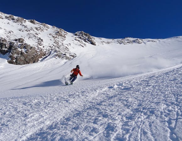
Freeride Skiing Difficult

This is a popular freeride skiing route which is generally considered to be difficult. It's remote, it features low exposure (e1) and is typically done between December and April. From a low point of 2.4 km to the maximum altitude of 2.6 km, the route covers 292 m, 0 vertical metres of ascent and 183 vertical metres of descent. It's graded 3.2 and Labande grade 3.
An enjoyable, short couloir which is a good introduction to this kind of skiing. The couloir is accessed from the traverse on the classic Vallons Chancel route - cross a small rock band to find the entrance. It is around 100m long. Watch for windslab on the approach.
Difficult
Serious gradient of 30-38 degrees where a real risk of slipping exists.

Exposure is limited to that of the slope itself. Getting hurt is still likely if the slope is steep and/or the snow is hard.

Away from help but easily accessed.
630 m away
One of the best known La Grave Couloirs - a classic
Severe Freeride Skiing
777 m away

A wild adventure and 800m long couloir
Severe Freeride Skiing
941 m away

Classic La Grave couloir skiing
Severe Freeride Skiing
1.4 km away

A variation on the classic Grand Couloir
Severe Freeride Skiing
1.5 km away

A direct variation on the La Grave classic
Difficult Freeride Skiing
1.5 km away

A very serious and wild series of couloirs down to the valley
Severe Freeride Skiing
1.6 km away

A short hike gives access to some good skiing
Difficult Freeride Skiing
1.6 km away

Another steeper, more serious variant of the Trifides couloirs
Extreme Freeride Skiing
1.6 km away
A La Grave mega-classic with 1800m of steep North facing skiing back to La Grave
Difficult Freeride Skiing
1.6 km away
The La Grave mega-classic
Difficult Freeride Skiing
5 routes · Freeride Skiing

50 routes · Freeride Skiing · Ski Touring

15 routes · Freeride Skiing · Ski Touring