499 m away
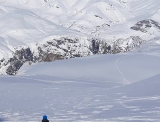
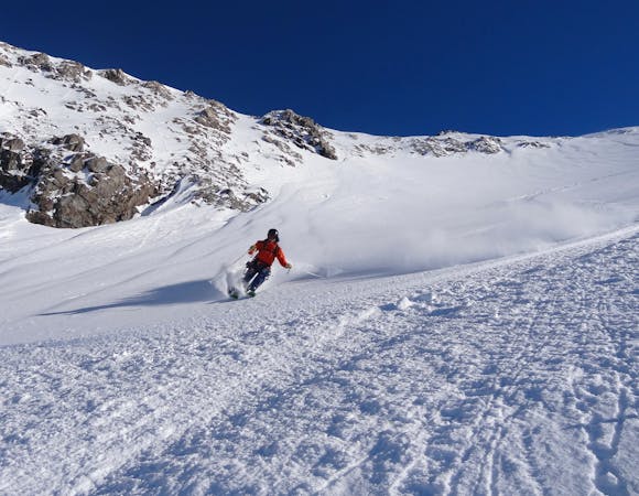
Chalance

A great off-piste line down a wild bowl
Difficult Freeride Skiing
- Distance
- 2 km
- Ascent
- 2 m
- Descent
- 782 m
A long and classic but serious off-piste descent, well away from the crowds.
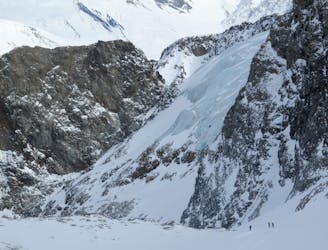
Freeride Skiing Severe

This is a very long and interesting off-piste journey, which takes you right out of the ski area. The difficulty can vary considerably depending on the conditions and very careful route-finding is required; a wrong turn at a couple of crucial points can leave you in a very serious situation. The route is only to be attempted by very competent parties with full knowledge and experience of high mountain navigation and safety. The route ends below 1300 metres, so ensure there is sufficient snow cover at lower altitudes before you start. Starting from the top of the Signal chair, follow the Signal 4 red piste for about 100 metres until the piste bears right down the first steeper section. Traverse left off the piste, under the chair, and across to a broad flat-ish plateau. Head north-west across the plateau towards a low dome, and skirt this on the right. Continue traversing on gentle slopes all the way around the dome until you reach steeper slopes beneath the face on the far side. Continue traversing leftwards under this face until you reach a broad ridge marking the left-hand side of the bowl below. DO NOT be tempted to ski into the bowl - this leads to cliffs and very serious terrain below. Ski down the ridge until it ends at a shoulder (just below 2700 metres) where the ridge drops away steeply - this is the Jocotte Ridge. The first part is steep (40 degrees) and narrow, and can be tricky/rocky in poor snow conditions. The angle soon eases though, and the ridge widens. At this point an escape can be made down fairly steep slopes to the left to the Fée 1 piste. To continue to Cuculet, carry on down the left side of the easy ridge until it flattens, and then climbs slightly to a gentle summit. Continue over this, traversing above a rock-face on the left, until the ridge turns leftwards and a wide, steep slope opens below you on the left. Ski down this slope for about 500 vertical metres, bearing slightly right and not straying too far from the ridge. Where the slope flattens a little before the bottom, traverse out rightwards (there are large cliffs below), taking care as it crosses a steep funnel, to rejoin the ridge. Follow the ridge, gently at first, and then over a final steepening in the trees, to emerge in the village.
Severe
Steep skiing at 38-45 degrees. This requires very good technique and the risk of falling has serious consequences.

Little chance of being seen or helped in case of an accident.
499 m away
A great off-piste line down a wild bowl
Difficult Freeride Skiing
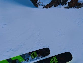
598 m away

A short but challenging couloir and fun slopes below
Difficult Freeride Skiing
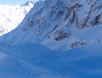
3.5 km away

A fine, challenging couloir with easy access
Severe Freeride Skiing
3.5 km away

Off piste entrance to the moguls of the Grand Couloir, making this route only for experience skiers
Difficult Freeride Skiing
3.7 km away

A beautiful, fairly steep bowl
Difficult Freeride Skiing
3.9 km away
Breathtaking views and fantastic glacier skiing
Difficult Freeride Skiing
3.9 km away
2300m of legendary, serious, wild and committing skiing
Severe Freeride Skiing
4.8 km away

A very serious and wild series of couloirs down to the valley
Severe Freeride Skiing
4.9 km away
Easy to access, steep couloir skiing. A La Grave classic.
Severe Freeride Skiing
4.9 km away
The La Grave mega-classic
Difficult Freeride Skiing

10 routes · Freeride Skiing
5 routes · Freeride Skiing

50 routes · Freeride Skiing · Ski Touring

15 routes · Freeride Skiing · Ski Touring