176 m away
Tête Rousse Hut
A challenging loop showcasing the diversity of the Mont Blanc mountain range.
Severe Hiking
- Distance
- 23 km
- Ascent
- 2.2 km
- Descent
- 2.2 km
The most famous multi-day mountain hike in the Alps
Also in Haute-Savoie, France • Aoste, Italy • Valais, Switzerland
Hiking Difficult

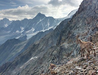
Circling the Mt. Blanc Range means hiking as close as possible to this legendary alpine giant without actually climbing. Every day, enjoy so many new discoveries as you explore the different sides, cultures, and landscapes of the range: first through France, and then Italy and Switzerland. The well-marked trails and circuits are trade and communications that have been used, in some cases, since Antiquity. This is hands down one of the world’s major and most classic multi-day mountain hikes!
Difficult
Hiking trails where obstacles such as rocks or roots are prevalent. Some obstacles can require care to step over or around. At times, the trail can be worn and eroded. The grade of the trail is generally quite steep, and can often lead to strenuous hiking.

The path is on completely flat land and potential injury is limited to falling over.
Close to help in case of emergency.
176 m away
A challenging loop showcasing the diversity of the Mont Blanc mountain range.
Severe Hiking
900 m away
Easy hike to the statue du Christ-Roi.
Moderate Hiking
2 km away
A pleasant hike with views of the Mont Blanc Massif
Moderate Hiking
2.3 km away
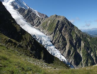
Day 2: An excellent day taking in a huge variety of views, from alpine meadows to hanging glaciers and rocky ridges.
Difficult Hiking
2.8 km away

While one of the less interesting sections of the TMB, this stretch still offers a few hidden trail gems.
Moderate Hiking
4 km away
A famous hike which was the starting point for Jacques Balmat and Michel Paccard when they made the first ascent of Mont Blanc in 1786.
Difficult Hiking
5.7 km away

Circumnavigate the iconic Mont Blanc massif on this epic multi-day route.
Severe Hiking
5.7 km away

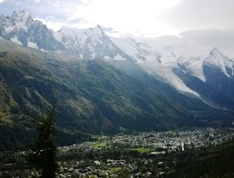
Day 1: A gentle downhill day on the sun-kissed south-facing slopes of the Brévent peak.
Moderate Hiking
6.6 km away

Escape the crowds at Lac Blanc by hiking to Lac Cornu instead.
Severe Hiking
6.9 km away
A short and pleasant hike up to a picturesque little mountain hut.
Moderate Hiking

6 routes · Hiking

14 routes · Hiking

5 routes · Hiking

12 routes · Hiking