8 m away
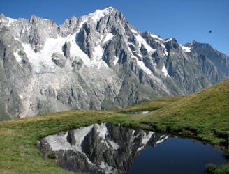
Aiguilles Marbrées Traverse
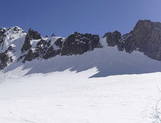
A great training route that can be done in either direction, easier N to S as described.
Moderate Alpine Climbing
- Distance
- 2.7 km
- Ascent
- 248 m
- Descent
- 249 m
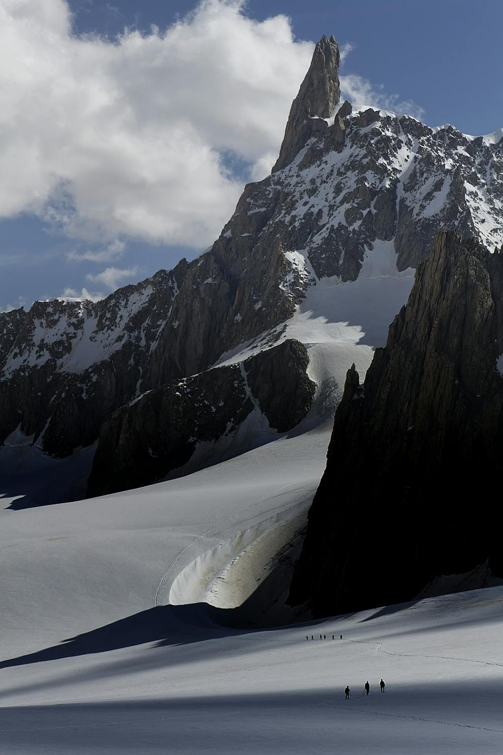
A popular and exposed route to a stunning granite spire, with epic views.
Alpine Climbing Difficult

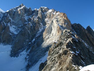
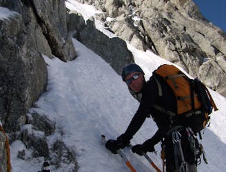
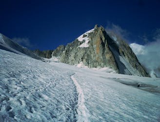
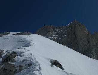
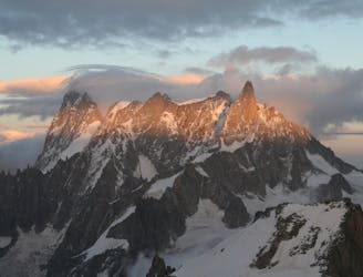
From the Torino Hut descend slightly to the Col du Géant, then rise up gently initially passing the Aiguilles Marbrées to their left. Continue up snow slopes to steeper slopes which then become mixed. In early season this steep slope is pleasant mixed ground with odd rocky steps. Later on it becomes loose scree and scrambling with rockfall danger from other parties. Various lines exist on the upper section of this slope with occasional cairns and crampon scratches as waymarkers. After 2- 2 ½ hours you reach the foot of the Dent itself at the “Salle a Manger”.
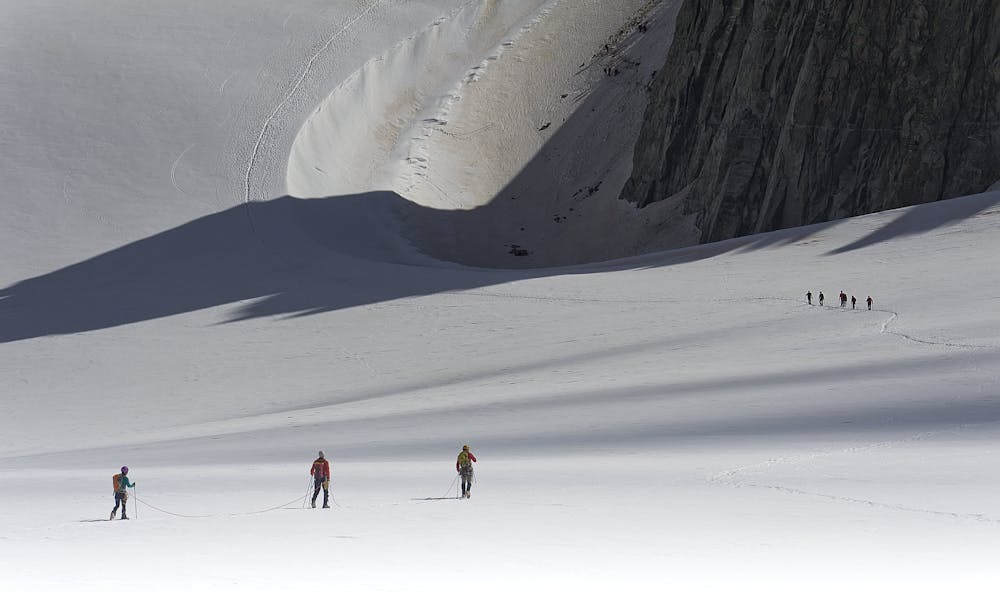
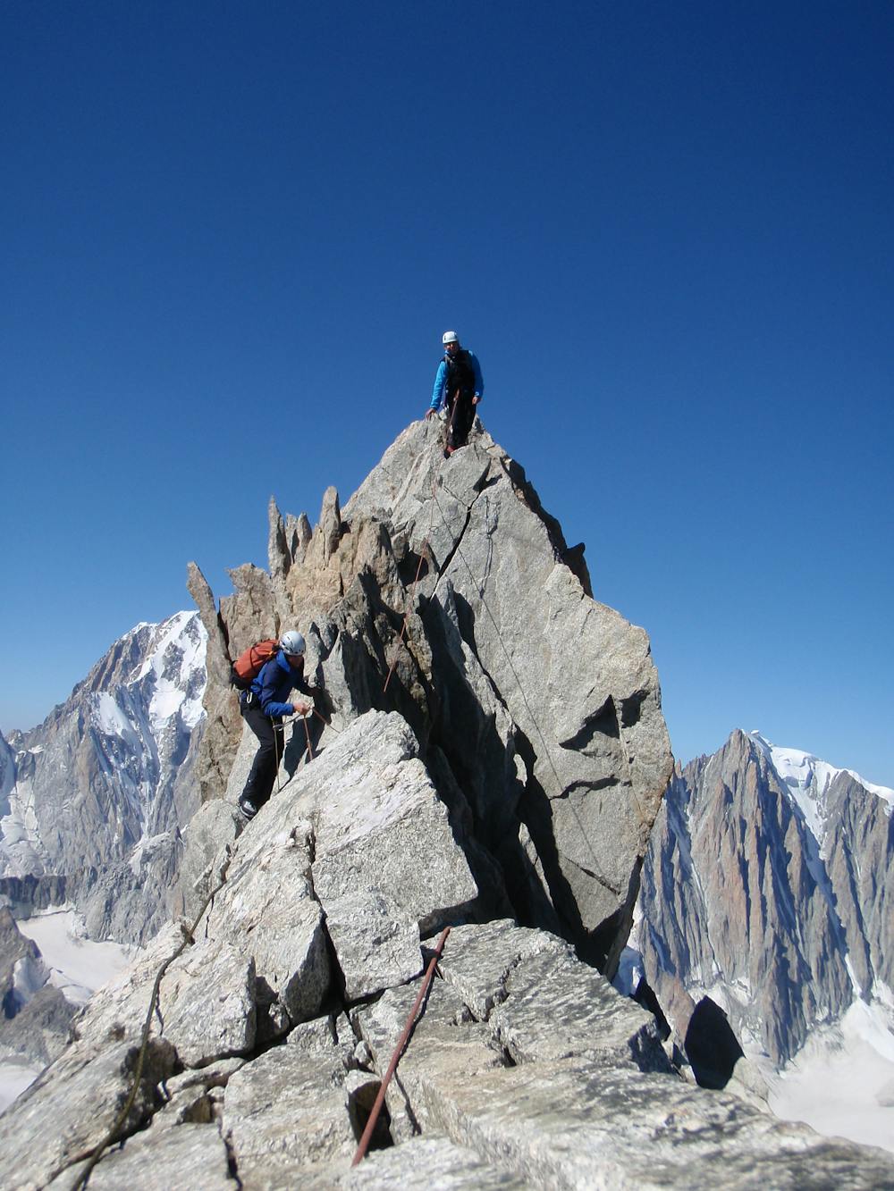
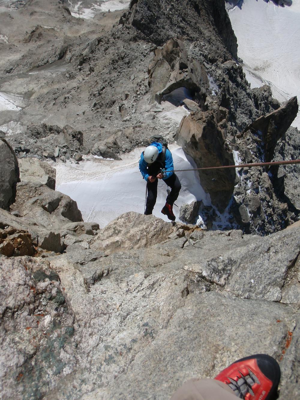
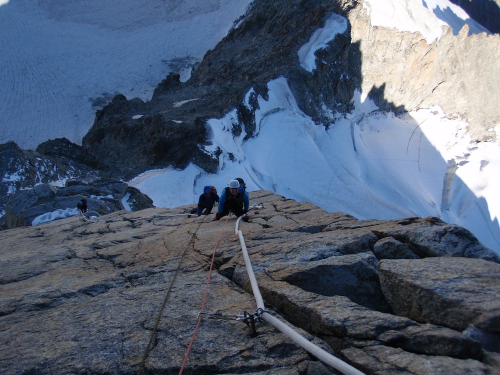
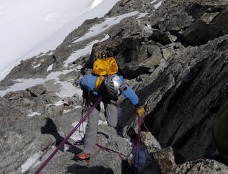
You have the option of leaving sacks but may want to leave crampons/axe on ledges at the foot of the SW arete. Don't do this if you aren't confident about returning to them from the foot of the rap line- this is in a different place. From the ledge traverse round left to bolt belays (3+). Go up the groove above (2+) to a large platform above. No route finding difficulties will be found from here on as it is equipped with enormous fixed ropes, similar to those found on the Matterhorn. Initially these are low angled up the Burgener slabs, then they head up to the R before steep and strenuous yarding up the final steepening to the W summit. The notch lies beyond and the E summit the far side of it. 2 hours from the Salle a Manger but much longer if it is overcrowded.
This summit is probably the best lightning conductor in the Alps so avoid at all costs with even the faintest forecast/signs of storms/lightning. Even in a completely cloudless blue sky cumulonimbus clouds can develop with alarming speed if there is sufficient heat and humidity. The descent is equipped for multiple 25m raps and starts from the notch between the 2 summits.
Difficult
The beginning of truly technical terrain which might involve pitched climbing on rock and/or ice, exposed terrain and complex route finding in ascent and descent. Equivalent to AD, AD+

The route features some exposed and/or difficult to protect sections.
Away from help but easily accessed.
8 m away
A great training route that can be done in either direction, easier N to S as described.
Moderate Alpine Climbing
65 m away
A memorable technical mountaineering route up one of the finest ridges of its standard in the Alps, the Frontier Ridge.
Severe Alpine Climbing
105 m away
A great introduction to one of the more accessible N faces in the area.
Difficult Alpine Climbing
105 m away
A megaclassic rite of passage for the budding N Face alpinist.
Severe Alpine Climbing
105 m away
An amazingly exposed rocky ridge, but never too hard, with incredible views
Difficult Alpine Climbing
105 m away
An aesthetic short traverse and a good introduction to steeper snow.
Difficult Alpine Climbing
105 m away

A relatively short route to a fantastic summit with breathtaking views of the S side of Mont Blanc
Moderate Alpine Climbing
106 m away
A long and very committing route of the highest calibre
Severe Alpine Climbing
3.5 km away
An unforgettable journey through complex terrain for the 4000m peak connoisseur
Difficult Alpine Climbing
4 km away
Committed now, you continue your sensational journey, space-walking along the historic ridge.
Severe Alpine Climbing

12 routes · Alpine Climbing · Hiking

15 routes · Alpine Climbing · Hiking

6 routes · Alpine Climbing · Hiking

9 routes · Alpine Climbing · Hiking

10 routes · Alpine Climbing · Hiking

10 routes · Alpine Climbing