3.8 km away
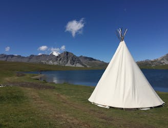
Via Alpina: Tignes Lake to Leisse Refuge
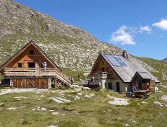
From the shores of Tignes Lake, pass two Cols on your way to the peaceful refuge below Grande Motte.
Moderate Hiking
- Distance
- 12 km
- Ascent
- 701 m
- Descent
- 306 m
This summit climb provides a high alpine challenge along a ridgeline beside Sassière glacier, with stunning views the entire route.
Hiking Difficult

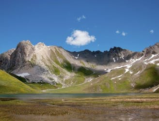
Aiguille de la Grande Sassière is a mountain in the Graian Alps, on the boundary between the Aosta Valley (northern Italy) and the French department of Savoie in the Tarentaise Valley.
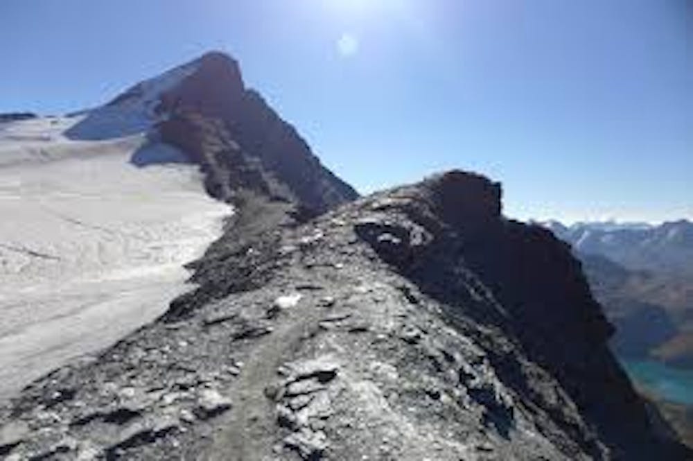
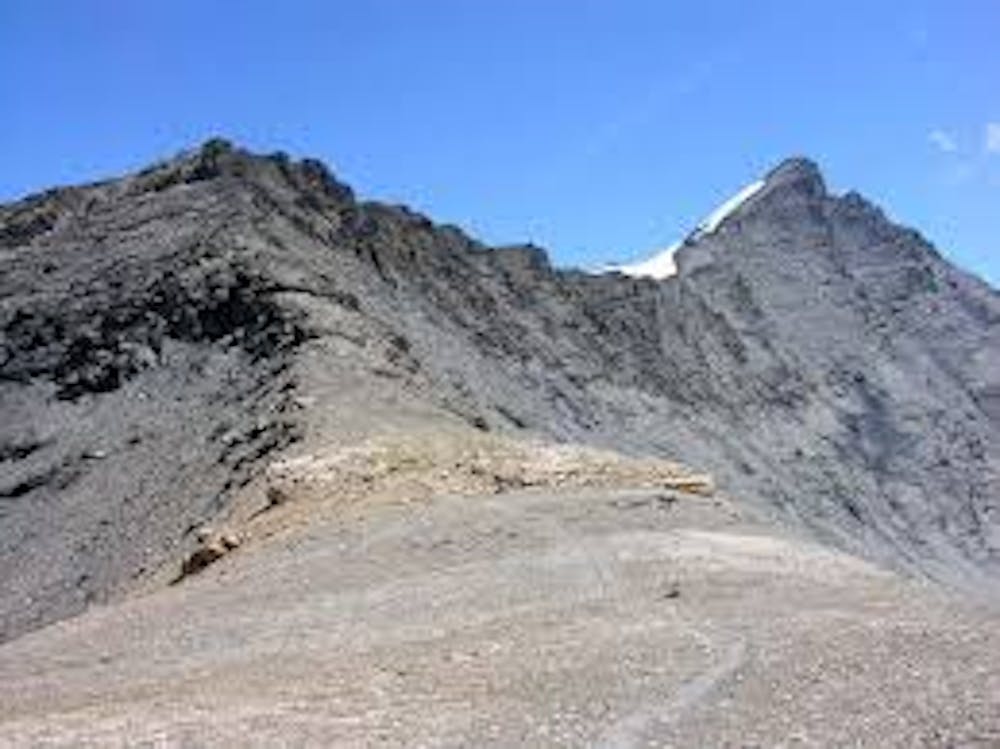
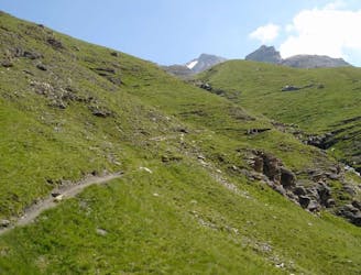
This route to the summit of Aiguille de la Grande Sassière (3,747m) is a high alpine challenge, with the final third being along a ridgeline beside Sassière glacier. There are stunning views the entire route! Highlights include views of the nearby Grande Sassière, multiple lakes, Sassière Glacier, and down the Aosta Valley from the summit.
There’s only about a 6-week window every summer (July-August) where the snow on the glacier has melted on the West Ridge part of the trail. Of course, it is possible to undertake this route outside of this period if you have suitable experience and equipment.
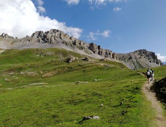
Start from the parking at Le Chevril, the route is up pretty much all the way to the summit, and at times along very steep terrain and loose shale.
Take the time to enjoy the stunning views, particularly as the path comes around the back of Grande Sassière—you can look down on Sainte Foy and Tignes.
The final third of the ascent is straight up a 45° rocky shale slope on the west ridge. Shale will move below foot and is difficult to get a good grip on. Black ice is also highly possible, so extreme caution is required here.
You’ll undoubtedly experience an overwhelming sense of triumph once you reach the summit! Pause to take in the amazing views over the Western Alps and towards the Aosta Valley.
To return, reverse the route.
This is an incredible, epic route and should be undertaken seriously and responsibly. But despite the difficulty, it is well-worth the effort.
Difficult
Hiking trails where obstacles such as rocks or roots are prevalent. Some obstacles can require care to step over or around. At times, the trail can be worn and eroded. The grade of the trail is generally quite steep, and can often lead to strenuous hiking.

Some trail sections have exposed ledges or steep ascents/descents where falling could cause serious injury.

In the high mountains or remote conditions, all individuals must be completely autonomous in every situation.
3.8 km away
From the shores of Tignes Lake, pass two Cols on your way to the peaceful refuge below Grande Motte.
Moderate Hiking
3.8 km away

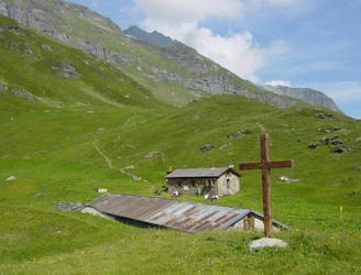
A lovely route with lakes, a dam, traditional alpine hamlets, and beautiful views of Mount Pourri.
Moderate Hiking
3.8 km away
Instead of riding the lift, follow this hike to reach the top of the Palafour Lift and extend the Aiguille Percée hike.
Moderate Hiking
3.8 km away
A combination of the Tignes Resort and the heart of the national park. The contrast is amazing but telling of the history of the Vanoise.
Moderate Hiking
3.9 km away
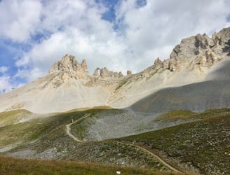
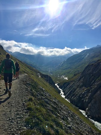
A hike to one of the best geological curiosities in Vanoise National Park: the "eye of the needle" and a spectacular high alpine ridgeline trail.
Difficult Hiking
4.8 km away
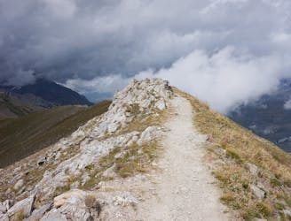
A true alpine experience with high exposure along the Tovière ridge.
Moderate Hiking
5.9 km away
Hike to an incredible glacier from the small town of La Gurraz.
Moderate Hiking
6.2 km away
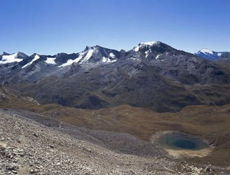
A stunning and strenuous round circuit through the Bailletaz Nature Reserve, passing above the glacial Lac de la Sassière.
Difficult Hiking
6.2 km away
Discover Lac d'Ouillette, hidden from view from the Val d'Isere resort and onwards to a remote, rugged Col.
Moderate Hiking
7.9 km away
A long-distance hike with a rare landscape on arrival.
Moderate Hiking
8 routes · Hiking

14 routes · Hiking