1.2 km away
Lagginhorn West Ridge
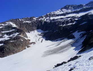
A great one day trip to the summit of a gorgeous 4000er
Moderate Alpine Climbing
- Distance
- 6.6 km
- Ascent
- 1 km
- Descent
- 1 km
Avoids Lagginsgletscher
Alpine Climbing Moderate

This is a popular alpine climbing route which is generally considered to be moderate. It's remote, it features high exposure and is typically done between October and December. From a low point of 2.8 km to the maximum altitude of 4 km, the route covers 2.4 km, 1142 vertical metres of ascent and 0 vertical metres of descent. You'll need ice axe, bivy kit, crampons, climbing shoes and wires and friends to complete it safely.
Wanted to avoid Lagginsgletscher this weekend due to heavy snowfall so adjusted route follows full West Route.
Moderate
May involve slightly more complex glacier hikes, easy but possibly long rock ridges and steep snow up to 45 degrees. Equivalent to PD, PD+

Much of the route is difficult to protect and a fall could be disastrous at certain points.

Away from help but easily accessed.
1.2 km away
A great one day trip to the summit of a gorgeous 4000er
Moderate Alpine Climbing
1.3 km away
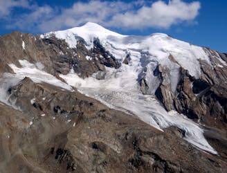
A very popular route to a relatively easy 4000m peak, also commonly climbed in the spring as a ski tour
Moderate Alpine Climbing
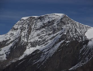
5 km away

A fantastic traverse of a popular peak, starting from a remote hut.
Moderate Alpine Climbing
8.4 km away
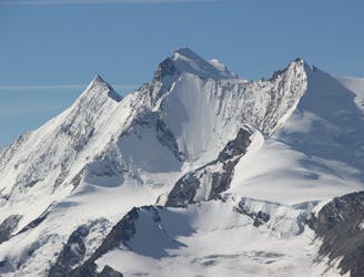
A great route traversing two 4000m peaks, with excellent rock towards the summit of the Nadelhorn
Difficult Alpine Climbing
9.9 km away
A long glacial journey up a complicated glacier to a remote summit.
Moderate Alpine Climbing

9 routes · Alpine Climbing · Hiking

11 routes · Alpine Climbing · Hiking

6 routes · Alpine Climbing · Hiking

20 routes · Alpine Climbing · Hiking