2 km away
Transept Trail
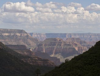
Quiet stroll along the canyon rim near North Rim Campground and Grand Canyon Lodge.
Easy Hiking
- Distance
- 5.7 km
- Ascent
- 108 m
- Descent
- 108 m
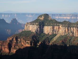
A quick trip to one of the canyon's most spectacular viewpoints.
Hiking Easy

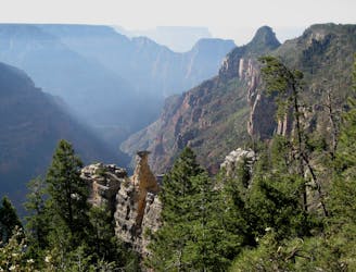
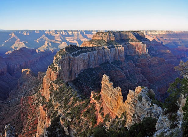
For one of the best views of the Grand Canyon, look no further than Bright Angel Point. In no more than a few minutes’ walk from Grand Canyon Lodge, you can stand atop a precipitous spine of rock on the edge of the abyss. It’s not as death-defying as it sounds, but the sensation really is breathtaking.
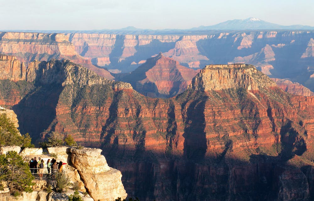
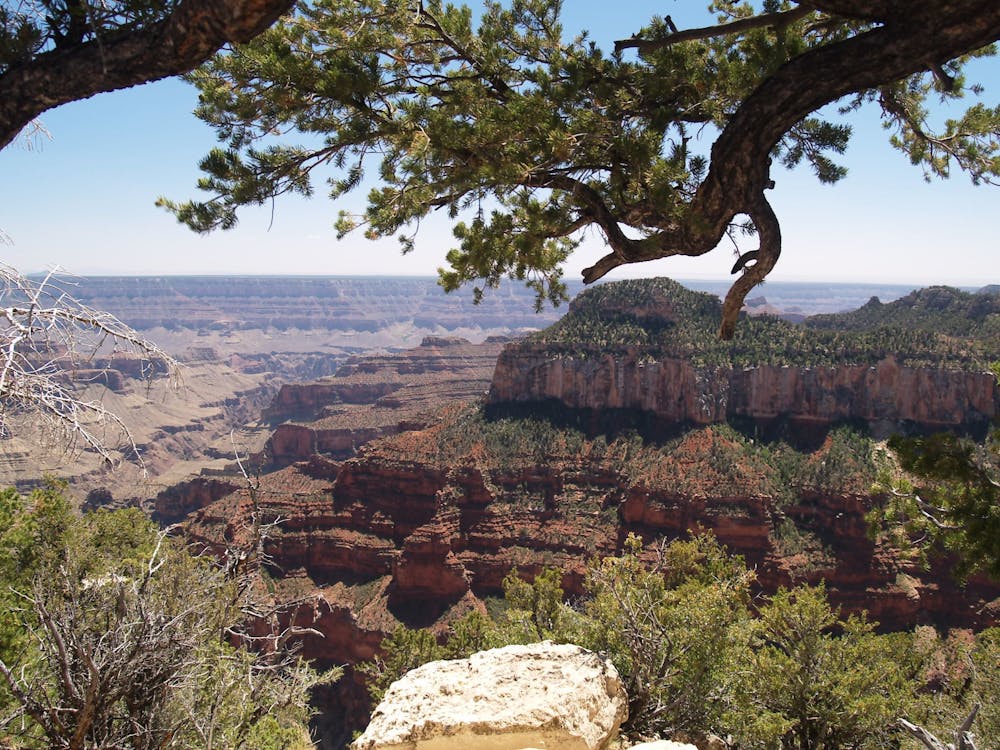
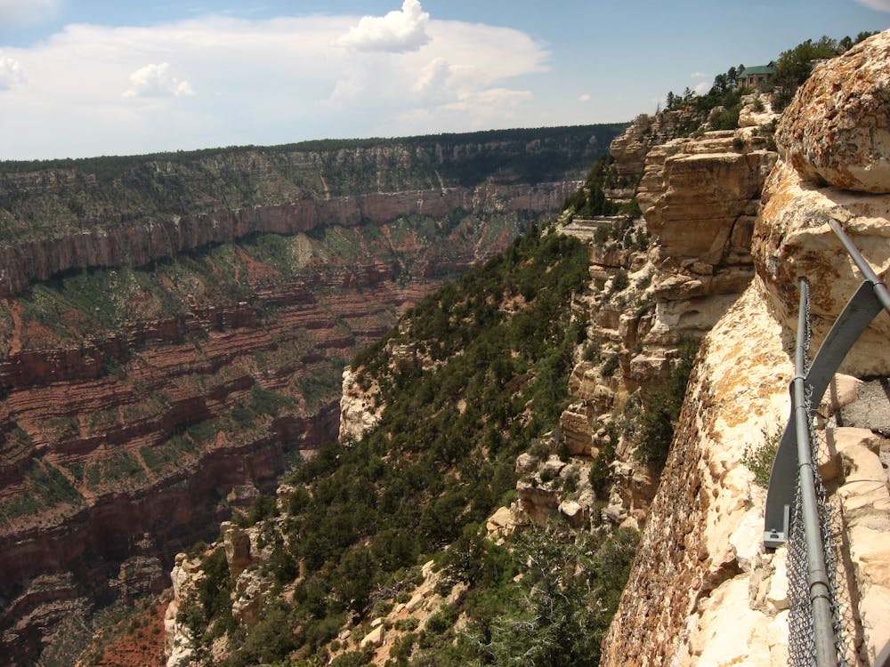
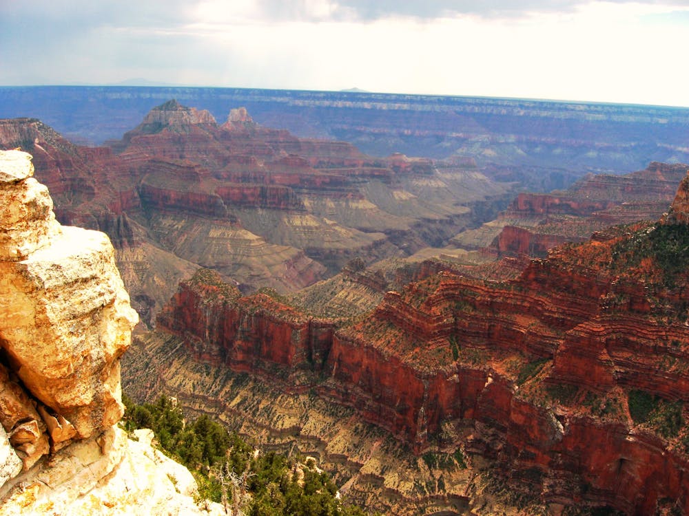
The trail to Bright Angel Point is paved, but the surface is uneven, and it’s steep in places, so it’s not great for strollers or wheelchairs. Handrails are in place, but those afraid of heights may still feel uneasy because of the sheer drop on either side. For those unphased by heights, there are plenty of boulders and unprotected ledges to scramble on for wilder view. Of course, extreme care must be taken because a fall could be fatal. Stay on the paved path to remain perfectly safe.
Because this trail is accessible and short, and the view so dramatic, it’s worth coming back at different times of day if you are staying at the North Rim. You can link with Transept Trail to make an out-and-back hike from the campground. Visit Bright Angel Point at both sunrise and sunset to see the full spectrum of color show on the canyon’s cliffs.
Sources: https://www.nps.gov/grca/learn/news/upload/nr-pocket-map.pdf
Easy
Walking along a well-kept trail that’s mostly flat. No obstacles are present.

The trail contains some obstacles such as outcroppings and rock which could cause injury.

Close to help in case of emergency.
2 km away
Quiet stroll along the canyon rim near North Rim Campground and Grand Canyon Lodge.
Easy Hiking
2.2 km away
Journey back to the bottom of the Grand Canyon and out again, bushwhacking and canyoneering much of the way.
Severe Hiking
2.2 km away
The main route from Grand Canyon's North Rim down to the Colorado River, and one of the most beautiful trails in America.
Difficult Hiking
2.2 km away
Rolling hills and colorful forest lead to an airy overlook on the canyon rim.
Moderate Hiking
3.1 km away
Lesser-traveled trail with canyon views, big trees, and a chance at spotting wildlife.
Moderate Hiking
3.7 km away
Another beautiful day on the North Kaibab Trail with a fantastic side trip to Ribbon Falls.
Moderate Hiking

23 routes · Mountain Biking · Hiking
14 routes · Hiking
8 routes · Hiking
9 routes · Hiking

14 routes · Hiking