2.2 km away
Thunder Mountain -> Javelina
Combine a longtime Sedona classic trail with a flowy loop on the end.
Severe Mountain Biking
- Distance
- 18 km
- Ascent
- 429 m
- Descent
- 429 m
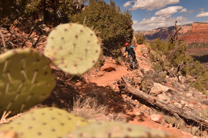
This intermediate-friendly primer to Sedona's red rock will entertain expert-level riders as well.
Mountain Biking Difficult

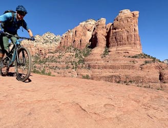
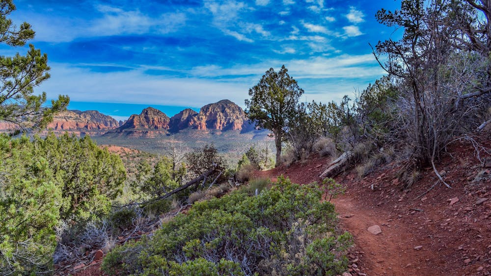
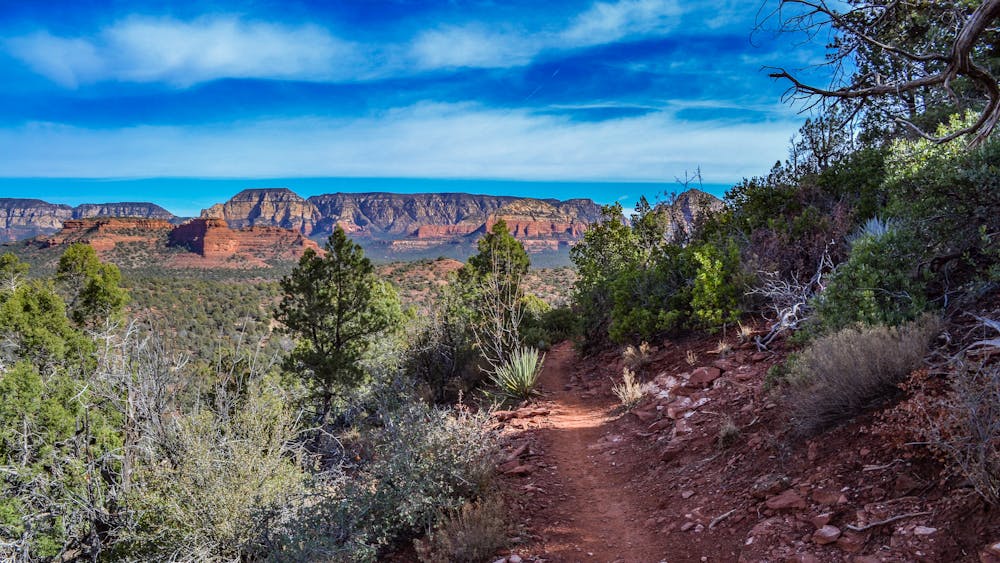
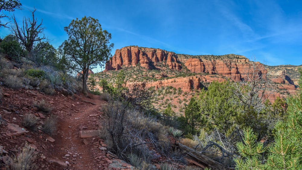
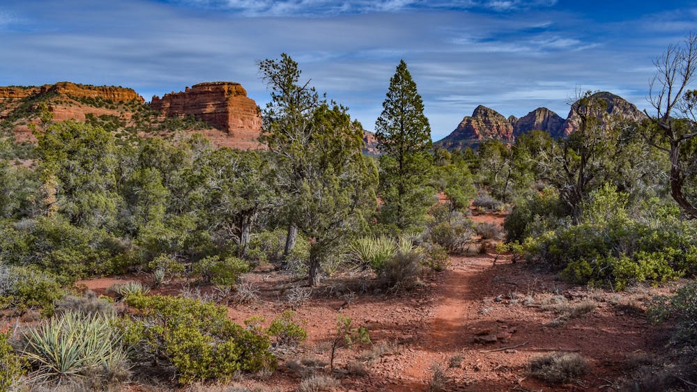
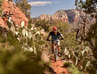
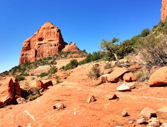
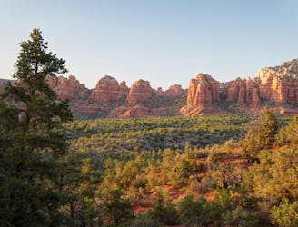
Trails like Hangover and the White Line have put Sedona on the map as an epicenter of gnarly, death-defying mountain biking... but not every ride has to risk life and limb. The Upper Dry Creek Area that this loop runs through is the perfect zone for intermediate riders looking to sample Sedona's famed red rock mountain biking and enjoy gorgeous views of the region. Even expert-level riders can use a break from max-level exposure, and these trails are entertaining enough that just about everyone will enjoy them!
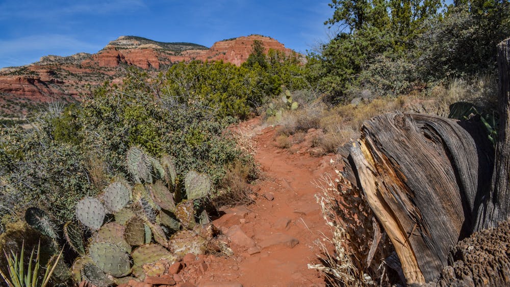
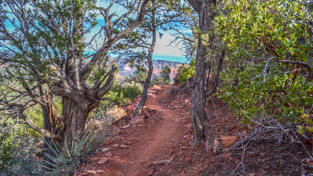
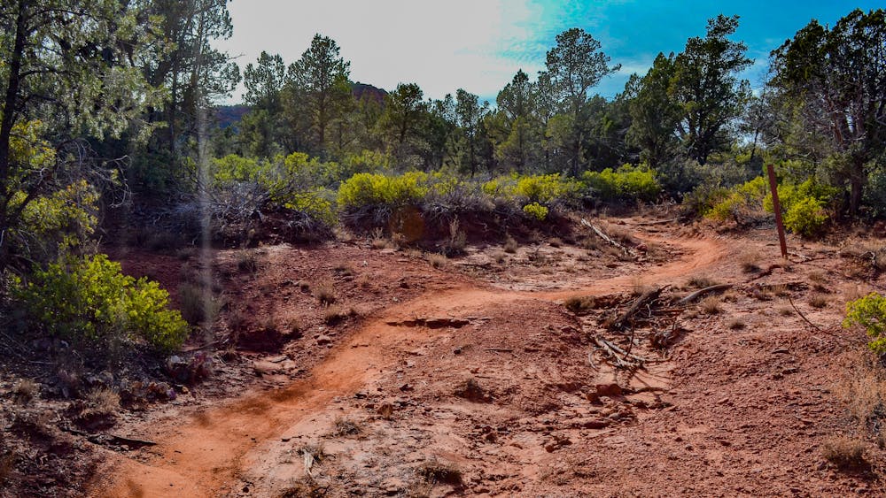
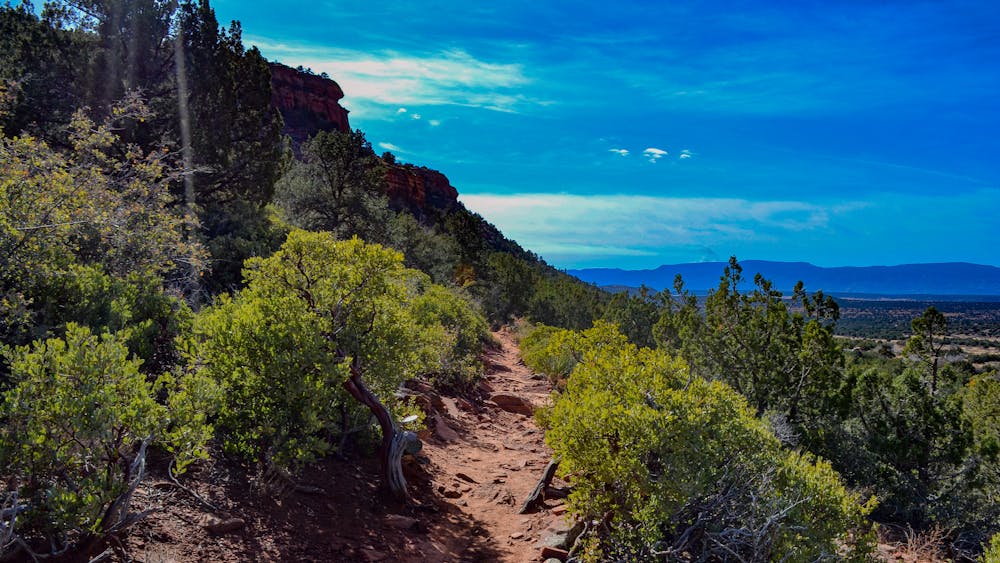
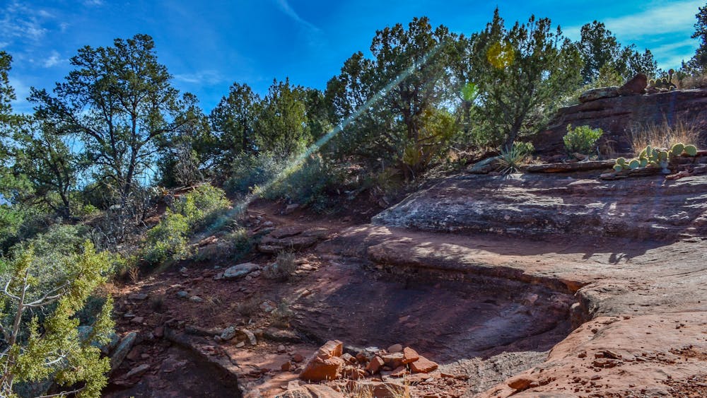
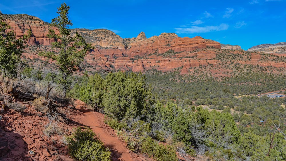
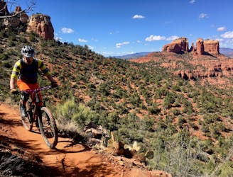
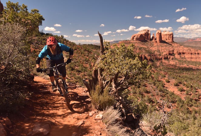
This zone also provides more true singletrack riding, instead of just rock slabs all the time—Sedona's famous velcro rojo. Swooping through the low pinion pines and spiny cholla cactus, even the mellowest of trails offers up a fun, flowy rip!
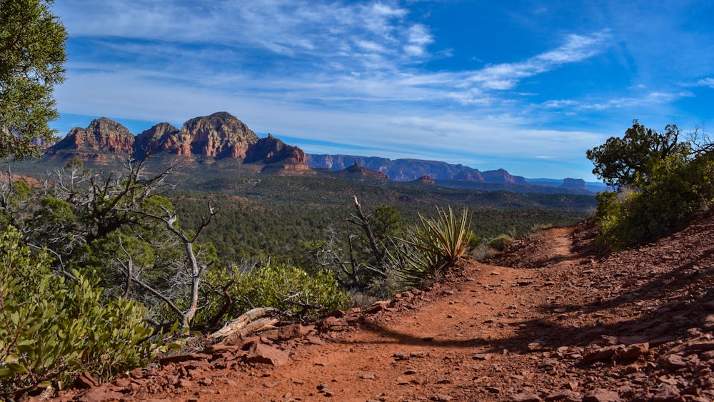
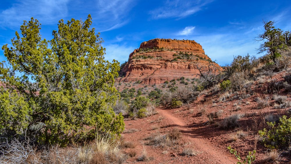
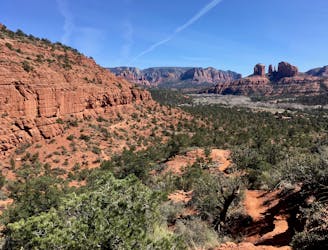
The three main trails anchoring this loop are Chuckwagon, Mescal, and Aerie. While Mescal is a bit tougher and more exposed than the others and could warrant a black-diamond rating, confident intermediate riders should still have a blast. These sections of trail skirt the red rock slabs that Sedona is renowned for, with some of the upper reaches on Mescal especially offering jaw-dropping views from the side of Mescal Mountain of the greater Red Rocks Region.
Climbs and descents alternate back and forth in true Sedona style. Nothing kicks up for long... or descends for long, for that matter. Once you get into the rhythm of constant climbing and descending you'll come to enjoy the short, techy downhill rips, the gorgeous views, and the ever-changing character of this trail.
Difficult
Mostly stable trail tread with some variability featuring larger and more unavoidable obstacles that may include, but not be limited to: bigger stones, roots, steps, and narrow curves. Compared to lower intermediate, technical difficulty is more advanced and grades of slopes are steeper. Ideal for upper intermediate riders.

Some trail sections have exposed ledges or steep ascents/descents where falling could cause serious injury.

Close to help in case of emergency.
2.2 km away
Combine a longtime Sedona classic trail with a flowy loop on the end.
Severe Mountain Biking
4.3 km away

A long loop connecting Sedona trails both old and new.
Difficult Mountain Biking
4.9 km away
One of Sedona's easiest mountain bike rides.
Difficult Mountain Biking
5.4 km away
A technical, but gorgeous, loop around Airport Butte.
Severe Mountain Biking
6.4 km away
A loop connecting some of the newest singletrack that Sedona has to offer.
Severe Mountain Biking
7.1 km away
Extreme exposure coupled with brutally-technical rock moves make Hangover one of the most technical--and dangerous--trails in the nation.
Extreme Mountain Biking
7.7 km away
The Hogs are some of the most entertaining—and challenging—trails in Sedona, with technical rock rolls and rock gardens, cliff exposure, and of course—beautiful views!
Severe Mountain Biking
7.7 km away
Hiline offers stunning views of the Red Rocks region from exposed mountainside singletrack. Finish it off with a raucous descent down a black-diamond plunge!
Extreme Mountain Biking
10 routes · Mountain Biking

25 routes · Mountain Biking

37 routes · Mountain Biking
3 routes · Mountain Biking

25 routes · Mountain Biking

10 routes · Mountain Biking