
2.4 km away
Airport Loop

A technical, but gorgeous, loop around Airport Butte.
Severe Mountain Biking
- Distance
- 5.2 km
- Ascent
- 132 m
- Descent
- 133 m
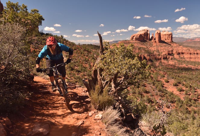
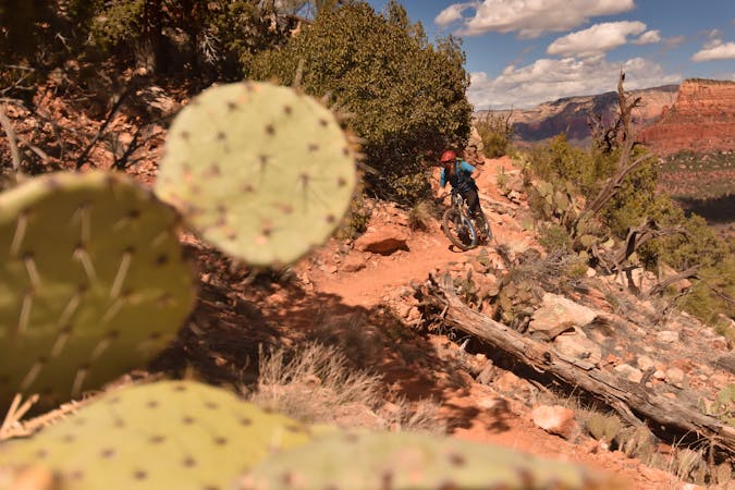
The Hogs are some of the most entertaining—and challenging—trails in Sedona, with technical rock rolls and rock gardens, cliff exposure, and of course—beautiful views!
Mountain Biking Severe

Along with Hiline and Hangover, the Hogs form Sedona's Triple H. If you're an advanced rider who's not scared of technical challenge and potentially deadly cliff exposure, the three H's form your must-do hit list when you visit Sedona.
The Hogs themselves consists of Hog Heaven, High on the Hog, and Hogwash, and technically they lie in the Broken Arrow Trail System (although the name "The Hogs" is now the most popular). Classic Sedona cliffside exposure makes The Hogs formidable and intimidating to some riders, and yet it's not nearly as death-defying as the exposure on Hangover. This makes The Hogs a good warmup before tackling some of Sedona's more difficulty trails—ironic considering how difficult The Hogs are by themselves.
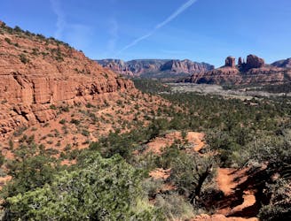
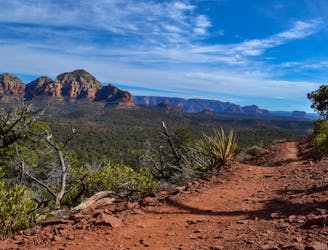
In addition to steep slickrock slabs and rock gardens, The Hogs offer steep rock rolls and a couple of visually-stunning built up rock berms on the edge of cliffs.
While Pig Tail isn't one of The Hogs exactly, this short but sweet black diamond descent is a welcome change of pace from the vast majority of Sedona's singletrack offering. Filled with booters, kickers, drops, and some berms, Pig Tail feels like a hidden jump line tucked away in a sea of gnarly rock slabs.
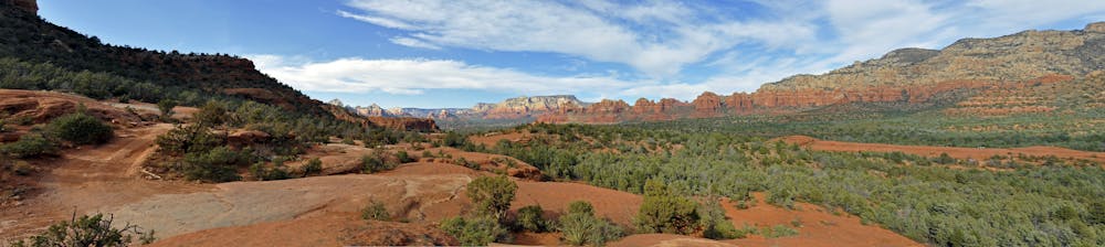
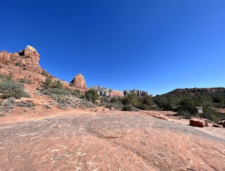
As you can imagine, with the cliffside exposure The Hogs offer stunning views of the surrounding red rock landscape. Nearby Submarine Rock is a popular destination for the tourist-filled 4x4 tours, but the view of Submarine Rock from The Hogs, sans tourist crowds, is undoubtedly better. This entire trail system is right on the border of the Munds Mountain Wilderness Area which is home to a gorgeous range of mountains. Unfortunately, this is as close as you can legally get on your bike, so soak in the views while you can!
Severe
Widely variable, narrow trail tread with steeper grades and unavoidable obstacles of 15in/38cm tall or less. Obstacles may include unavoidable bridges 24in/61cm wide or less, large rocks, gravel, difficult root sections, and more. Ideal for advanced-level riders.

Some trail sections are extremely exposed where falling will almost certainly result in serious injury or death.

Away from help but easily accessed.
2.4 km away
A technical, but gorgeous, loop around Airport Butte.
Severe Mountain Biking
2.5 km away

Extreme exposure coupled with brutally-technical rock moves make Hangover one of the most technical--and dangerous--trails in the nation.
Extreme Mountain Biking
2.8 km away
One of Sedona's easiest mountain bike rides.
Difficult Mountain Biking
4.4 km away

A short but rewarding descent that can be ridden independently, or in conjunction with Hiline.
Difficult Mountain Biking
5.4 km away
A loop connecting some of the newest singletrack that Sedona has to offer.
Severe Mountain Biking
5.4 km away

Hiline offers stunning views of the Red Rocks region from exposed mountainside singletrack. Finish it off with a raucous descent down a black-diamond plunge!
Extreme Mountain Biking
5.8 km away

Combine a longtime Sedona classic trail with a flowy loop on the end.
Severe Mountain Biking
6.9 km away

A long loop connecting Sedona trails both old and new.
Difficult Mountain Biking
7.7 km away
This intermediate-friendly primer to Sedona's red rock will entertain expert-level riders as well.
Difficult Mountain Biking
10 routes · Mountain Biking

25 routes · Mountain Biking

37 routes · Mountain Biking
3 routes · Mountain Biking

25 routes · Mountain Biking

10 routes · Mountain Biking