3.9 km away
Hiline
Hiline offers stunning views of the Red Rocks region from exposed mountainside singletrack. Finish it off with a raucous descent down a black-diamond plunge!
Extreme Mountain Biking
- Distance
- 14 km
- Ascent
- 329 m
- Descent
- 329 m
A short but rewarding descent that can be ridden independently, or in conjunction with Hiline.
Mountain Biking Difficult

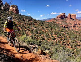
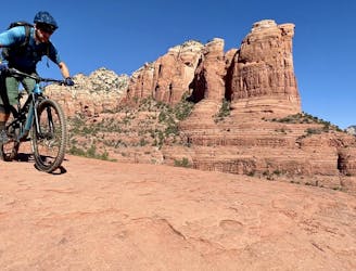
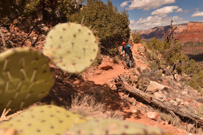
The Slim Shady Trail doesn’t have the flashy name appeal from viral videos that Hangover and Hiline do, and yet this trail is quite popular and well-loved. Slim Shady's popularity is due in part to the extremely easy access. As you can see in the map, the loop route outlined here can be ridden from the Yavapai Trailhead, or it can easily be tacked on to a Hiline ride. For advanced riders that want to crank out miles, I recommend pedaling a Hiline + Slim Shady combo.
The climb to the top of Slim Shady mapped here is the most direct option, which ascends the black diamond Templeton Trail. The climb is technical and blocky, with some big ledges to pedal/lunge up. A few sections will likely require you to push your bike, unless you possess superhuman bike handling prowess. For an easier, albeit longer, pedal to the top, opt for Easy Breezy to Easy Street instead.
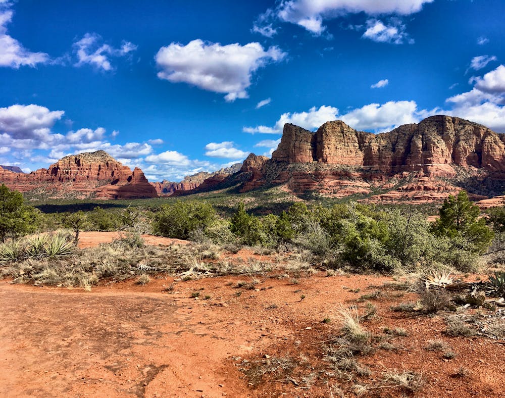
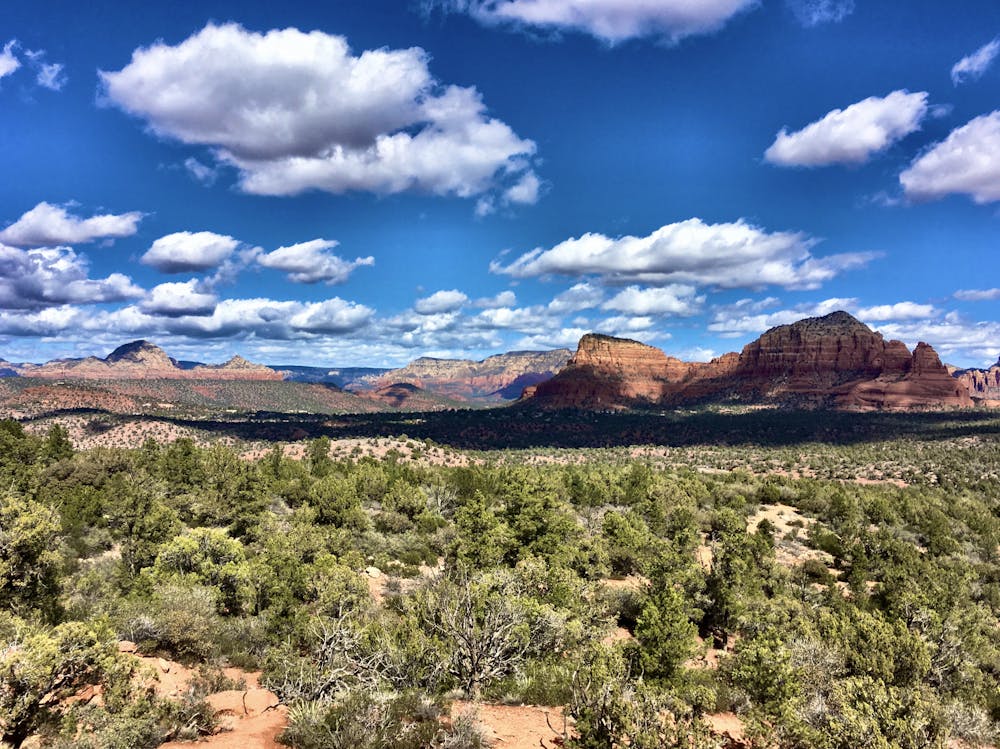
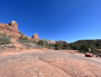
Once on top of the slickrock plateau, expansive views of Red Rock Country spread out below you. The views looking north and east from the Coconino Trail at the top of Slim Shady are some of the best in Sedona—pack your camera!
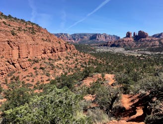
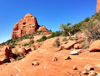
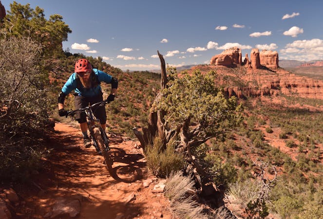
Once you’ve finished with your photos and are ready to descend, Slim Shady plummets rapidly down the mountainside. Mostly following a dried up stream bed (that can sometimes have water after a rain or snow), the trail drops down a cascade of rock ledges that offer the opportunity to roll or to huck. Blocky rock gardens will keep you on your toes, and down low a few flowy sections of dirt singletrack add a little relief from the rocky chunder.
While this loop combination may only be a few miles long, this short route is perfect as a quick hit or an addition to a longer ride in the area.
Difficult
Mostly stable trail tread with some variability featuring larger and more unavoidable obstacles that may include, but not be limited to: bigger stones, roots, steps, and narrow curves. Compared to lower intermediate, technical difficulty is more advanced and grades of slopes are steeper. Ideal for upper intermediate riders.

Some trail sections have exposed ledges or steep ascents/descents where falling could cause serious injury.

Close to help in case of emergency.
3.9 km away
Hiline offers stunning views of the Red Rocks region from exposed mountainside singletrack. Finish it off with a raucous descent down a black-diamond plunge!
Extreme Mountain Biking
4.4 km away

The Hogs are some of the most entertaining—and challenging—trails in Sedona, with technical rock rolls and rock gardens, cliff exposure, and of course—beautiful views!
Severe Mountain Biking
4.9 km away
A loop connecting some of the newest singletrack that Sedona has to offer.
Severe Mountain Biking
5.5 km away

A technical, but gorgeous, loop around Airport Butte.
Severe Mountain Biking
6.4 km away
One of Sedona's easiest mountain bike rides.
Difficult Mountain Biking
6.9 km away
Extreme exposure coupled with brutally-technical rock moves make Hangover one of the most technical--and dangerous--trails in the nation.
Extreme Mountain Biking
7.6 km away

A long loop connecting Sedona trails both old and new.
Difficult Mountain Biking
8.1 km away
Combine a longtime Sedona classic trail with a flowy loop on the end.
Severe Mountain Biking
10 routes · Mountain Biking

25 routes · Mountain Biking

37 routes · Mountain Biking
3 routes · Mountain Biking

25 routes · Mountain Biking

10 routes · Mountain Biking