1.3 km away
Scorpion / Pyramid Loop
A loop connecting some of the newest singletrack that Sedona has to offer.
Severe Mountain Biking
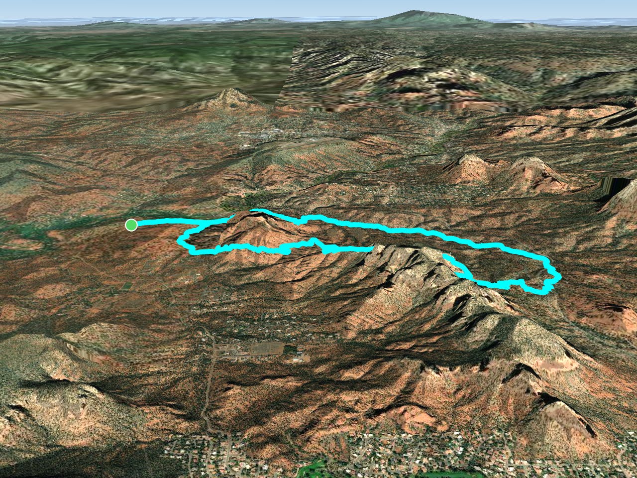
- Distance
- 14 km
- Ascent
- 310 m
- Descent
- 309 m
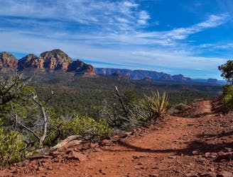
Hiline offers stunning views of the Red Rocks region from exposed mountainside singletrack. Finish it off with a raucous descent down a black-diamond plunge!
Mountain Biking Extreme
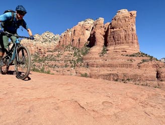
The Hiline Trail is both stunningly beautiful and incredibly technical but thankfully, not at the same time.
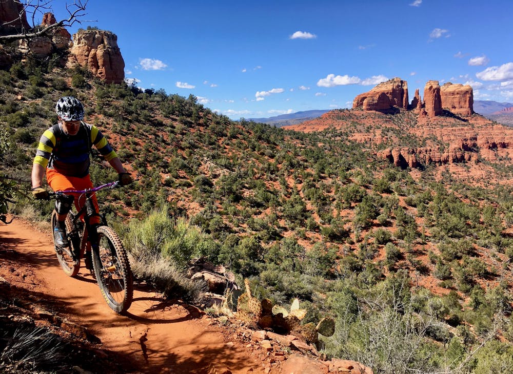
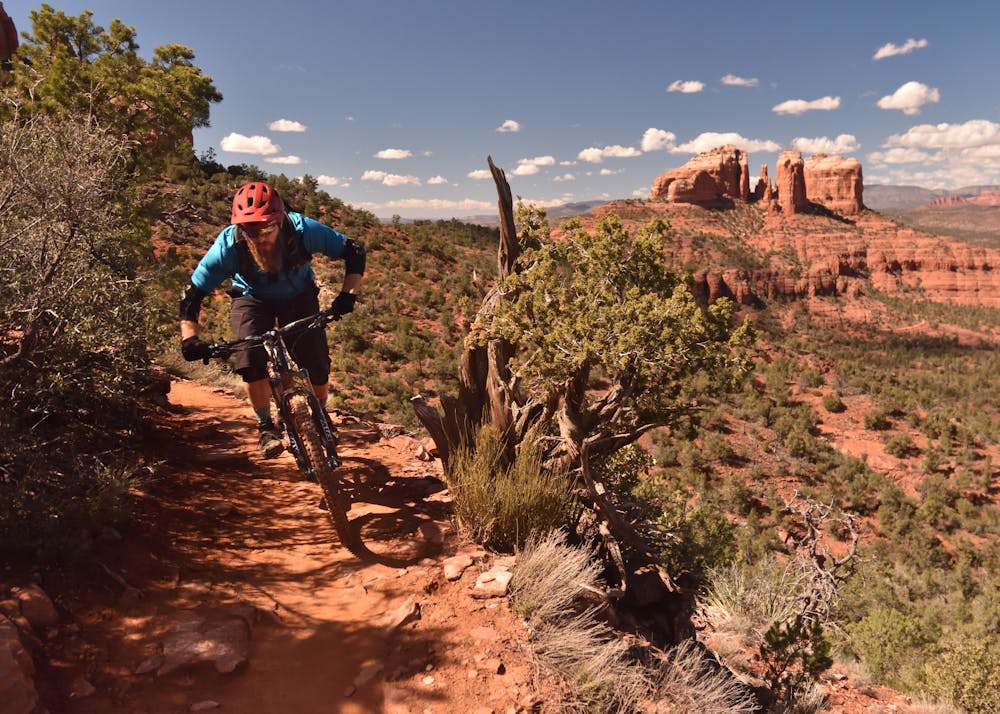
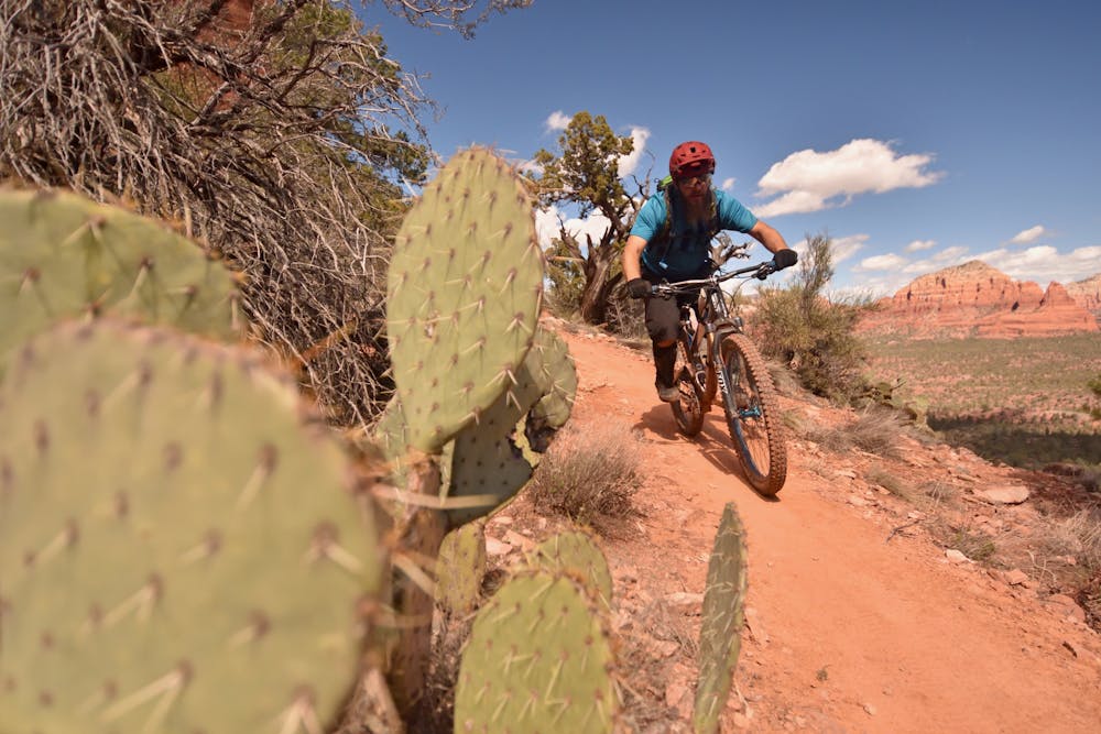
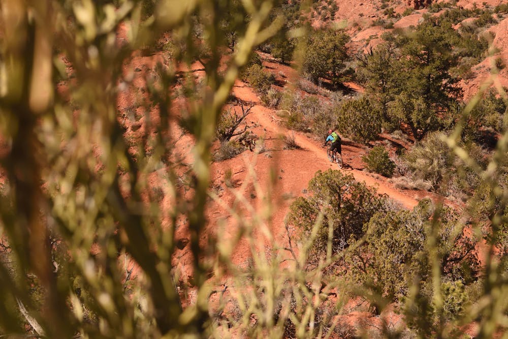
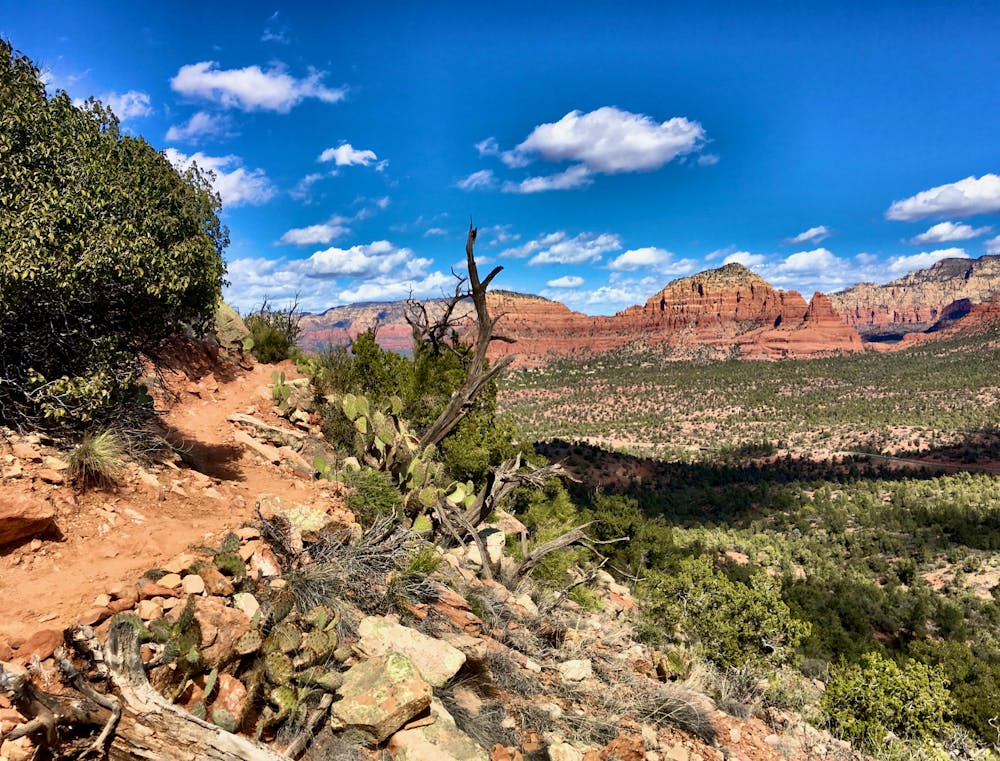
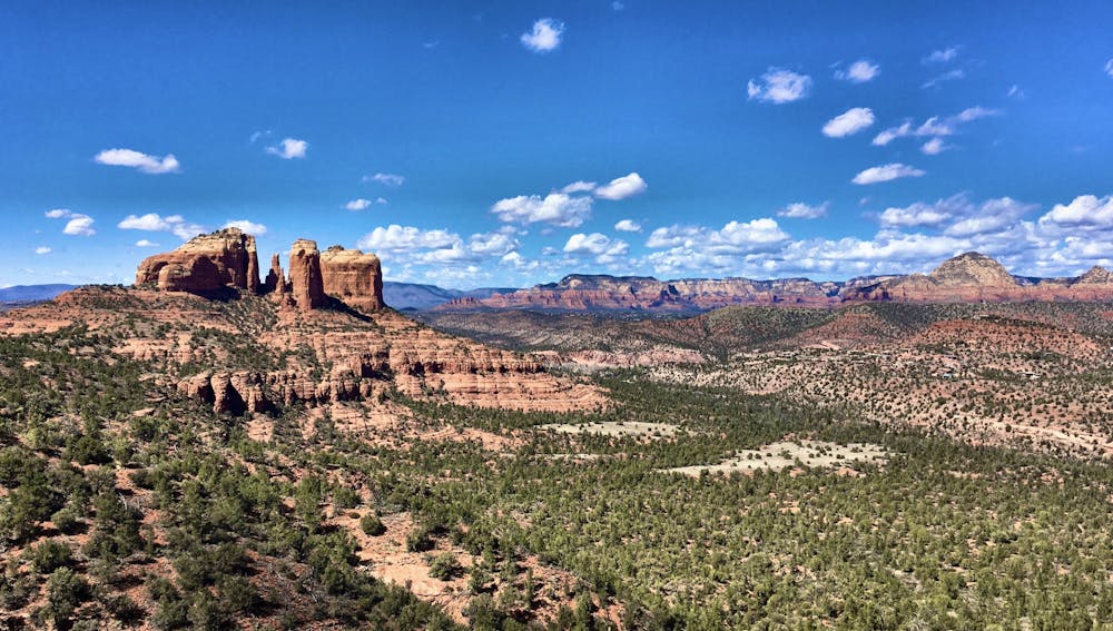
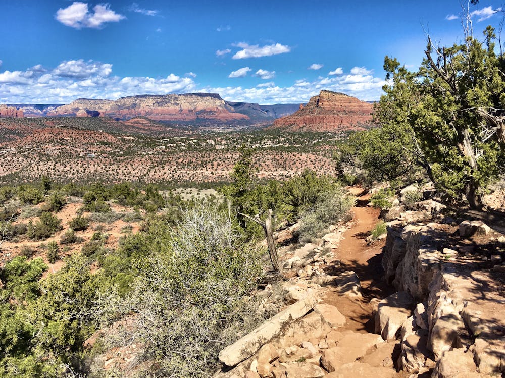
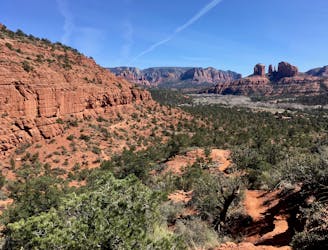
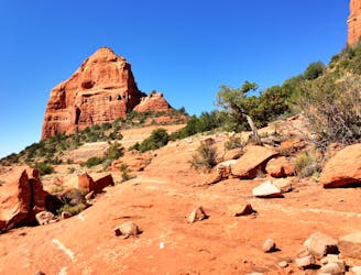
The trail gets its name from the high traverse that it performs above sheer cliff bands along the side of one of Sedona's red rock mountains. Thanks to the trail's vantage point high above the valley floor, riders can enjoy stunning views of the surrounding mountains and red rock formations. While the singletrack along the traverse is very exposed in places and a fall could be deadly, overall this portion of the singletrack is relatively non-technical.
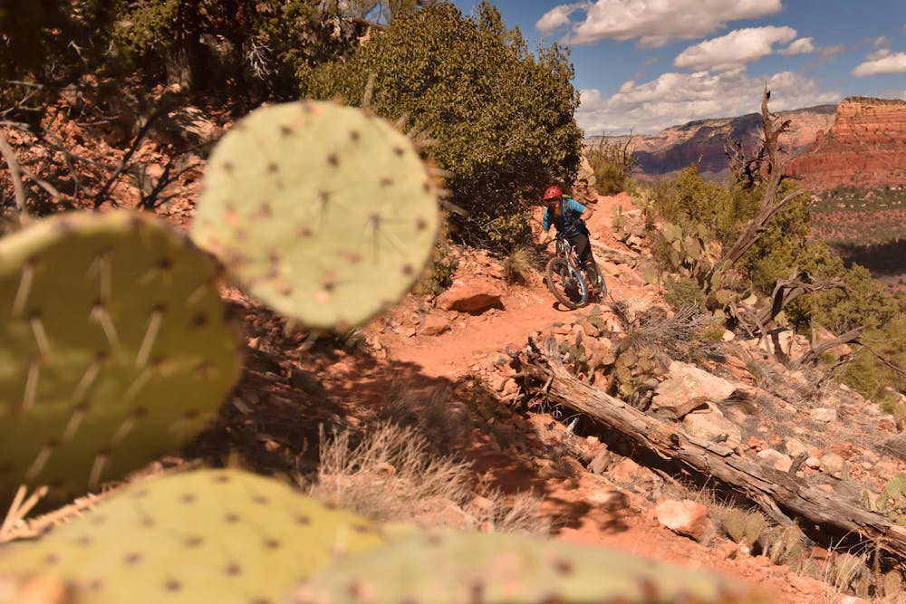
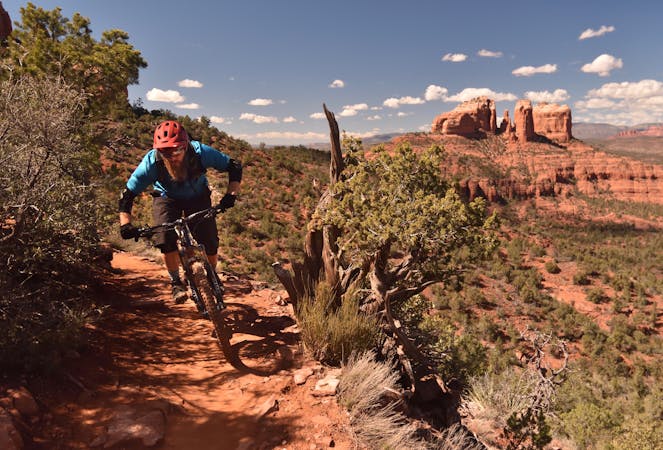
That all changes when the trail points downhill, with the singletrack funneling into steep, rocky chutes; boulder-filled rock gardens; and steep rock rolls. Watch out for the cacti lining the trail—there's no room for error!
Eventually this challenging black diamond descent drops out onto the valley floor, with a number of singletrack options to finish the loop. While Hiline is no joke, and is definitely a black diamond ride, this trail is much more approachable than the uber-technical and drastically-exposed Hangover. Since it's rideable by a larger number of mountain bikers, this trail is consequently more popular.
Several trail options provide great climbs up to Hiline, including Easy Breezy to Easy Sleezy (black diamond) and Hermit (blue square). Even the climbs and the other trails used to form a loop with Hiline are well-built and entertaining, meaning that this entire loop is worth your time!
Extreme
Very steep, difficult, narrow singletrack with widely variable and unpredictable trail conditions. Unavoidable obstacles could be 15in/38cm tall or greater, and unavoidable obstacles with serious consequences are likely to be present. Obstacles could include big rocks, difficult root sections, drops, jumps, sharp switchbacks, and more. Ideal for expert-level riders.

Some trail sections are extremely exposed where falling will almost certainly result in serious injury or death.

Close to help in case of emergency.
1.3 km away
A loop connecting some of the newest singletrack that Sedona has to offer.
Severe Mountain Biking
3.9 km away

A short but rewarding descent that can be ridden independently, or in conjunction with Hiline.
Difficult Mountain Biking
4 km away

A long loop connecting Sedona trails both old and new.
Difficult Mountain Biking
4.5 km away

A technical, but gorgeous, loop around Airport Butte.
Severe Mountain Biking
5.4 km away

The Hogs are some of the most entertaining—and challenging—trails in Sedona, with technical rock rolls and rock gardens, cliff exposure, and of course—beautiful views!
Severe Mountain Biking
5.5 km away
Combine a longtime Sedona classic trail with a flowy loop on the end.
Severe Mountain Biking
5.6 km away
One of Sedona's easiest mountain bike rides.
Difficult Mountain Biking
7.4 km away
Extreme exposure coupled with brutally-technical rock moves make Hangover one of the most technical--and dangerous--trails in the nation.
Extreme Mountain Biking
7.7 km away
This intermediate-friendly primer to Sedona's red rock will entertain expert-level riders as well.
Difficult Mountain Biking
10 routes · Mountain Biking

25 routes · Mountain Biking

37 routes · Mountain Biking

3 routes · Mountain Biking

25 routes · Mountain Biking

10 routes · Mountain Biking