2.7 km away
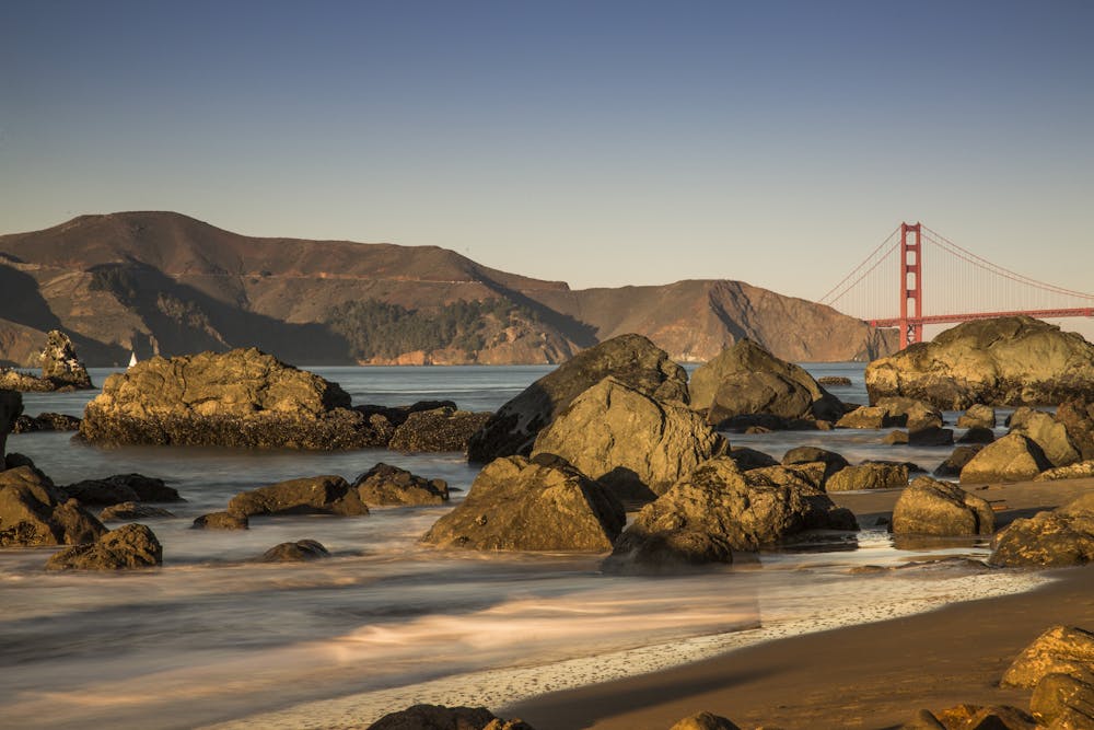
Coastal Trail: Baker Beach to Golden Gate Bridge
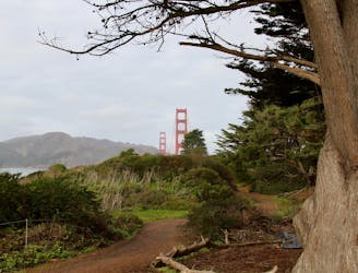
A path that links cliff-top views, sandy beaches, cypress groves, historic war defenses, and the entrance to the Golden Gate Bridge.
Easy Hiking
- Distance
- 5.2 km
- Ascent
- 119 m
- Descent
- 119 m
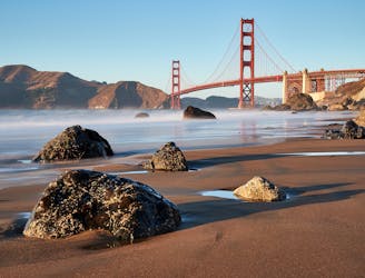
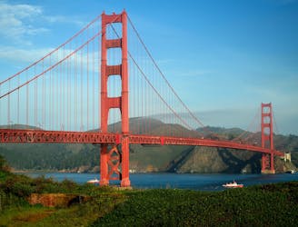
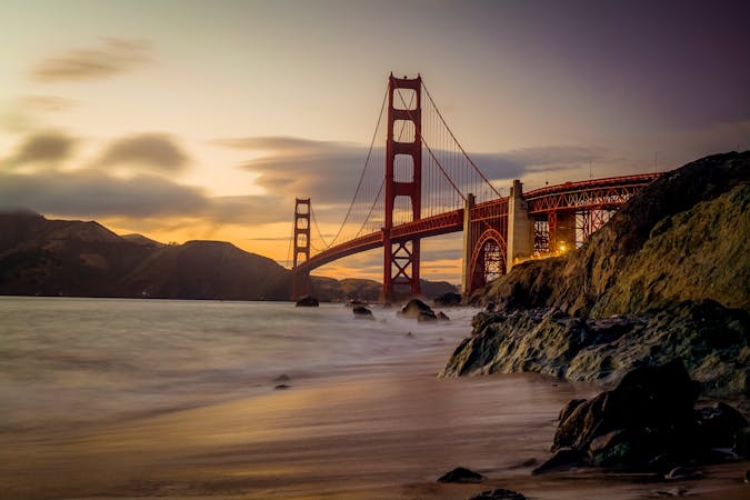
On the Lands End Trail you'll stroll through historic Lands End, in a beautiful forest, atop high sea cliffs, with lofty views of the Golden Gate Bridge.
Hiking Moderate

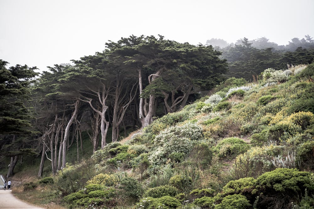
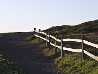
A short network of trails twists around the part of Golden Gate National Recreation Area known as Lands End. This far tip of San Francisco’s peninsula has incredible views of the ocean and the Golden Gate Bridge, tall sea cliffs, wind-warped cypress groves, historic ruins, and shipwrecks. All these highlights are located within a relatively small area and can be linked in one concise hiking loop.
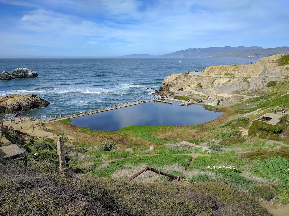
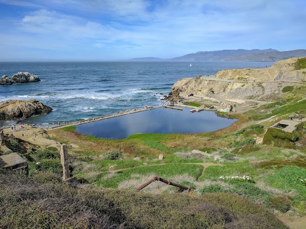
This loop uses mainly the Coastal Trail, El Camino del Mar Trail, and a few paved paths. You can begin from a number of parking areas, but described here is the Lands End Lookout Visitor Center as a starting point. From there, and moving in a clockwise direction around the loop, the first stop is an overlook of the Sutro Baths. Now in ruins, this used to be the world’s largest indoor swimming pool when it was opened in 1896. You can walk a staircase down to the baths for a closer look or continue on the Coastal Trail, passing a memorial to the USS San Francisco along the way.
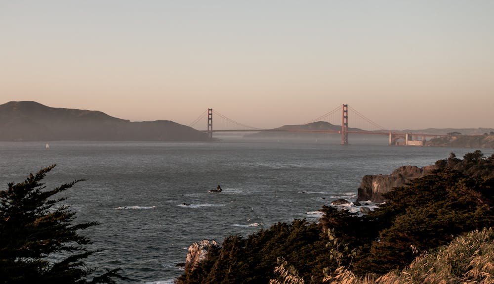
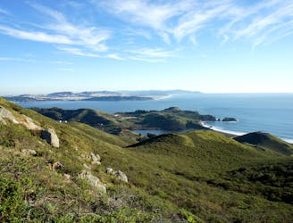
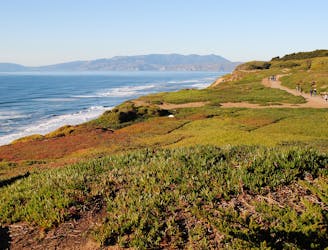
This trail is a dirt path that takes you along the top of progressively higher sea cliffs and through a surprisingly-verdant coastal forest. Many plants thrive here, including flowering shrubs and cypress trees stiffened into a swept-back posture from the constant ocean breeze. For nearly the entire way, you’ll enjoy views over the water, across to the Marin Headlands, and the Golden Gate Bridge. Perhaps the best view of the bridge is from Lands End Point, reached by a short, signed side trail. This spot and the small beach next to it are definitely worth the detour and steep stairs to get there. Atop huge gray cliffs near the eastern end of the Coastal Trail, you’ll gaze down on the sandy cove called China Beach, and earn lofty views over the bay.
To complete the loop, link with El Camino del Mar, which is at first a road beside the golf course but turns into a trail as you continue west toward your starting point. This way takes you by more significant memorials and statues, but if you prefer the natural scenery, you can simply retrace your steps on Coastal Trail.
Sources: https://www.thrillist.com/lifestyle/san-francisco/san-francisco-bay-area-hikes-with-beautiful-views https://www.nps.gov/goga/planyourvisit/landsend.htm https://californiathroughmylens.com/lands-end/ https://www.inside-guide-to-san-francisco-tourism.com/lands-end-san-francisco.html
Moderate
Hiking along trails with some uneven terrain and small hills. Small rocks and roots may be present.

The trail contains some obstacles such as outcroppings and rock which could cause injury.

Close to help in case of emergency.
2.7 km away
A path that links cliff-top views, sandy beaches, cypress groves, historic war defenses, and the entrance to the Golden Gate Bridge.
Easy Hiking
3.4 km away
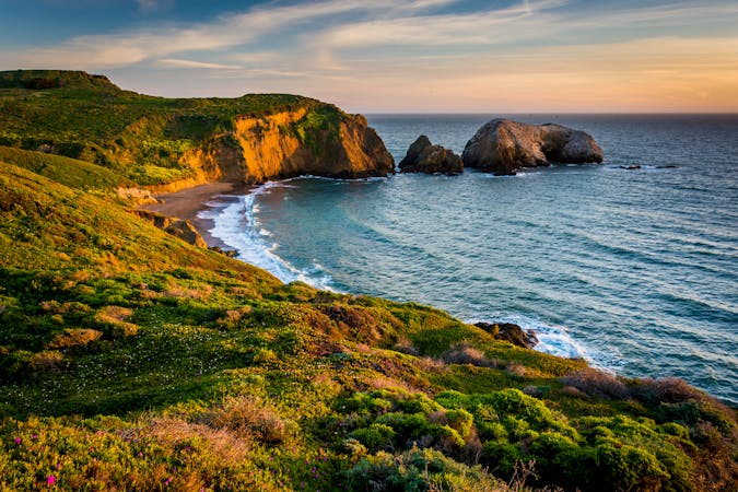
Explore history and scenery along the dramatic coastline near the Golden Gate Bridge.
Difficult Hiking
4.8 km away
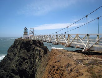
Exciting walk through a tunnel and over a suspension bridge to a lighthouse on the tip of Marin Headlands.
Easy Hiking
6.2 km away
Travel up and down panoramic hills above the sea, in between two of Marin County's best beaches
Difficult Hiking
6.2 km away
Hike from Rodeo Beach to a more secluded viewpoint along coastal cliffs.
Easy Hiking
6.2 km away
Amazing views of San Francisco and some interesting war relics near the Golden Gate Bridge.
Moderate Hiking
7.3 km away
Stroll through an urban park with many activities, and enjoy views of the bay and the Golden Gate Bridge.
Easy Hiking
7.4 km away
Family and dog-friendly loop featuring sea cliffs, wildflowers, a sandy beach, and historic war forts.
Moderate Hiking
9.1 km away
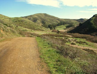
Popular hike through a verdant valley to a beach in a cliff-lined beach.
Easy Hiking
12 routes · Hiking
8 routes · Hiking
7 routes · Hiking

7 routes · Hiking · Road Biking · Trail Running

13 routes · Hiking · Trail Running
8 routes · Hiking · Road Biking