753 m away
Coastal Trail: Baker Beach to Golden Gate Bridge
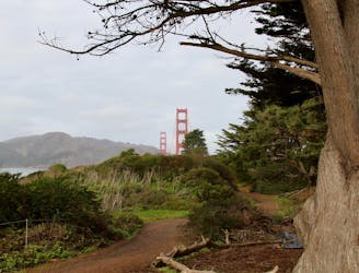
A path that links cliff-top views, sandy beaches, cypress groves, historic war defenses, and the entrance to the Golden Gate Bridge.
Easy Hiking
- Distance
- 5.2 km
- Ascent
- 119 m
- Descent
- 119 m
Explore history and scenery along the dramatic coastline near the Golden Gate Bridge.
Hiking Difficult

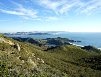
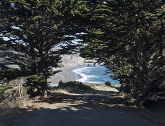
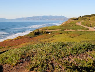
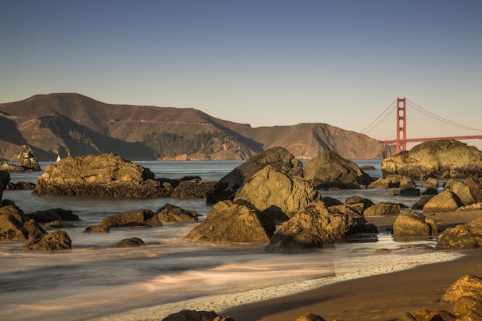
Batteries to Bluffs Trail is an excellent tour of the scenery and history on the San Francisco coastline. It winds along seaside hills covered in colorful vegetation, crosses the walls of wartime defense structures, and reaches a beach with a picture-perfect view of the Golden Gate Bridge.
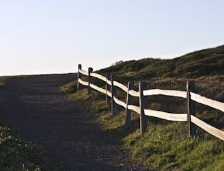
It’s a sandy path for hikers only, and is generally less busy than other trails in the area. Staircases aid some of the ups and downs, and narrow traverses cut across some steep slopes. Those afraid of heights may get nervous in places, but it’s safe if you are careful. Children should be closely supervised, especially around drop-offs on the walls of the batteries.
Battery Crosby is the primary defense structure along the trail. The huge guns that once armed it have been removed, but you can walk inside the turrets that housed them. Climb the stairs to get on top, and see the vantage once strategic for defense. If you want to explore more batteries, take a short side trip from the northern end of Batteries to Bluffs Trail to visit Battery West and Battery Godfrey.
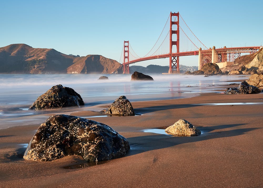
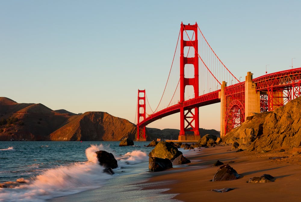
Another spur leads to Marshall’s Beach, which is well worth the extra stairs to reach it. This sandy and rocky beach is rarely crowded, but has one of the best views anywhere of the Golden Gate Bridge. Don’t miss the photo opportunity.
Other highlights along the loop include a World War II memorial and Immigrant Point Overlook. If you want, you can skip those two and shorten the loop by returning on California Coastal Trail, which is completely flat and parallels Lincoln Blvd between either end of Batteries to Bluffs.
Sources: https://www.presidio.gov/trails/batteries-to-bluffs-trail https://www.presidio.gov/transportation-internal/Shared%20Documents/presidio-trails.pdf
Difficult
Hiking trails where obstacles such as rocks or roots are prevalent. Some obstacles can require care to step over or around. At times, the trail can be worn and eroded. The grade of the trail is generally quite steep, and can often lead to strenuous hiking.

Some trail sections have exposed ledges or steep ascents/descents where falling could cause serious injury.

Close to help in case of emergency.
753 m away
A path that links cliff-top views, sandy beaches, cypress groves, historic war defenses, and the entrance to the Golden Gate Bridge.
Easy Hiking
3.4 km away
On the Lands End Trail you'll stroll through historic Lands End, in a beautiful forest, atop high sea cliffs, with lofty views of the Golden Gate Bridge.
Moderate Hiking
4 km away

Stroll through an urban park with many activities, and enjoy views of the bay and the Golden Gate Bridge.
Easy Hiking
5.2 km away
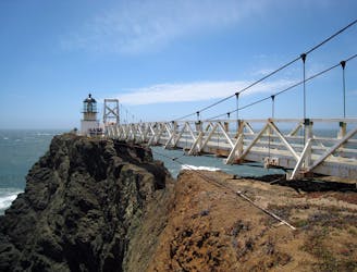
Exciting walk through a tunnel and over a suspension bridge to a lighthouse on the tip of Marin Headlands.
Easy Hiking
6.3 km away
Amazing views of San Francisco and some interesting war relics near the Golden Gate Bridge.
Moderate Hiking
6.6 km away
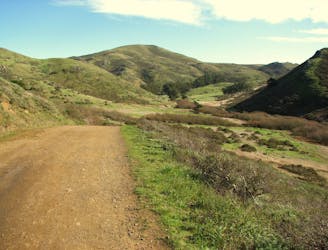
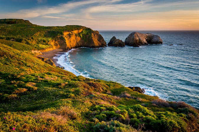
Travel up and down panoramic hills above the sea, in between two of Marin County's best beaches
Difficult Hiking
6.6 km away
Hike from Rodeo Beach to a more secluded viewpoint along coastal cliffs.
Easy Hiking
8.7 km away
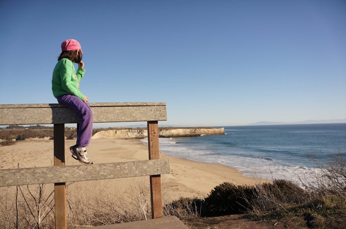
Popular hike through a verdant valley to a beach in a cliff-lined beach.
Easy Hiking
8.9 km away
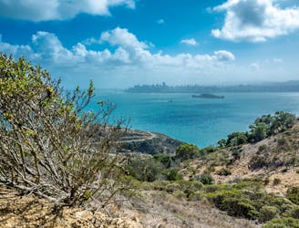
Views over the San Francisco Bay and rich history on the hike to the top of Mount Livermore.
Moderate Hiking
9.4 km away
Family and dog-friendly loop featuring sea cliffs, wildflowers, a sandy beach, and historic war forts.
Moderate Hiking

12 routes · Hiking
8 routes · Hiking
7 routes · Hiking
7 routes · Hiking · Road Biking · Trail Running

13 routes · Hiking · Trail Running
8 routes · Hiking · Road Biking