2.3 km away
Quandary Peak
Rugged ridgeline hike to the top of one of Colorado's more accessible 14ers.
Severe Hiking
- Distance
- 11 km
- Ascent
- 1 km
- Descent
- 1 km

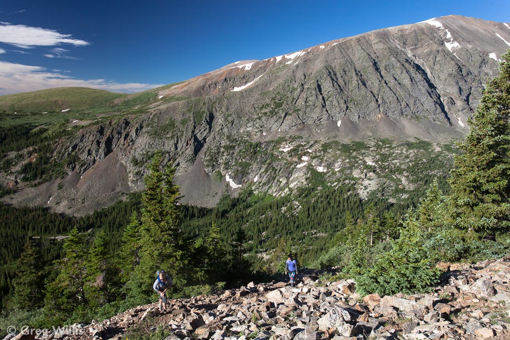
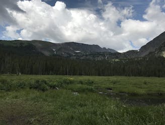
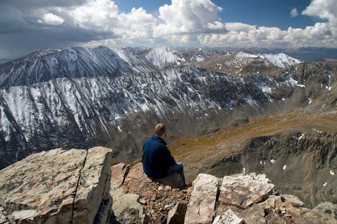
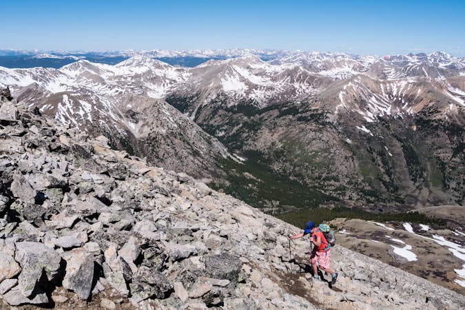
North Star Mountain, just south of Breckenridge, is a stark ridgeline on the Continental Divide, which separates the Tenmile and Mosquito Ranges. Thus, it is a significant peak and climbing it is a worthy challenge, even though it tops out shy of the 14,000-foot threshold of some nearby summits. Its long crest contains a few false summits and some impressive exposure for most of its length, but the hiking is not especially rugged and routefinding is straightforward. The 7.8-mile roundtrip begins on a 4WD road then follows the ridge to the westernmost, true summit at 13,614 feet. Views are spectacular at the first false summit and from then on, so shorter out and backs are rewarding as well.
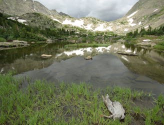
Begin from Hoosier Pass on Highway 9, at a large gravel lot on the west side of the road. The east ridge of North Star begins from this pass, and though the summit is not yet visible from the road, the ridge can be seen arcing upward to the west. From this trailhead, a 4WD road heads up the ridge, beginning as a gentle slope through conifer forest. After only 0.3 miles it reaches a T intersection at the edge of a meadow. The two roads that diverge from here form a loop around the easternmost false summit on this ridgeline. The loop, which features a small lake on the north side of the ridge, is a great option for a shorter hike or snowshoe without committing to the exposed higher ridgeline. Travel the loop in either direction. To continue up the ridge toward the true summit, go left (south) at the T for the more direct route.
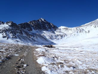
The 4WD road contours around the south side of the false summit and climbs to a saddle on the ridgeline (mile 1.5). Continue up the spine of the ridge from here. You will leave the main 4WD road but still be on a well-traveled path. A few old mine sites as well as current claims are scattered throughout this area. Respect all private property signs and closed gates.
Punch up the ridgeline for 1.2 miles, and the slope lessens at the top of another peak. This is a proud summit with 360-views, but is not the true summit of North Star. A slightly higher peak lies another 1.2 miles west along the ridge. If you have the time and energy to continue, you can claim the true summit of this highly underrated mountain.
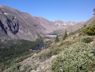
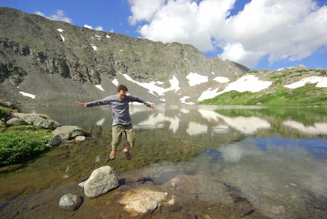
From here the route is straightforward, with only one way to go. The drop on either side becomes increasingly steeper as you move along and the views get better and better. 14ers loom on either side--Quandary Peak (14,265 ft) to the north with the Blue Lakes shimmering below, and Mt. Lincoln (14,295 ft) to the south, with its snowy north-facing chutes.
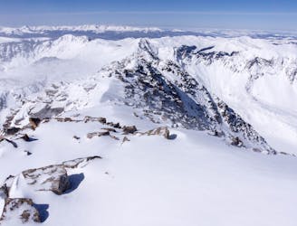
When you reach the true summit, you will see the ridge extends westward in much the same manner, but slopes downward to a saddle that joins it with the next mountain, Wheeler Mountain. A longer loop to link Wheeler and other peaks is possible, but the simplest option is to turn around and go down the way you came.
Sources: https://www.summitpost.org/north-star-mountain/154261
Difficult
Hiking trails where obstacles such as rocks or roots are prevalent. Some obstacles can require care to step over or around. At times, the trail can be worn and eroded. The grade of the trail is generally quite steep, and can often lead to strenuous hiking.

Some trail sections are extremely exposed where falling will almost certainly result in serious injury or death.

Away from help but easily accessed.
2.3 km away
Rugged ridgeline hike to the top of one of Colorado's more accessible 14ers.
Severe Hiking
4.2 km away
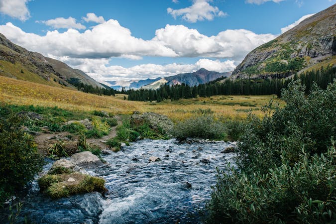
An easy stroll around alpine lakes and waterfalls beneath a 14,000-foot peak near Breckenridge.
Easy Hiking
6 km away

A steep old mining road that leads to ruins on the slopes of Red Mountain with great views over the Blue River Valley and surrounding peaks.
Difficult Hiking
6.9 km away
Climb four 14ers in one hike!
Severe Hiking
8.4 km away
Moderate hike among waterfalls and mining ruins to surpass the treeline and reach alpine lakes in a high valley.
Moderate Hiking
8.4 km away
Trail that climbs a out of a forested valley to an alpine basin with lakes and waterfalls, dotted with historic mine sites along the way.
Moderate Hiking
8.5 km away
Rugged hike above treeline between two high-elevation lakes near Breckenridge.
Difficult Hiking

16 routes · Hiking
8 routes · Hiking
5 routes · Alpine Climbing · Hiking

25 routes · Alpine Climbing · Hiking
5 routes · Alpine Climbing · Hiking
3 routes · Hiking
6 routes · Alpine Climbing · Hiking

46 routes · Alpine Climbing · Hiking