2 m away
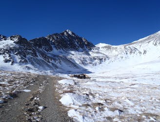
Mohawk Lakes
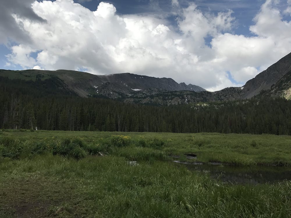
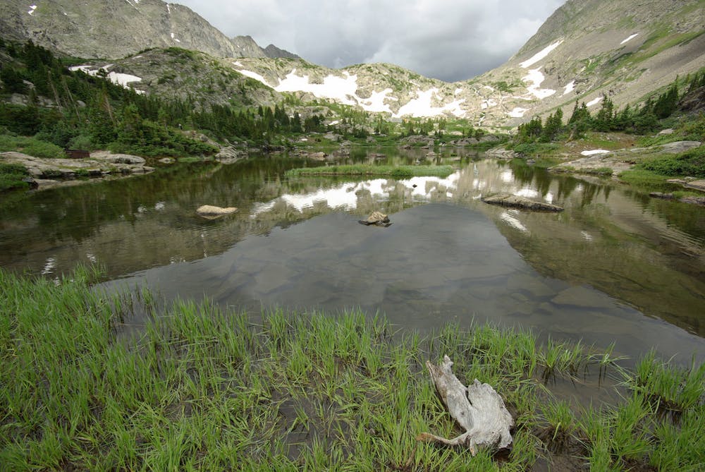
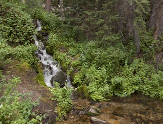
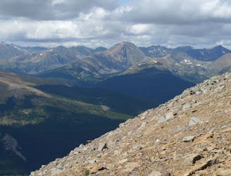
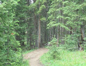
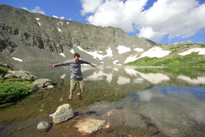
Moderate hike among waterfalls and mining ruins to surpass the treeline and reach alpine lakes in a high valley.
Moderate Hiking
- Distance
- 11 km
- Ascent
- 581 m
- Descent
- 581 m
Trail that climbs a out of a forested valley to an alpine basin with lakes and waterfalls, dotted with historic mine sites along the way.
Hiking Moderate

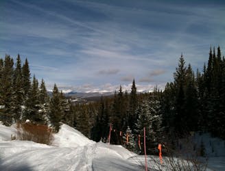
Spruce Creek Trail is easy to hike and easy to get to from Breckenridge. From this one trailhead on Spruce Creek Road many destinations are possible. You can explore a waterfall, alpine lakes, old mine sites, or summit a surrounding peak. The shortest and most popular excursions are to Mayflower Lakes and Continental Falls. Both can be seen in an out and back of about 5 miles. The trailhead is typically accessible in winter as well, making it good for snowshoeing and cross country skiing.
In summer when all of Spruce Creek Road is open, high-clearance vehicles can drive about 2 miles farther up the road. This shaves the same distance from the hike, as the trail follows the creek in the bottom of the valley below the road. From this upper trailhead, a few different trails diverge. Upper Spruce Creek Trail rejoins with the main Spruce Creek Trail, which bypasses this parking area to the south. The Mayflower Lakes Trail finds a lovely view at the lake, then also joins Spruce Creek Trail just before Continental Falls. In this vicinity are many old mining ruins, which short side trails weave among.
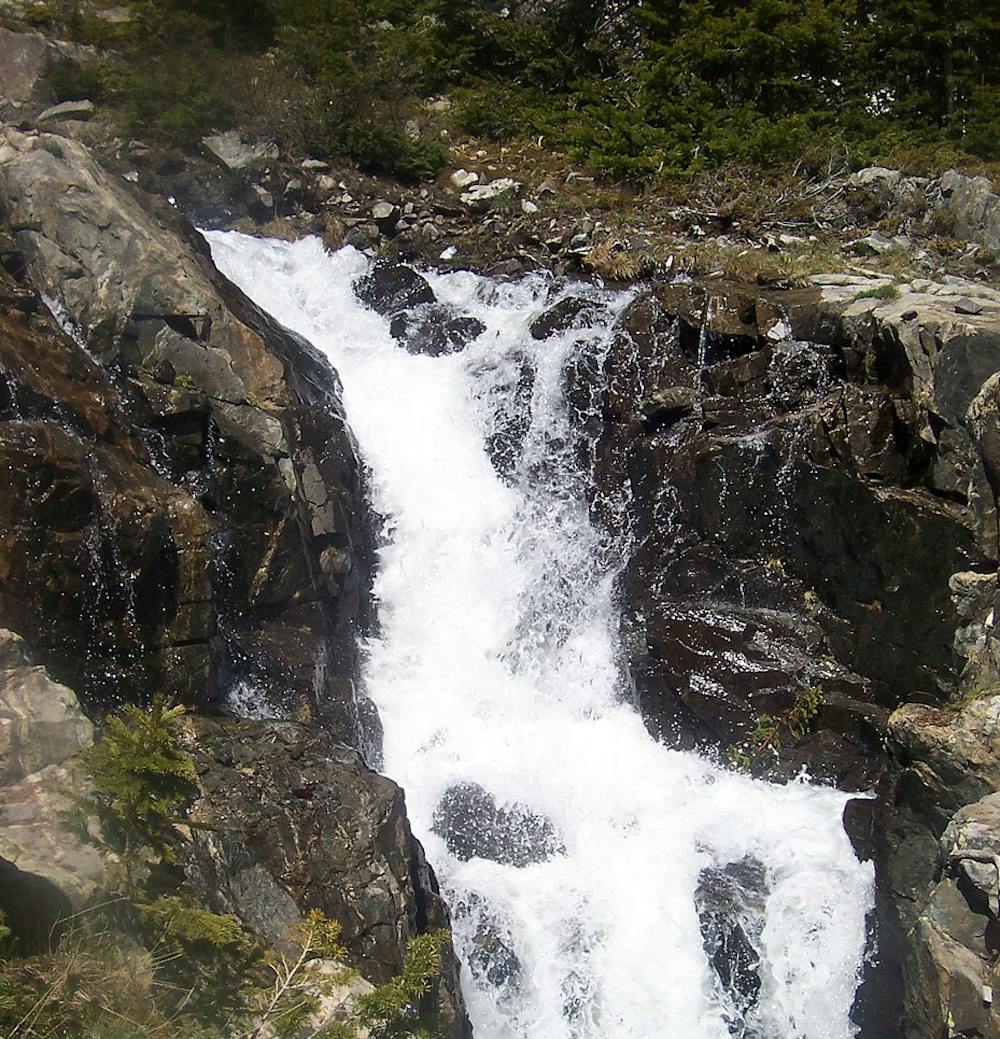
Continental Falls is a a two-tiered waterfall dropping through a cleft in the valley’s bedrock. It is part of the stream that flows out of Mohawk Lakes to feed Spruce Creek. It is 2.6 miles from the Spruce Creek Trailhead, or roughly 0.6 miles from the upper trailhead. The trail continues steeply past Continental Falls for about another ½ mile to Mohawk Lakes, and beyond that to reach higher lakes in the valley. Go as far as you wish and return the way you came.
Sources: https://www.alltrails.com/explore/trail/us/colorado/spruce-creek-trail-to-mohawk-lake-and-continental-falls https://dayhikesneardenver.com/continental-falls-hike-colorado/ http://fdrd.org/files/2614/0561/2388/MohawkLakeviaSpruceCreek.pdf
Moderate
Hiking along trails with some uneven terrain and small hills. Small rocks and roots may be present.

The trail contains some obstacles such as outcroppings and rock which could cause injury.
Away from help but easily accessed.
2 m away
Moderate hike among waterfalls and mining ruins to surpass the treeline and reach alpine lakes in a high valley.
Moderate Hiking
2.7 km away

A steep old mining road that leads to ruins on the slopes of Red Mountain with great views over the Blue River Valley and surrounding peaks.
Difficult Hiking
3.3 km away
Rugged hike above treeline between two high-elevation lakes near Breckenridge.
Difficult Hiking
3.6 km away
Steep hike on a wide trail to the tallest summit above Breckenridge Ski Resort.
Difficult Hiking
3.8 km away

Singletrack connector through the forest between Indiana Creek Road and Boreas Pass Road in Breckenridge.
Easy Hiking
3.8 km away
Forested trail near Boreas Pass Road with mountain views and a chance at spotting wildlife.
Moderate Hiking
4.2 km away
Forest hike that begins from Breckenridge Ski Resort, alongside a trickling stream and beneath brilliant foliage in fall.
Moderate Hiking
4.8 km away
Easy hike up a gentle gradient to the scenic remains of an old mine in a mountain valley.
Easy Hiking
4.8 km away
Steep hike to panoramas atop a 13,000-foot peak just outside of Breckenridge.
Difficult Hiking
5.2 km away
Network of trails through forest and wetlands of a wildlife preserve, nestled between the town and ski resort of Breckenridge.
Easy Hiking

16 routes · Hiking
8 routes · Hiking