907 m away
Baker's Tank Trail
Forested trail near Boreas Pass Road with mountain views and a chance at spotting wildlife.
Moderate Hiking
- Distance
- 8.7 km
- Ascent
- 310 m
- Descent
- 310 m
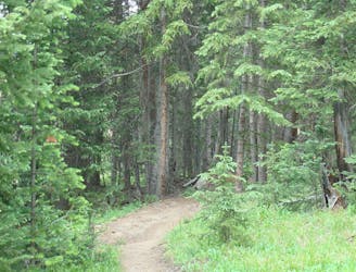
Singletrack connector through the forest between Indiana Creek Road and Boreas Pass Road in Breckenridge.
Hiking Easy

This is a dirt path in the woods that travels in between Boreas Pass Road and Indiana Creek Road in Breckenridge. It passes behind some private homes along Indiana Creek, but the middle portion of the trail is in a miniature valley tucked out of sight, which is surprisingly quiet despite its proximity to the road. A small pond sits perched unexpectedly here, and offers a chance to spot wildlife like waterfowl, deer and maybe even a moose.
The trail is mostly used by mountain bikers to link with other trails south of town, but it makes a nice short, family-friendly outing for anyone in Breckenridge. There is no dedicated parking area for the trail, however. The northern end on Boreas Pass is at the Sawmill Museum and the southern end meets Indiana Creek in between private lots where there is no roadside parking.
Sources: https://www.alltrails.com/explore/trail/us/colorado/indiana-gulch-trail
Easy
Walking along a well-kept trail that’s mostly flat. No obstacles are present.

The trail contains some obstacles such as outcroppings and rock which could cause injury.

Close to help in case of emergency.
907 m away
Forested trail near Boreas Pass Road with mountain views and a chance at spotting wildlife.
Moderate Hiking
1.1 km away
Easy hike up a gentle gradient to the scenic remains of an old mine in a mountain valley.
Easy Hiking
1.5 km away
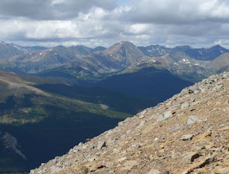
Steep hike to panoramas atop a 13,000-foot peak just outside of Breckenridge.
Difficult Hiking
1.9 km away
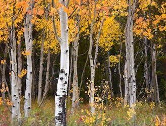
Forest hike that begins from Breckenridge Ski Resort, alongside a trickling stream and beneath brilliant foliage in fall.
Moderate Hiking
3.2 km away
Network of trails through forest and wetlands of a wildlife preserve, nestled between the town and ski resort of Breckenridge.
Easy Hiking
3.5 km away

Hillside hike outside Breckenridge with abandoned mine sites and valley views.
Easy Hiking
3.8 km away
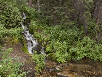
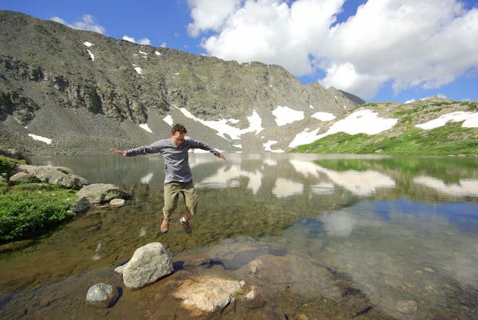
Trail that climbs a out of a forested valley to an alpine basin with lakes and waterfalls, dotted with historic mine sites along the way.
Moderate Hiking
3.8 km away
Moderate hike among waterfalls and mining ruins to surpass the treeline and reach alpine lakes in a high valley.
Moderate Hiking
4.1 km away
Steep hike on a wide trail to the tallest summit above Breckenridge Ski Resort.
Difficult Hiking
6.1 km away

A steep old mining road that leads to ruins on the slopes of Red Mountain with great views over the Blue River Valley and surrounding peaks.
Difficult Hiking

16 routes · Hiking
8 routes · Hiking