2.3 km away
Bald Mountain Summit
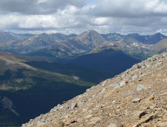
Steep hike to panoramas atop a 13,000-foot peak just outside of Breckenridge.
Difficult Hiking
- Distance
- 16 km
- Ascent
- 949 m
- Descent
- 949 m
Hillside hike outside Breckenridge with abandoned mine sites and valley views.
Hiking Easy

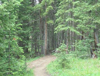
This is an easy loop with French Gulch Road that connects Reiling Dredge and B&B trailheads, and passes old mine ruins. Beginning from Reiling Dredge, the trail to Minnie Mine cuts west and upward on an old dirt road cut into the hillside. It starts out heavily treed but thins as you get higher on this sunny south slope. In only ¾ mile the road reaches the ruins of Minnie Mine and its large tailings pile. The clearing around the mine makes a great viewpoint as well.
Most of the buildings are collapsed into piles of wood, but some structures still partially stand, along with the remains of more foundations. Be careful because the structures and ground around them may be unstable. Continue past the mine to find several more ruins and tailings piles, which were all part of the same complex during the heydey of mineral extraction in French Gulch. These are all located along a relatively level traverse that the old road takes. Head downhill on a narrower trail about .75 miles further past Minnie Mine to end at the B&B Mine Trailhead, then use the road to complete a loop.
Sources: https://www.alltrails.com/explore/trail/us/colorado/minnie-mine-loop https://www.mtbproject.com/trail/5566515/minnie-mine
Easy
Walking along a well-kept trail that’s mostly flat. No obstacles are present.

The trail contains some obstacles such as outcroppings and rock which could cause injury.

Close to help in case of emergency.
2.3 km away
Steep hike to panoramas atop a 13,000-foot peak just outside of Breckenridge.
Difficult Hiking
2.4 km away
Easy hike up a gentle gradient to the scenic remains of an old mine in a mountain valley.
Easy Hiking
3.2 km away

Hike along a forested ridgeline that follows a historic flume and other mining relics.
Moderate Hiking
3.3 km away
Forested trail near Boreas Pass Road with mountain views and a chance at spotting wildlife.
Moderate Hiking
3.5 km away

Singletrack connector through the forest between Indiana Creek Road and Boreas Pass Road in Breckenridge.
Easy Hiking
4.7 km away
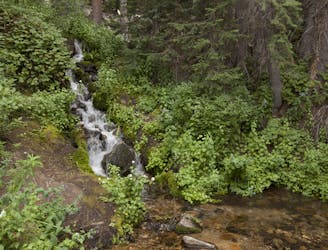
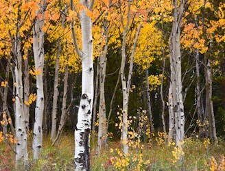
Forest hike that begins from Breckenridge Ski Resort, alongside a trickling stream and beneath brilliant foliage in fall.
Moderate Hiking
5.5 km away
Network of trails through forest and wetlands of a wildlife preserve, nestled between the town and ski resort of Breckenridge.
Easy Hiking
7.1 km away
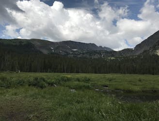
Trail that climbs a out of a forested valley to an alpine basin with lakes and waterfalls, dotted with historic mine sites along the way.
Moderate Hiking
7.1 km away
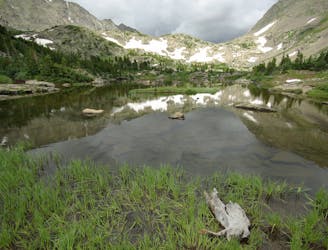
Moderate hike among waterfalls and mining ruins to surpass the treeline and reach alpine lakes in a high valley.
Moderate Hiking
7.4 km away
Steep hike on a wide trail to the tallest summit above Breckenridge Ski Resort.
Difficult Hiking

16 routes · Hiking
8 routes · Hiking