3.2 km away
Minnie Mine Loop

Hillside hike outside Breckenridge with abandoned mine sites and valley views.
Easy Hiking
- Distance
- 3 km
- Ascent
- 93 m
- Descent
- 93 m
Hike along a forested ridgeline that follows a historic flume and other mining relics.
Hiking Moderate

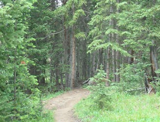
One of several good trails along French Gulch Road, Little French leads up into quiet forest with historic ruins and can be used to make a loop along a ridgeline and back to the road. It begins as a 4WD road (County Rd 569 on some maps) that branches off French Gulch Road about a mile east of Sallie Barber Trailhead.
Follow this road as it heads steeply up a narrow drainage through trees and small meadows. You will pass a cabin after about a mile. The wide trail continues up this valley to eventually reach an old mine in the north slopes of Mt. Guyot, which makes an interesting side trip. To complete the loop, however, you will want to take the singletrack that branches off about 0.2 miles south of the cabin and crosses the wash to head back north. The wash is often dry but may require getting your feet wet during early season.
The steep climb is now over, as the trail contours the hillside to gain the top of a ridgeline, where it follows an old flume for about a mile and a half. This section stays mostly level along the forested ridge. You can catch glimpses through the trees of the verdant valley below.
At 2.75 miles you’ll reach a 5-way trail intersection at a saddle. Go left to take the Humbug Hill Trail downhill to French Gulch Road, which completes the loop. Go straight to stay on Little French and gain the top of Humbug Hill (11,100 ft) in another ½ mile. From the summit you can backtrack to go down the Humbug Hill trail or continue over the top to make a longer loop with Forest Queen and Yellowbrick Trails back to French Gulch Road.
Sources: https://www.mtbproject.com/trail/5949014/little-french https://www.alltrails.com/explore/trail/us/colorado/little-french-gulch-trail
Moderate
Hiking along trails with some uneven terrain and small hills. Small rocks and roots may be present.

The trail contains some obstacles such as outcroppings and rock which could cause injury.

Close to help in case of emergency.
3.2 km away
Hillside hike outside Breckenridge with abandoned mine sites and valley views.
Easy Hiking
4.6 km away
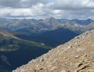
Steep hike to panoramas atop a 13,000-foot peak just outside of Breckenridge.
Difficult Hiking
5.1 km away
Easy hike up a gentle gradient to the scenic remains of an old mine in a mountain valley.
Easy Hiking
5.5 km away
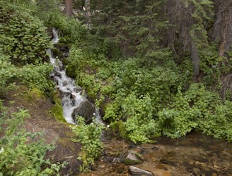
Forested trail near Boreas Pass Road with mountain views and a chance at spotting wildlife.
Moderate Hiking
6.1 km away

Singletrack connector through the forest between Indiana Creek Road and Boreas Pass Road in Breckenridge.
Easy Hiking
7.7 km away
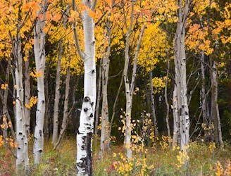
Forest hike that begins from Breckenridge Ski Resort, alongside a trickling stream and beneath brilliant foliage in fall.
Moderate Hiking
8.7 km away
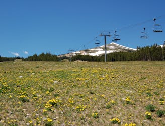
Network of trails through forest and wetlands of a wildlife preserve, nestled between the town and ski resort of Breckenridge.
Easy Hiking
9.1 km away
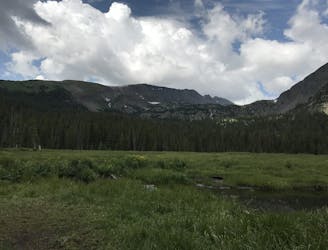
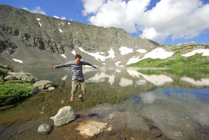
Trail that climbs a out of a forested valley to an alpine basin with lakes and waterfalls, dotted with historic mine sites along the way.
Moderate Hiking
9.1 km away
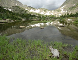
Moderate hike among waterfalls and mining ruins to surpass the treeline and reach alpine lakes in a high valley.
Moderate Hiking

16 routes · Hiking
8 routes · Hiking