1.4 km away
Cucumber Gulch Trails
Network of trails through forest and wetlands of a wildlife preserve, nestled between the town and ski resort of Breckenridge.
Easy Hiking
- Distance
- 3.4 km
- Ascent
- 87 m
- Descent
- 87 m
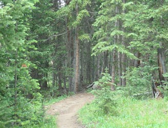
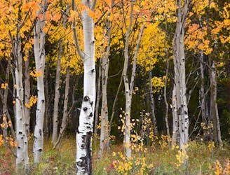
Forest hike that begins from Breckenridge Ski Resort, alongside a trickling stream and beneath brilliant foliage in fall.
Hiking Moderate

This is an easy out and back that leaves from the ski resort at Breckenridge. It travels through the forest on a gentle ascent along a creek. Though it never reaches any particularly dramatic viewpoint, the shady foliage makes a pleasant summer hike with wildflowers or brilliant autumn outing. In the winter it’s popular for snowshoeing and backcountry skiing. Proximity to the resort makes it a convenient option for anyone working or vacationing here, seeking a relaxed afternoon stroll.
Begin near the bottom of Quicksilver chairlift, in a pay parking lot, or walk there from elsewhere in town. Cross the ski run heading south, looking for trail signs. Watch out for skiers. The trail enters to woods and soon becomes very quiet among the trees. Once in the woods, signs no longer lead the way but the path is generally easy to follow. It ascends the valley of Lower Lehman Creek for about half a mile, then contours to the east slope of the mountain. The neighborhoods of Spruce Creek Road are a few hundred below, but generally not visible or heard through the woods.
You can turn around at any point to return the way you came, or make a loop in one of a few ways. Burro Trail’s southern end is at Crystal Creek Trail near Spruce Creek Road, so you can continue to Mohawk Lakes, Crystal Peak, or Peak 10. One possible loop is to follow the Wheeler Trail up Peak 10 and descend back into the ski resort.
Moderate
Hiking along trails with some uneven terrain and small hills. Small rocks and roots may be present.

The trail contains some obstacles such as outcroppings and rock which could cause injury.

Close to help in case of emergency.
1.4 km away
Network of trails through forest and wetlands of a wildlife preserve, nestled between the town and ski resort of Breckenridge.
Easy Hiking
1.9 km away

Singletrack connector through the forest between Indiana Creek Road and Boreas Pass Road in Breckenridge.
Easy Hiking
2.7 km away
Easy hike up a gentle gradient to the scenic remains of an old mine in a mountain valley.
Easy Hiking
2.7 km away
Steep hike on a wide trail to the tallest summit above Breckenridge Ski Resort.
Difficult Hiking
2.8 km away
Forested trail near Boreas Pass Road with mountain views and a chance at spotting wildlife.
Moderate Hiking
3.3 km away
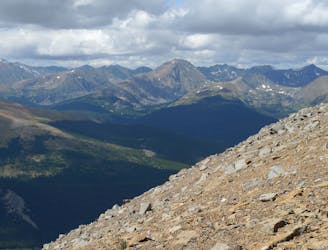
Steep hike to panoramas atop a 13,000-foot peak just outside of Breckenridge.
Difficult Hiking
4.2 km away
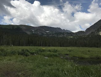
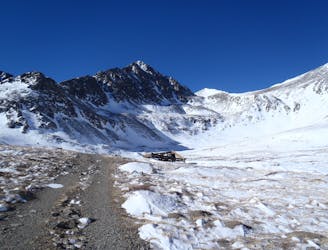
Trail that climbs a out of a forested valley to an alpine basin with lakes and waterfalls, dotted with historic mine sites along the way.
Moderate Hiking
4.2 km away
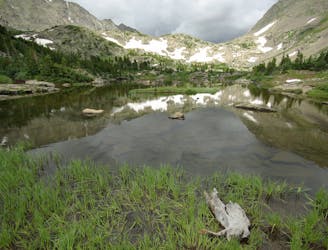
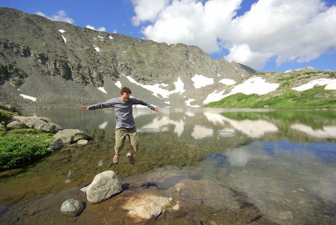
Moderate hike among waterfalls and mining ruins to surpass the treeline and reach alpine lakes in a high valley.
Moderate Hiking
4.7 km away

Hillside hike outside Breckenridge with abandoned mine sites and valley views.
Easy Hiking
5.4 km away
Rugged hike above treeline between two high-elevation lakes near Breckenridge.
Difficult Hiking

16 routes · Hiking
8 routes · Hiking