8.4 km away
Monarch Crest -> Green's Creek
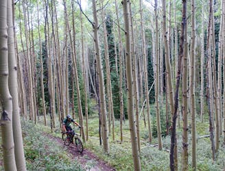
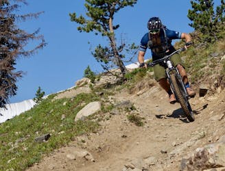
Green's Creek is the most relentlessly-technical singletrack trail dropping off of the Monarch Crest, making it a favorite of enduro racers.
Severe Mountain Biking
- Distance
- 34 km
- Ascent
- 278 m
- Descent
- 1.5 km
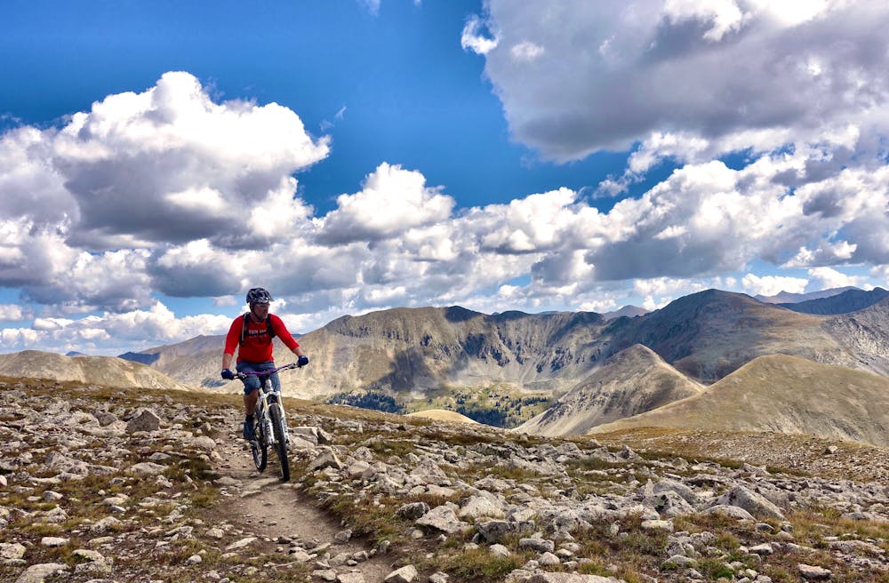
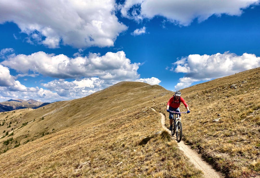
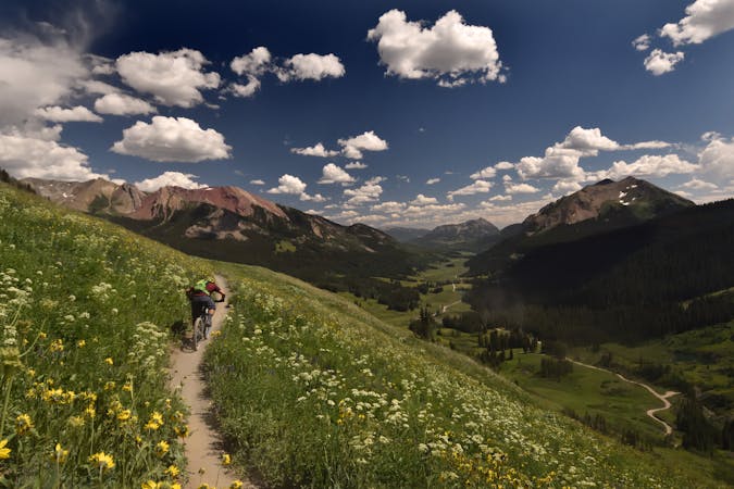
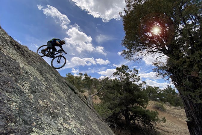
The 10-mile descent ripping down the Canyon Creek Trail from this route's high point atop a 12,500-foot mountain is to die for!
Mountain Biking Severe

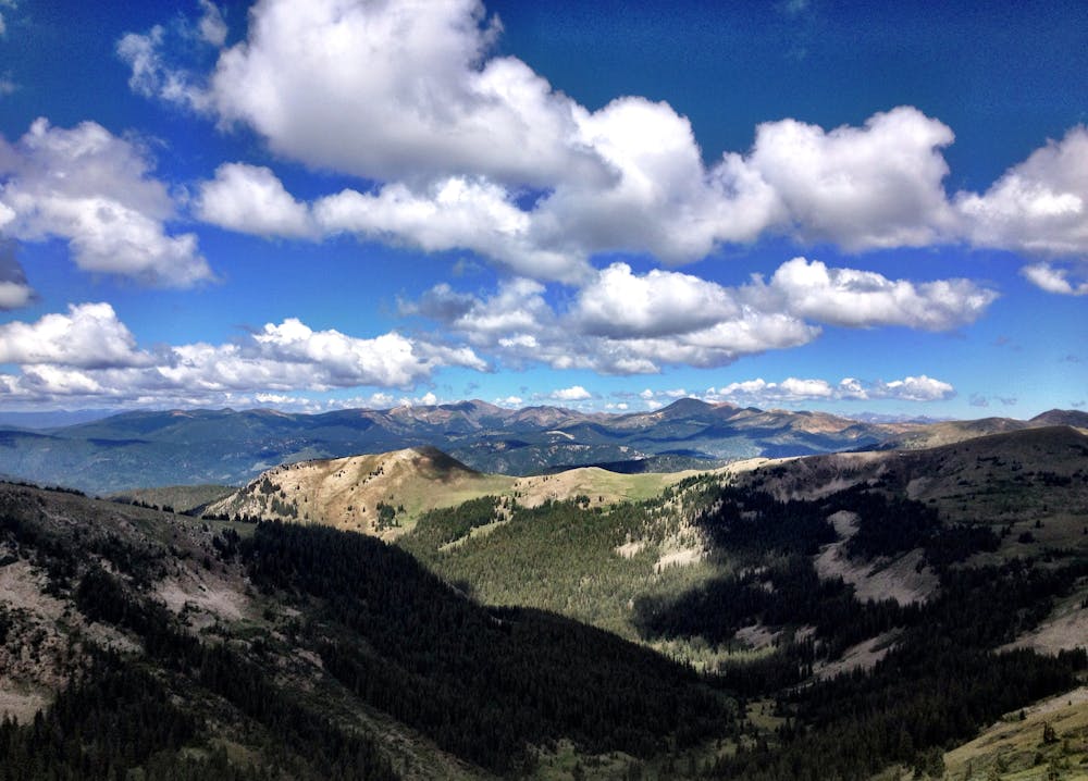
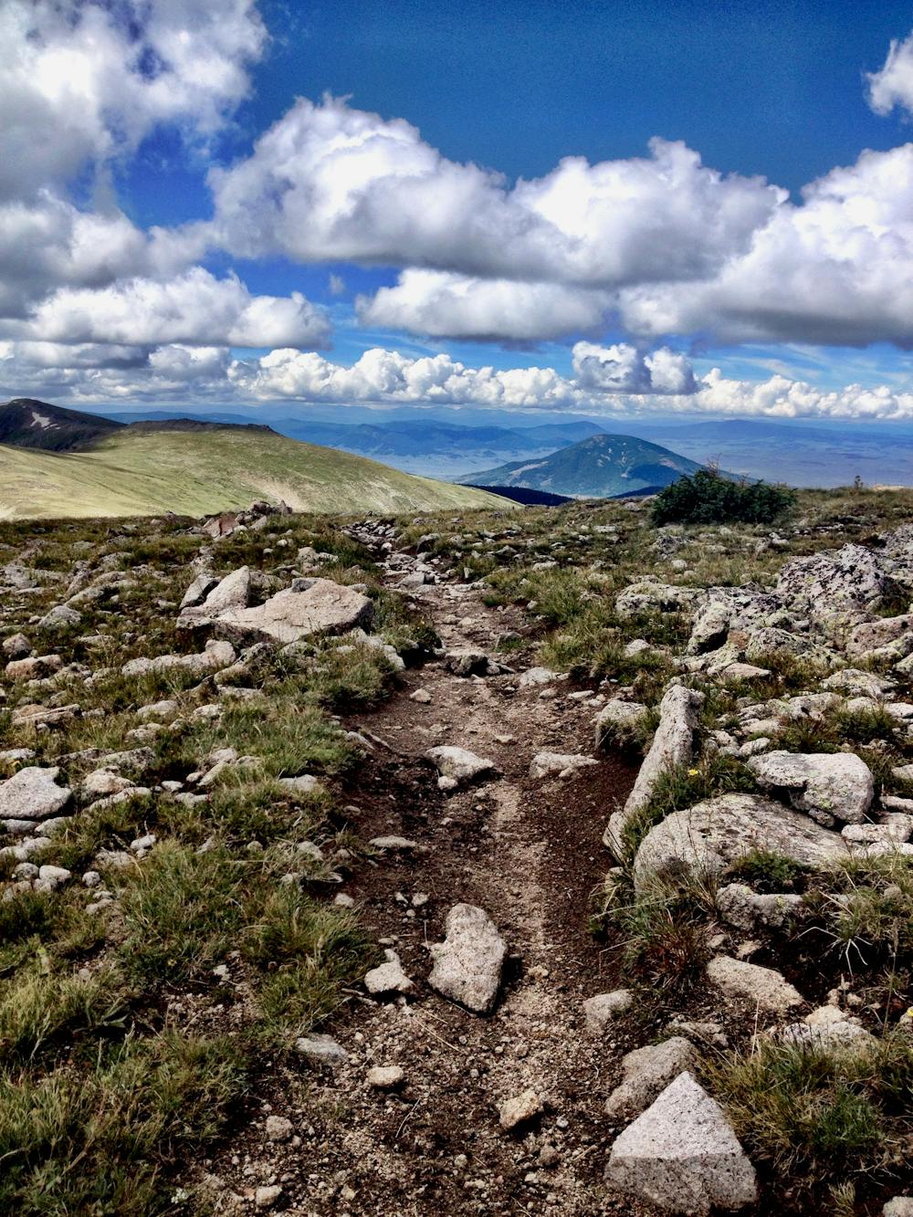
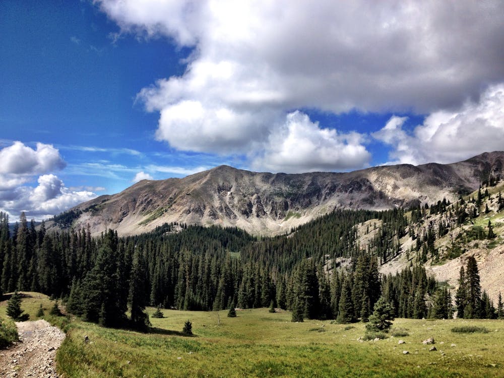
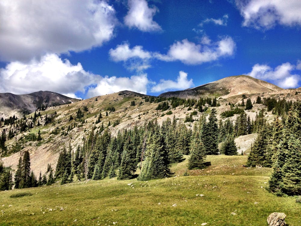
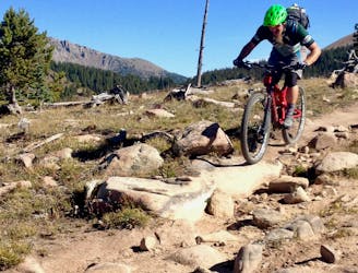
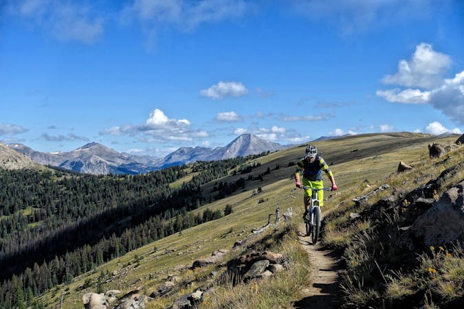
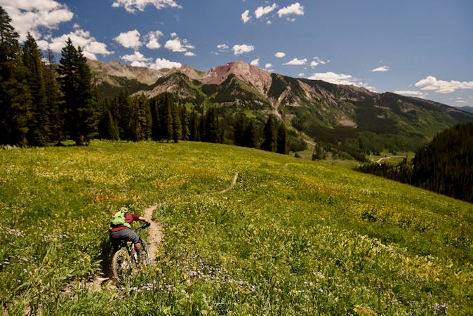
Surprisingly few mountain bike rides actually arrive at the top of a mountain, and Canyon Creek is one of the rare of few. Topping out on a 12,500-foot mountain provides jaw-dropping views in all directions, with views of the Continental Divide, numerous 14ers, and glimpses of the Gunnison Valley far, far below. And once on top, one of the best descents in the state—maybe the nation, maybe the world—awaits, dropping almost 10 miles straight back down.
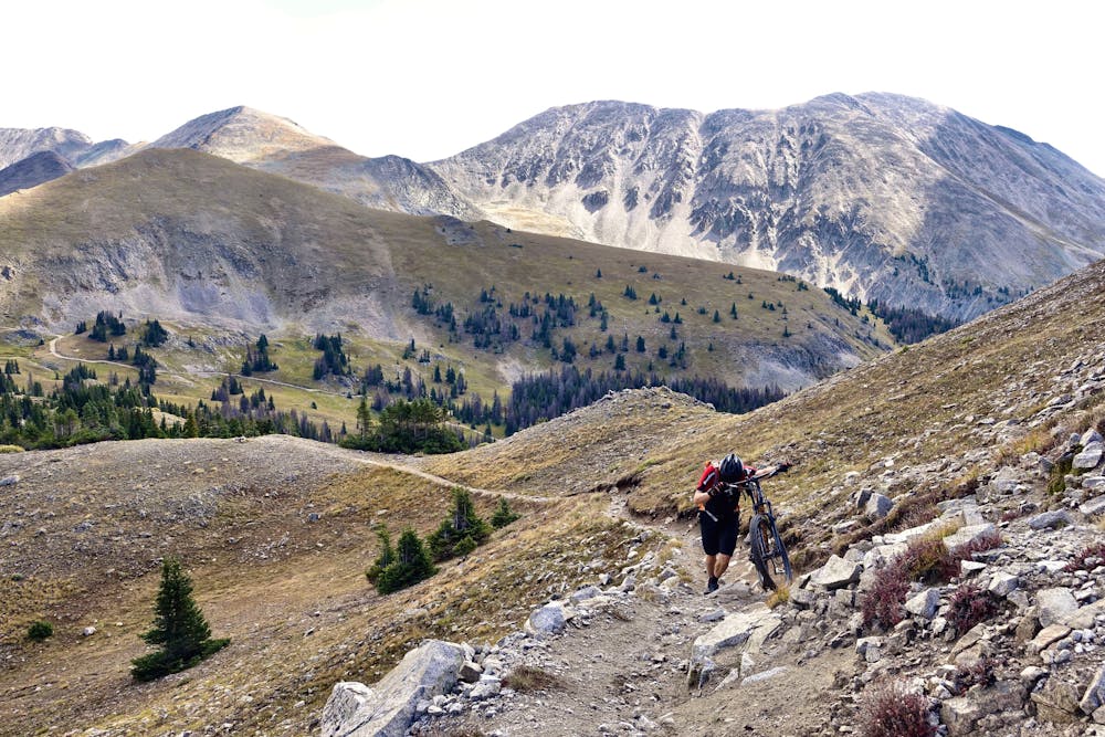
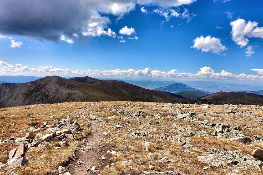
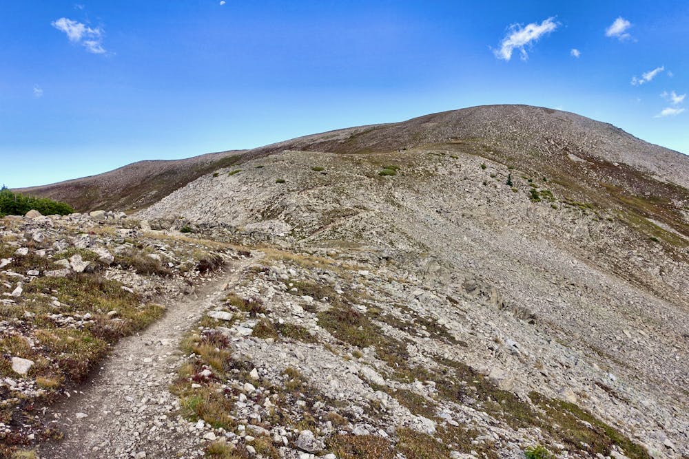
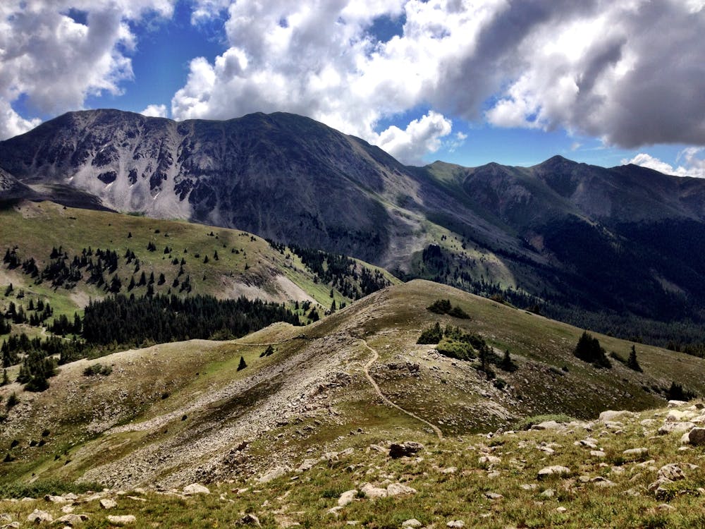
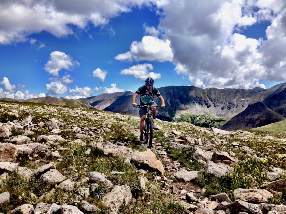
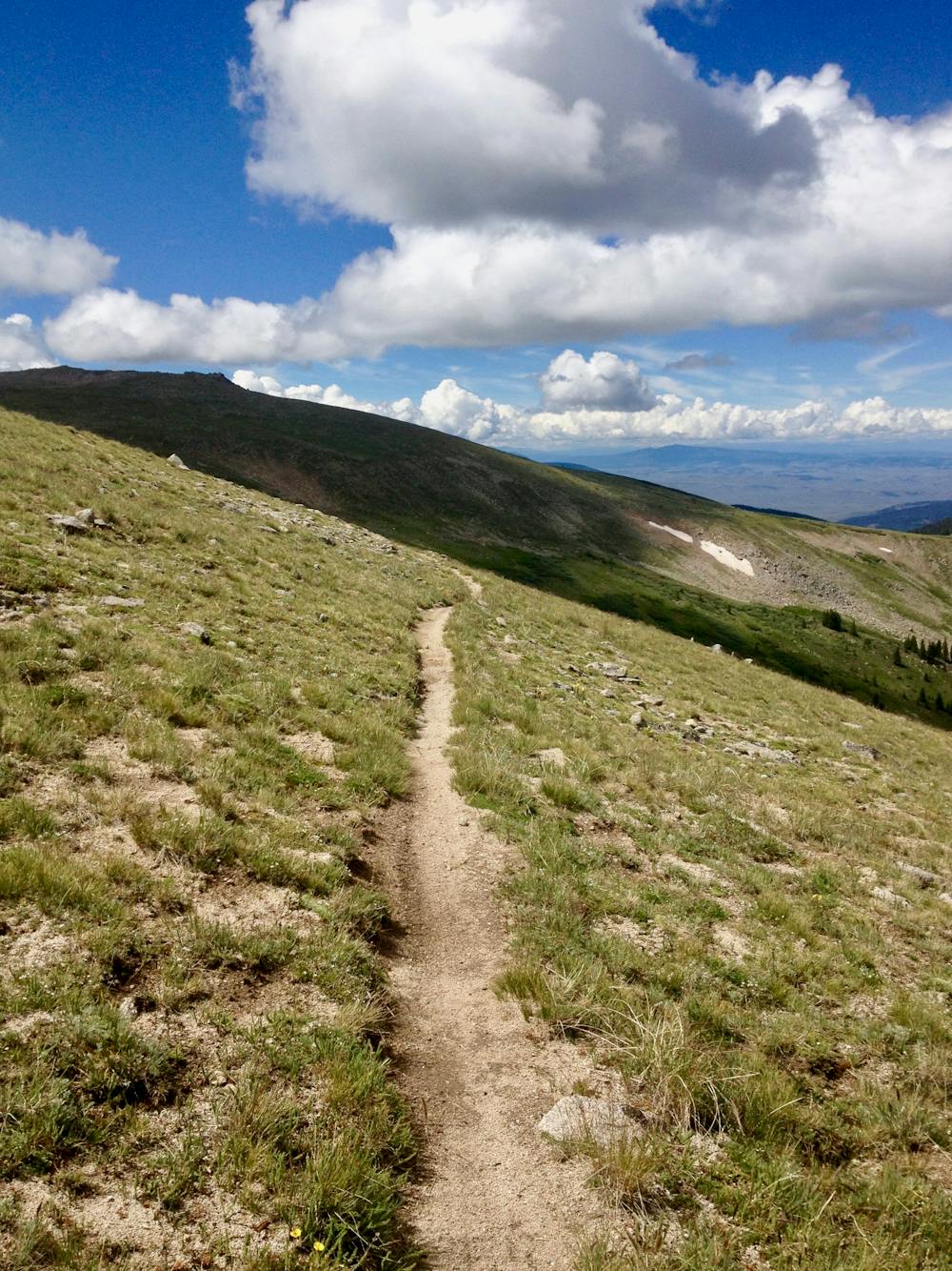
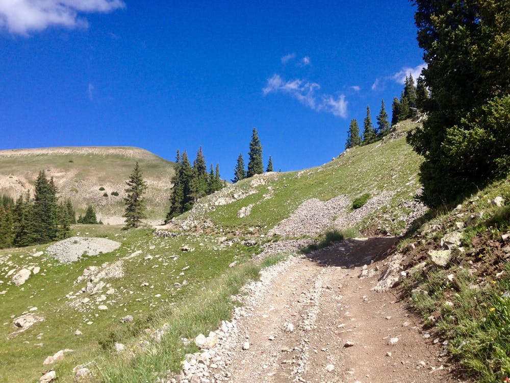
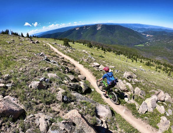
Getting to the top is the challenge. The roughly 10-mile climb begins by grinding slowly up a dirt road that continues to get steeper and rougher as it progresses. Eventually, you'll break out above treeline and reach the left turn onto the Canyon Creek trail. The climbing isn't over yet: most riders will take over an hour to hike-a-bike from the dirt road to the top of the mountain. This moto-legal trail is extremely rough, with piles of baby head rocks, rutted-out sections, and steep, scree-filled switchbacks.
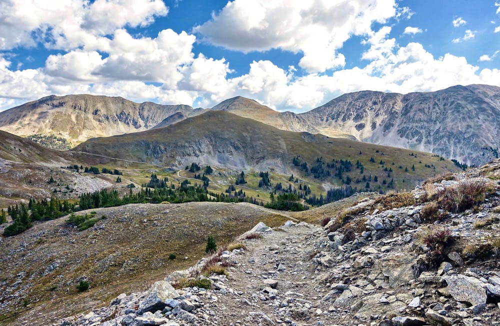
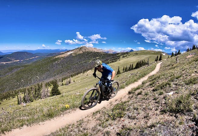
Once on top of the mountain, it's time to shred! The trail traverses along the ridge, but unlike the nearby Monarch Crest Trail, the singletrack drops out of the alpine in just a couple of miles. The above-treeline descent into the basin is rocky, challenging, and ultra-fast. With some decent exposure, falling isn't advised.
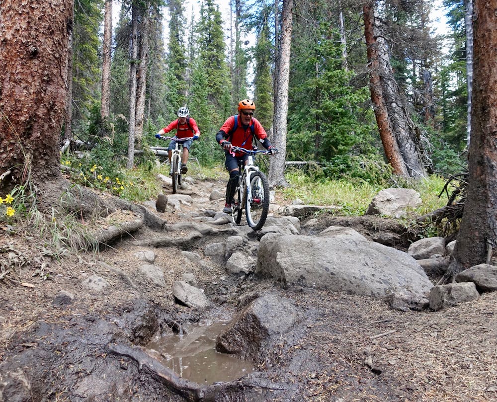
The angle of the trail mellows once it enters the trees, but the trail tread only gets more technical. The singletrack funnels into massive boulder-filled rock gardens and in between the rocks--slick mud holes. As riders splash through the muck, the roots and boulders get slicked with mud, which can make for treacherous riding.
The trail quickly mellows out, feeding into flowy singletrack with moto whoops and berms, opening up options to double the whoops, getting air wherever you feel confident.
After taking a left turn at the horse corral and fording a river, the flowing singletrack continues, punctuated by some massive rock slab up-and-overs.
One final punch-to-the-gut hike-a-bike climb takes you over a ridge, with steep, fast, switchbacked singletrack providing a sweet finish to the ride.
Severe
Widely variable, narrow trail tread with steeper grades and unavoidable obstacles of 15in/38cm tall or less. Obstacles may include unavoidable bridges 24in/61cm wide or less, large rocks, gravel, difficult root sections, and more. Ideal for advanced-level riders.

Some trail sections are extremely exposed where falling will almost certainly result in serious injury or death.
In the high mountains or remote conditions, all individuals must be completely autonomous in every situation.
8.4 km away
Green's Creek is the most relentlessly-technical singletrack trail dropping off of the Monarch Crest, making it a favorite of enduro racers.
Severe Mountain Biking
8.4 km away
This epic trail provides high alpine ridge top riding at treeline with views for hundreds of miles in all directions, finishing with a ripping descent down the mountain.
Difficult Mountain Biking
8.4 km away
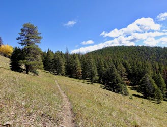
Beautiful old school singletrack through a deep valley.
Severe Mountain Biking
8.4 km away
A fast, technical descent down the west side of the Continental Divide from the Monarch Crest Trail
Severe Mountain Biking

26 routes · Mountain Biking
8 routes · Mountain Biking · Fat biking

25 routes · Mountain Biking
6 routes · Mountain Biking
14 routes · Mountain Biking

10 routes · Mountain Biking
4 routes · Mountain Biking

10 routes · Mountain Biking
10 routes · Mountain Biking
5 routes · Mountain Biking

24 routes · Mountain Biking