255 m away
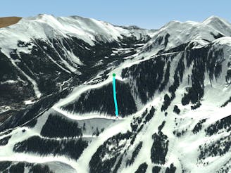
Etch's

A mixed bag in the trees.
Moderate Freeride Skiing
- Distance
- 164 m
- Ascent
- 0 m
- Descent
- 89 m
A short glade.
Freeride Skiing Difficult

This is a popular freeride skiing route which is generally considered to be difficult. It's remote, it features unknown exposure and is typically done in an unknown time of year. From a low point of 3.2 km to the maximum altitude of 3.3 km, the route covers 291 m, 0 vertical metres of ascent and 118 vertical metres of descent.
Hannes Schneider is an often-missed tree run off skier's left on porcupine. It dumps you out onto Powderhorn near the Bambi Terrain Park.
Difficult
Serious gradient of 30-38 degrees where a real risk of slipping exists.

Away from help but easily accessed.
255 m away
A mixed bag in the trees.
Moderate Freeride Skiing
396 m away

A short shot through the trees.
Moderate Freeride Skiing
405 m away

A more difficult version of Whitefeather.
Easy Freeride Skiing
710 m away

A steep chute with trees and an open section.
Difficult Freeride Skiing
738 m away

A steep line through trees and big rocks.
Severe Freeride Skiing
878 m away
Steep trees with a fun drop at the exit.
Difficult Freeride Skiing
1 km away

A line that splits the skier's left of T-Bird Trees and High Somewhere.
Difficult Freeride Skiing
1 km away

Runs along a technical spine then spills into open skiing.
Severe Freeride Skiing
1.1 km away

Tight and steep trees.
Severe Freeride Skiing
1.1 km away

A steep chute with trees.
Difficult Freeride Skiing