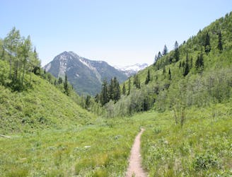
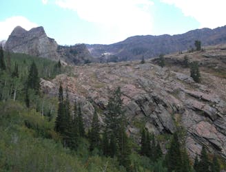
Cardiff Fork
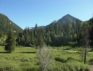
This is an easy hike up an old road grade through a beautiful drainage lined by rugged alpine peaks.
Moderate Hiking
- Distance
- 14 km
- Ascent
- 840 m
- Descent
- 841 m
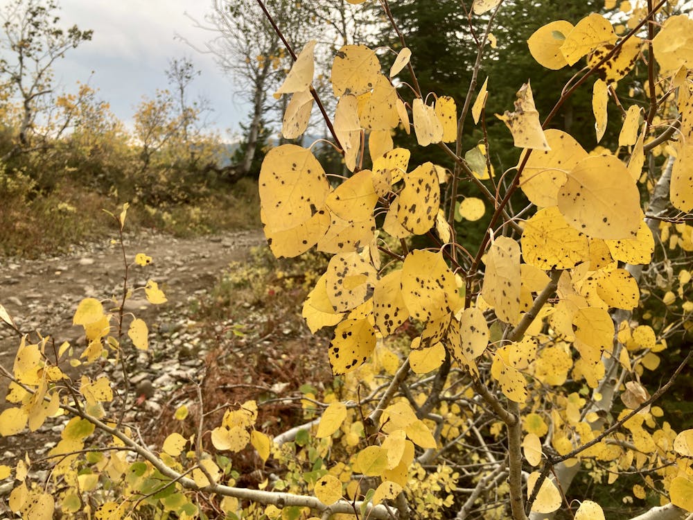
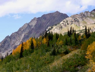
Scenic hike to a small waterfall in a narrow canyon.
Hiking Moderate

Thanks to its easy access right off the pavement and the unique waterfall feature, Donut Falls is one of the most popular hikes in Big Cottonwood Canyon.

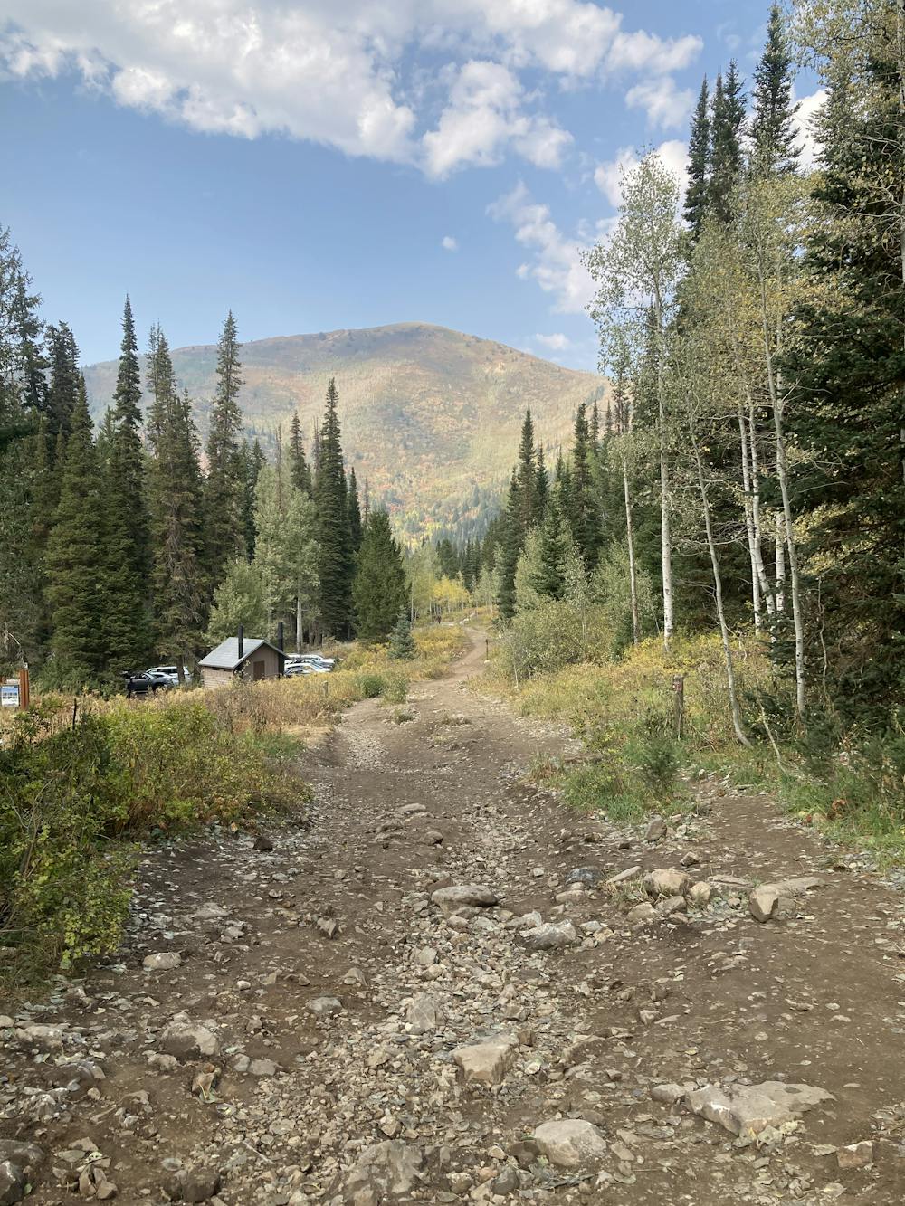
While there is a small trailhead closer to the waterfalls, due to the popularity of this hike, it's difficult to get a parking spot there, so the route mapped here begins from a larger trailhead located on the shoulder of the highway. If departing from the highway, you'll hike a short distance on the paved side road before turning left onto a trail.
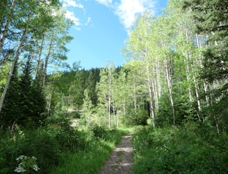
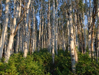
The trail begins as a smooth dirt track with minimal climbing as it weaves through the aspen trees near the Jordan Pines Campground. After passing the campground, the trail gets a bit rougher and a bit steeper, but it's still easily passable.
After a section of sidehill traversing, the trail passes the upper trailhead, where you might be able to score a parking spot if you're lucky. But hasn't the hike so far been simply gorgeous?! You would have missed out on that beautiful section if you had opted for the higher parking lot.
From the higher parking lot, the trail is older, wider, and more eroded. It consists largely of wide doubletrack for the rest of its length, and the climb gets a bit steeper from here. That said, the climb is still quite moderate, and this hike only receives a Moderate FATMAP difficulty rating.
Once at the canyon, you'll have to negotiate a scramble down a rock to reach the base of the falls, but it's a short drop.
Once at the falls, enjoy the beautiful, narrow mountain canyon! You'll note the signs warning that climbing close to the falls could prove deadly, but undoubtedly you'll see people disregarding those signs. That choice is up to you, but it would dramatically increase the technical difficulty of this hike. Due to the slickness of some of the rocks from the water mist, it's probably best to just enjoy the vista from the lower viewpoint, then return to your car via the same route.
Moderate
Hiking along trails with some uneven terrain and small hills. Small rocks and roots may be present.

The trail contains some obstacles such as outcroppings and rock which could cause injury.
Away from help but easily accessed.
This is an easy hike up an old road grade through a beautiful drainage lined by rugged alpine peaks.
Moderate Hiking
1 m away
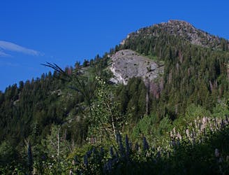
A very steep hike to one of the most prominent peaks in Big Cottonwood Canyon
Extreme Hiking
64 m away
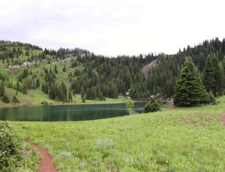
This is a lovely moderate hike through some large aspen groves reaching a quiet little lake.
Moderate Hiking
1.1 km away
This is a 7 mile loop with 2,000 feet of elevation that passes through thick woods and opens up with breathtaking views across the canyon.
Difficult Hiking
1.1 km away
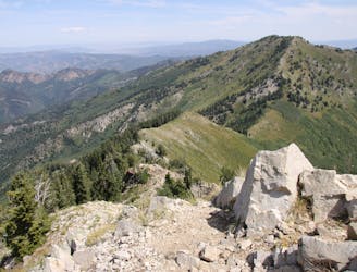
Mount Raymond is one of the tallest and most prominent peaks along the Big Cottonwood/Millcreek ridge.
Severe Hiking
1.1 km away

The trail up Gobblers Knob is a Wasatch classic that offers moderate hiking through aspen groves and into the open alpine.
Difficult Hiking
1.2 km away
The Days Fork trail is a little over 7 miles round trip with some good elevation gain through a heavily wooded canyon that opens up into the Alpine as you gain the Little Cottonwood Ridge.
Difficult Hiking
6.6 km away
This is a moderate hike that gains access to one of the most scenic lakes in the Wasatch.
Difficult Hiking
6.6 km away
The mighty Twin Peaks are the most visible and prominent mountains in the Wasatch front.
Extreme Hiking
6.6 km away
The most iconic and well-known peak in the Wasatch Mountains.
Severe Hiking

10 routes · Hiking

10 routes · Hiking

10 routes · Alpine Climbing · Hiking