1.8 km away
Heughs Canyon
Short and easy hike right out of the valley. Great place to walk the dog, or enjoy the waterfall that's in existence through the spring and early summer.
Moderate Hiking
- Distance
- 4.3 km
- Ascent
- 449 m
- Descent
- 449 m
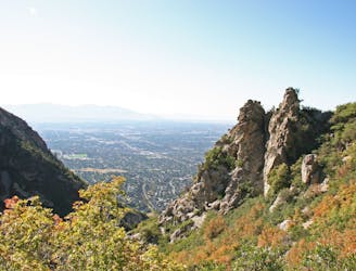
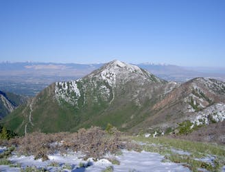
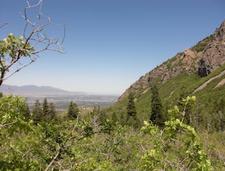
Mount Olympus is one of the most visible and well known peaks along the Wasatch Front.
Hiking Extreme

Hiking Mount Olympus is no easy task, the trail is one of the steepest around, it gains 4,000 feet in 4 miles. It is a well maintained trail right until the summit scramble.
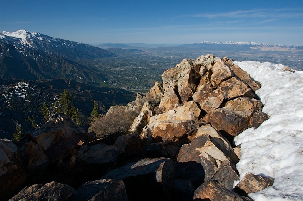
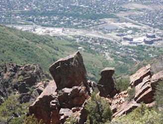
The trail is steep and strenuous and the final rock scramble to the summit puts a nice finish on one of the most difficult hikes in the range. However, the views from the summit more than make up for the effort when the entire Salt Lake Valley sits right under your feet.
Because it is low elevation and west facing this trail sees traffic almost all year long. Proper footwear and shoe traction can help greatly in the winter months. In the summer the temperatures can soar into the 100 degree range so it's best to get an early start and be off the mountain by 9 or 10am. Evening hikes are a good choice that provide glorious city lights and less encounters with rattlesnakes.
Extreme
Scrambling up mountains and along technical trails with moderate fall exposure. Handholds are necessary to navigate the trail in its entirety, although they are not necessary at all times. Some obstacles can be very large and difficult to navigate, and the grades can often be near-vertical. The challenge of the trail and the steepness of the grade results in very strenuous hiking. Hikes of this difficulty blur the lines between "hiking" and "climbing".
1.8 km away
Short and easy hike right out of the valley. Great place to walk the dog, or enjoy the waterfall that's in existence through the spring and early summer.
Moderate Hiking
4.9 km away
The Ferguson Canyon hike is a quick way to get out and away from the city.
Difficult Hiking
6.2 km away
A short, steep hike to the summit of Grandeur Peak.
Difficult Hiking
7.3 km away
The mighty Twin Peaks are the most visible and prominent mountains in the Wasatch front.
Extreme Hiking
7.3 km away
This is a moderate hike that gains access to one of the most scenic lakes in the Wasatch.
Difficult Hiking
8.9 km away
Bells Canyon is a very steep, long trail that takes you past beautiful waterfalls and into the rugged heart of the Wasatch Mountains.
Difficult Hiking
9.1 km away
This 7 mile out and back trail covers moderate ground as it climbs along the creek for 1,700 feet.
Moderate Hiking

10 routes · Hiking

10 routes · Hiking

10 routes · Alpine Climbing · Hiking