33 m away
Edith Basin
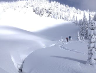
A power paradise just next to Paradise
Moderate Ski Touring
- Distance
- 5.8 km
- Ascent
- 448 m
- Descent
- 448 m
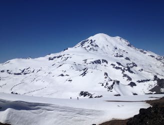
A classic ski descent off the southern summit of Mount Rainier
Ski Touring Severe

The Fuhrer Thumb is one of those lines on Mount Rainier that people put on there tick list for good reasons. Being that this is the longest vertical descent in all of North America as well as fall line turns from top to bottom it is hard to beat anywhere within the lower 48 states. Being South facing this line sets up for perfect corn if timed right and can be accessed via a few different routes climbing the mountain.

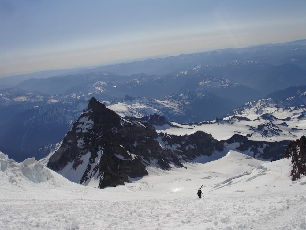
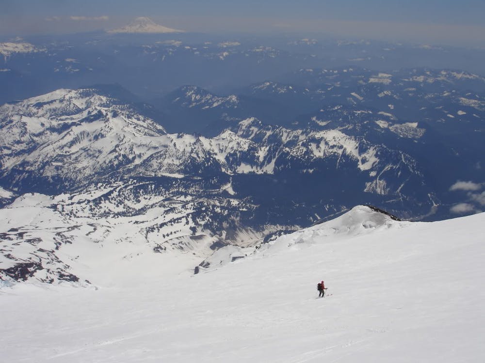
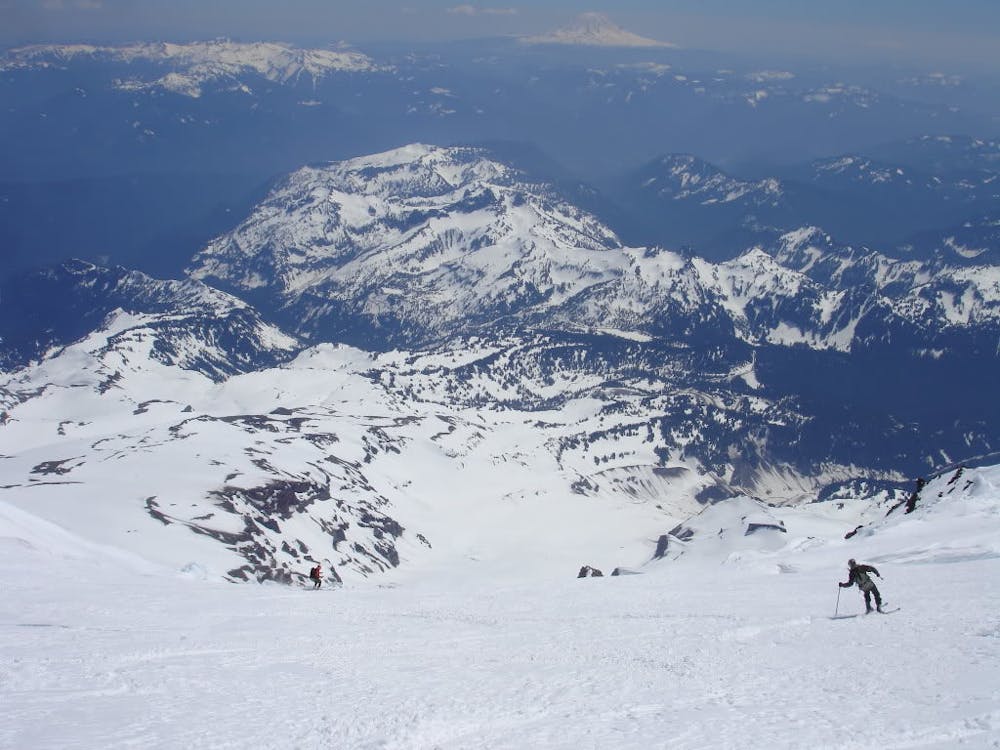
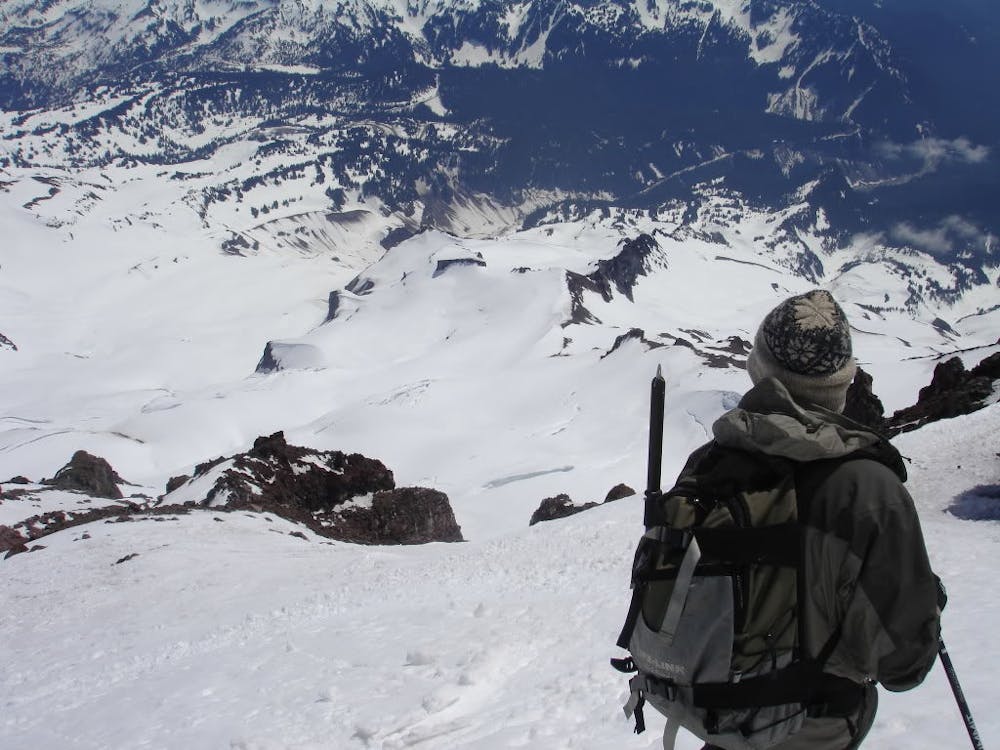
It must be said that this is just my experience and it is almost impossible to safely describe any summits of Mount Rainier. If you choose to do this trip my description below is just a general summary.
Climbing Mount Rainier from any aspect is a challenge within itself. You need to have perfect weather with a high freezing level above 12,000 feet and most importantly no wind. Standing on the upper slopes you will be on heavily glaciated terrain which changing yearly so don’t expect the crevasses to alway be at the same spot. Now on with the show.
There are two main ways to access the Fuhrer Thumb the first one is to climb up the route or the second way is to go up and over the Ingraham route before skiing down the Furher Thumb. I personally did the second way so this will be the route I describe.
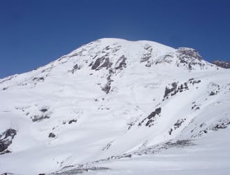
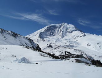
Leaving the Paradise Parking lot start heading up the Skyline trail until it reaches Panorama Point. From here start heading north on the long slog all the way up to Camp Muir where you can find shelter for the night and prepare for the next days descent. Take this opportunity to get information on the higher route from people who had just came back from the summit or the climbing rangers.
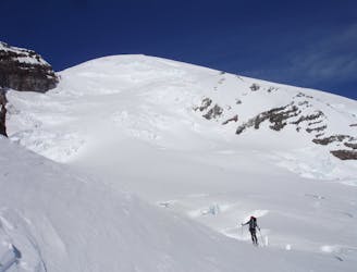
Start your summit climb just before sunrise making your way up and over Cathedral Gap before heading onto the Ingraham Glacier. From here you should have a good view of the climbing route above you and what the next few hours should be like. Follow the well beaten in trail which will soon enough head south just above Gibraltar Rock then push all the way to the summit. Remember that the earlier you go in the season the more direct this route is.
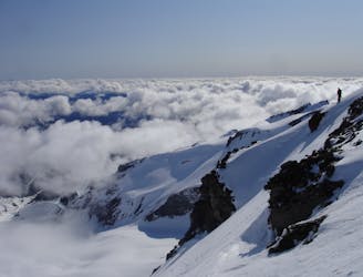
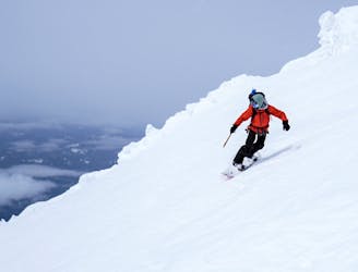
Standing on the crater rim every so often check is the snow up high has started to soften and once it feels as if it is edgeable it is time to start your descent. You will have a long descent so you don’t want it to be really soft up high and total slush down low.
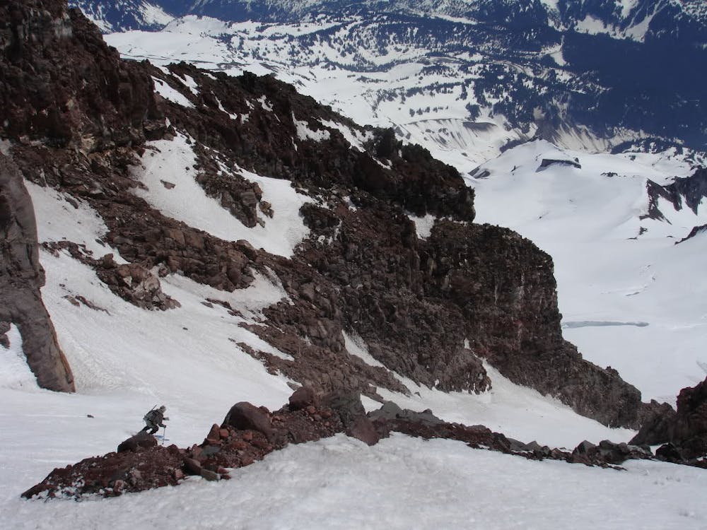
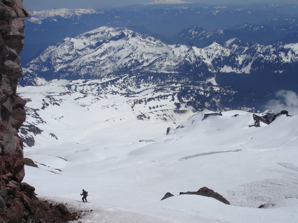
Snowboarding off the crater rim you need to make sure you are heading directly South towards the Nisqually Glacier which has a bowl feel up high. It is not uncommon to find a bootpack which if this is the case it is smart to follow. Once you are 100% sure you are on said glacier make your way down on the skiers right side loosing elevation with every turn and soon enough you will head off the main glacier and over to a rocky slope where you will spot two ramps. Heading for the skiers right one you are now on top of the Furher Thumb.
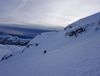
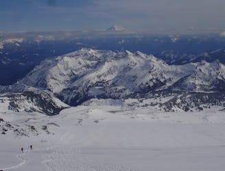
The Furher Thumb is a bit steep at first but mellows out quickly as it joins the Wilson Glacier. One would think that they can put there guard down from here on out but remember you are still on a Glacier and there are crevasses below you. Being on the Wilson Glacier you need to head on a hard skiers right traverse heading towards the upper ridge. Being around 7,700 feet you can start descending but once in the main bowl start riding to the skiers left where you can find a ramp all the way down to the Nisqually glacier. If the snowpack is still thick from here on out you can ride all the way down to the Nisqually Bridge. If there isn’t enough snow then make a hard skiers left traverse over to the edge of the Nisqually Moraine. With a little bit of searching spot the Moraine trail which will lead you back up to Paradise.
To see my trip in the area and more photos check out this link https://www.whereiskylemiller.com/mt-rainier/fuhrer-thumb/
Severe
Steep skiing at 38-45 degrees. This requires very good technique and the risk of falling has serious consequences.

In case of a fall, death is highly likely.

Away from help but easily accessed.
33 m away
A power paradise just next to Paradise
Moderate Ski Touring
40 m away
Riding down a stunning line within view of the Muir Snowfield
Severe Ski Touring
40 m away
Two separate zones within a single ski tour
Moderate Ski Touring
43 m away
A stunning Southwest-facing line onto the Nisqually Glacier
Moderate Ski Touring
47 m away
A multiday traverse exploring some seldom traveled areas within the park
Severe Ski Touring
52 m away
A great alternative to the Muir Snowfield
Moderate Ski Touring
88 m away
A 4 day traverse through Mount Rainier National Park
Difficult Ski Touring
471 m away
One of the most classic and longest ski descents in North America!
Severe Ski Touring
480 m away
One of the longest continuous ski descents in the continental US!
Severe Ski Touring
497 m away
The Birthplace of Turns All Year
Moderate Ski Touring

9 routes · Ski Touring

11 routes · Ski Touring