1 m away
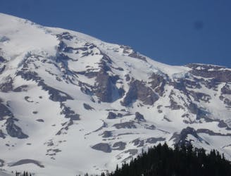
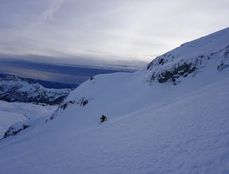
Cowlitz Glacier and the Nisqually Chute
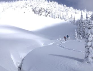
Two separate zones within a single ski tour
Moderate Ski Touring
- Distance
- 15 km
- Ascent
- 1.7 km
- Descent
- 1.7 km
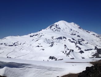
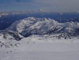
Riding down a stunning line within view of the Muir Snowfield
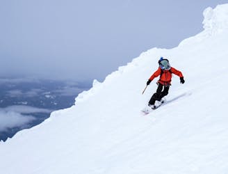
Ski Touring Severe

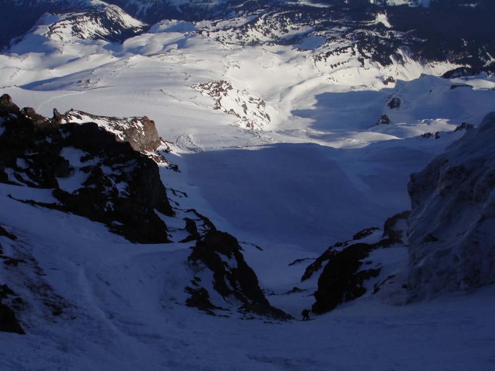
The Gib Chute can go from a sweet perfect fall line run to a horrible fearing for your life icy ramp. It’s all the difference between wether this line is in the sun with a high freezing level or in the shade. One of the big benefits to this line is that you can stay overnight at Camp Muir and leave most of the stuff there during the climb as it is just a 15 minute skin to get back to the shelter.
It must be said that this is just my experience and it is almost impossible to safely describe any summits of Mount Rainier. If you choose to do this trip my description below is just a general summary.
Like all summits of Mount Rainier you need to be incredibly confident with your climbing and skiing skills but that is not all. You are going to be on a heavily glaciated landscape where you can see some crevasses but you can’t see them all. Weather wise you need the freezing level around 14,000 feet for a few days as the first heat wave is a time for the snow to flush down the mountain. This climb takes time so it is better to be up top earlier than later and once again you want to have sun on the entire slope as you descend. If you want to do this trip you need both a climbing and camping permit from either Longmire or Paradise Visitor Center.
Leaving the Paradise Parking lot make your way up the Skyline trail. Once on the ridge near Panorama Point start heading north up the Muir Snowfield until arriving at Camp Muir. That afternoon rest and if you can chat with other people about the climbing route trying to get as much information as possible.
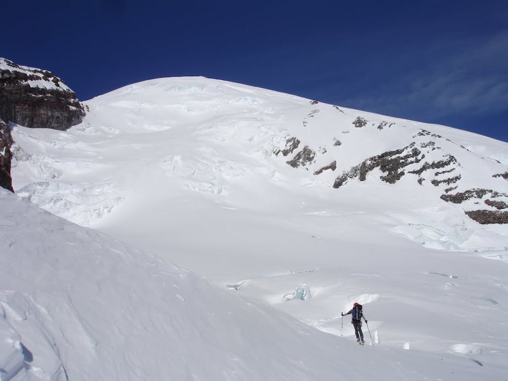
Below is the route I took as you can climb up via the Gib Chute but we made our way up the via Inghram Direct.
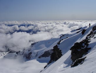
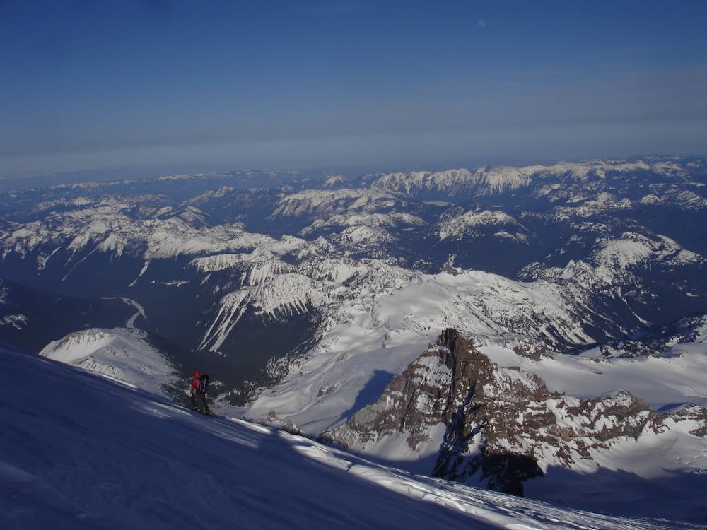
Leaving Camp Muir Early in the morning make your way up and over Cathedral Gap before traversing onto the Inghram Glacier. By now you will have a great look at the route in front of you and what you are up against. Since the route changes from year to year all I can really say is to rope up and if there is a trail already broken then follow it. Before long the route will traverse over above Gibraltar Rock and will make its way up to the summit flats. If you have extra energy make it over to the true summit before returning to this spot.
Skiing back down follow your initial tracks until you can spot Gibraltar Rock in the distance. Riding up to it you need to make sure that you are on the southwest side before traversing over to the entrance. Make sure you are in control of your turns as you get into the chute and have a good feeling for what conditions are like. Once it is time make your way down careful and controlled turns all the way to the bottom slopes which start to mellow out. Once you’ve passed the rock band on the skiers left side you can switch back to skinning heading East back over to Camp Muir. Once it is time to leave just head back via the same approach you had done earlier.
To see my trip in the area and more photos check out this link https://www.whereiskylemiller.com/mt-rainier/gib-chute/
Severe
Steep skiing at 38-45 degrees. This requires very good technique and the risk of falling has serious consequences.

In case of a fall, death is highly likely.

Away from help but easily accessed.
1 m away
Two separate zones within a single ski tour
Moderate Ski Touring
9 m away
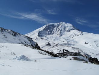
A stunning Southwest-facing line onto the Nisqually Glacier
Moderate Ski Touring
40 m away
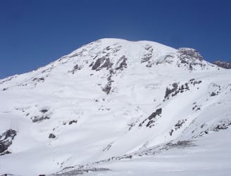
A classic ski descent off the southern summit of Mount Rainier
Severe Ski Touring
40 m away
A multiday traverse exploring some seldom traveled areas within the park
Severe Ski Touring
67 m away
A 4 day traverse through Mount Rainier National Park
Difficult Ski Touring
70 m away
A power paradise just next to Paradise
Moderate Ski Touring
86 m away
A great alternative to the Muir Snowfield
Moderate Ski Touring
447 m away
One of the most classic and longest ski descents in North America!
Severe Ski Touring
455 m away
One of the longest continuous ski descents in the continental US!
Severe Ski Touring
467 m away
The Birthplace of Turns All Year
Moderate Ski Touring

9 routes · Ski Touring

11 routes · Ski Touring