Upper Japanese Flag

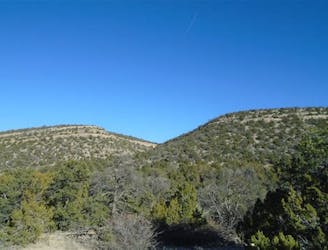
A quick shot through the trees.
Moderate Freeride Skiing
- Distance
- 143 m
- Ascent
- 0 m
- Descent
- 55 m
Explore New Mexico with curated guides of the best hiking trails, mountain bike trails, trail running routes, ski routes, and more. With over 208 3D trail maps in FATMAP, you can easily discover and navigate the best trails in New Mexico.
No matter what your next adventure has in store, you can find a guide on FATMAP to help you plan your next epic trip.
Get a top trail recommendation in New Mexico from one of our 28 guidebooks, or get inspired by the 208 local adventures uploaded by the FATMAP community. Start exploring now!
A quick shot through the trees.
Moderate Freeride Skiing

A more difficult version of Whitefeather.
Easy Freeride Skiing

Classic tree lines.
Difficult Freeride Skiing

A short glade.
Difficult Freeride Skiing

Essentially another entrance to Twin Trees Chute
Severe Freeride Skiing

A narrow, rocky spine.
Severe Freeride Skiing

Big rocks and cliffs; a foolish choice.
Extreme Freeride Skiing

A short and fun shot through the trees.
Moderate Freeride Skiing

A mixed bag in the trees.
Moderate Freeride Skiing

A steep chute with trees.
Difficult Freeride Skiing

A narrow line near the bottom of Kachina Peak.
Moderate Freeride Skiing

Tight and steep trees.
Severe Freeride Skiing

A waterslide-like line through the trees which is not steep.
Moderate Freeride Skiing

A peaceful hike in a remote part of New Mexico
Moderate Hiking

fun, picturesque trail
Moderate Mountain Biking
This is a hike to north sandia peak, starting at the Osha Spring trail head ending the north peak
Difficult Hiking