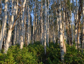
The Days Fork trail is a little over 7 miles round trip with some good elevation gain through a heavily wooded canyon that opens up into the Alpine as you gain the Little Cottonwood Ridge.
Difficult Hiking
- Distance
- 11 km
- Ascent
- 880 m
- Descent
- 880 m
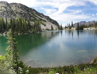
This is a moderate hike that gains access to one of the most scenic lakes in the Wasatch.
Difficult Hiking
- Distance
- 9.8 km
- Ascent
- 809 m
- Descent
- 809 m

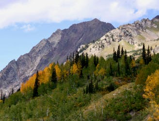
The trail up Gobblers Knob is a Wasatch classic that offers moderate hiking through aspen groves and into the open alpine.
Difficult Hiking
- Distance
- 11 km
- Ascent
- 927 m
- Descent
- 927 m
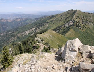
Mount Raymond is one of the tallest and most prominent peaks along the Big Cottonwood/Millcreek ridge.
Severe Hiking
- Distance
- 12 km
- Ascent
- 928 m
- Descent
- 926 m
Short and easy hike right out of the valley. Great place to walk the dog, or enjoy the waterfall that's in existence through the spring and early summer.
Moderate Hiking
- Distance
- 4.3 km
- Ascent
- 449 m
- Descent
- 449 m
A short roadside trail that follows the lower portion of the creek in Little Cottonwood Canyon
Difficult Mountain Biking
- Distance
- 15 km
- Ascent
- 567 m
- Descent
- 567 m
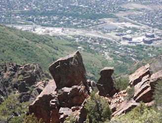
Mount Olympus is one of the most visible and well known peaks along the Wasatch Front.
Easy Alpine Climbing
- Distance
- 10 km
- Ascent
- 1.3 km
- Descent
- 1.3 km
The mighty Twin Peaks are the most visible and prominent mountains in the Wasatch front.
Extreme Hiking
- Distance
- 13 km
- Ascent
- 1.6 km
- Descent
- 1.6 km
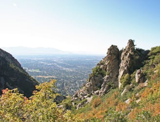
The Ferguson Canyon hike is a quick way to get out and away from the city.
Difficult Hiking
- Distance
- 9.4 km
- Ascent
- 1.3 km
- Descent
- 1.3 km
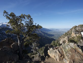
The most iconic and well-known peak in the Wasatch Mountains.
Severe Hiking
- Distance
- 7.5 km
- Ascent
- 764 m
- Descent
- 764 m
This is a strenuous, but classic hike that contains a mix of shaded forrest and high alpine environments.
Extreme Hiking
- Distance
- 15 km
- Ascent
- 1.2 km
- Descent
- 1.2 km
Bells Canyon is a very steep, long trail that takes you past beautiful waterfalls and into the rugged heart of the Wasatch Mountains.
Difficult Hiking
- Distance
- 15 km
- Ascent
- 1.3 km
- Descent
- 1.3 km
The effort on this unique and worthwhile hike puts you on top of one of the tallest and most dramatic peaks in the Wasatch Range.
Extreme Hiking
- Distance
- 19 km
- Ascent
- 1.7 km
- Descent
- 1.7 km

Virginia Slims is the fun dogleg chute next to the more popular Old Growth chute in the lower reaches of Cardiff Fork.
Difficult Ski Touring
- Distance
- 871 m
- Ascent
- 0 m
- Descent
- 472 m

Steep technical skiing in the Carbonate Cliffs.
Severe Freeride Skiing
- Distance
- 218 m
- Ascent
- 0 m
- Descent
- 144 m

Little Chute is the skinnier and more technical couloir to skiers right of the popular Main Chute on Mount Baldy
Severe Freeride Skiing
- Distance
- 291 m
- Ascent
- 0 m
- Descent
- 234 m