Wye Creek Route to Lake Alta
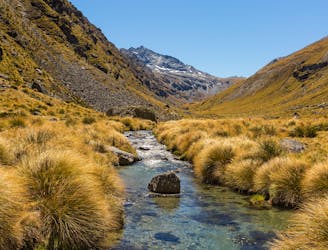
A challenging, yet rewarding one-way hike up to Lake Alta in the heart of the Remarkables Ski Field.
Difficult Hiking
- Distance
- 14 km
- Ascent
- 1.7 km
- Descent
- 284 m

Go hiking in Otago with curated guides of the best hikes across the region. With over 76 3D trail maps in FATMAP, you can easily discover and navigate the best trails in Otago.
No matter what your next adventure has in store, you can find a guide on FATMAP to help you plan your next epic trip.
Get a top hiking trail recommendation in Otago from one of our 8 guidebooks, or get inspired by the 76 local adventures uploaded by the FATMAP community. Start exploring now!
A challenging, yet rewarding one-way hike up to Lake Alta in the heart of the Remarkables Ski Field.
Difficult Hiking
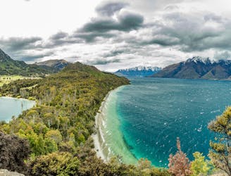
A gentle trail that follows the shoreline of Lake Wakatipu as it winds its way towards a secluded cove.
Easy Hiking

Great views, waterfalls and local history combine to make this family-friendly hike a popular one in Queenstown.
Easy Hiking

A fantastic hike over the top of Mount Dewar with an optional detour via to Shotover River.
Moderate Hiking
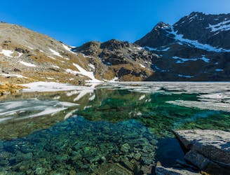
A short, sharp high-altitude hike to a beautiful lake featured in the Lord of the Rings.
Easy Hiking
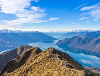
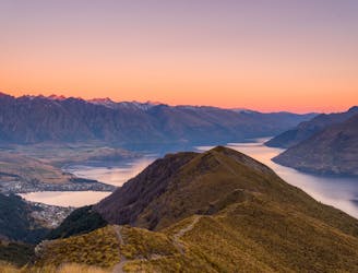
A bucket-list hike for locals and visitors alike, they all come for one thing: the view from the summit of Roy's Peak.
Moderate Hiking
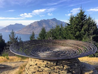
A trail that stays open year-round, this hike from the heart of Queenstown is not only accessible, but very rewarding.
Easy Hiking
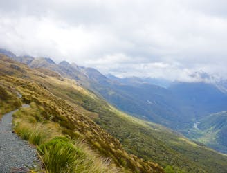
One of the most famous hikes in New Zealand, the Ben Lomond Track boasts spectacular views - and a leg-busting climb up from Queenstown.
Moderate Hiking
A beautiful valley walk to a remote hut
Moderate Hiking
Possibly the most famous hike in The Long of the White Cloud, this is New Zealand at its very finest.
Moderate Hiking

Hike to historic Stone Hut
Difficult Hiking

Take a left turn after the first waterfall from the lodge.
Moderate Hiking

1.5 hours one way - 5km
Moderate Hiking

1.5 hours one way - 5km
Moderate Hiking

2.5 hours one way - 7km
Moderate Hiking

Routeburn Track to górski szlak łączący dwa wyjątkowe parki Narodowe, Fiordland i Mount Aspiring.
Difficult Hiking