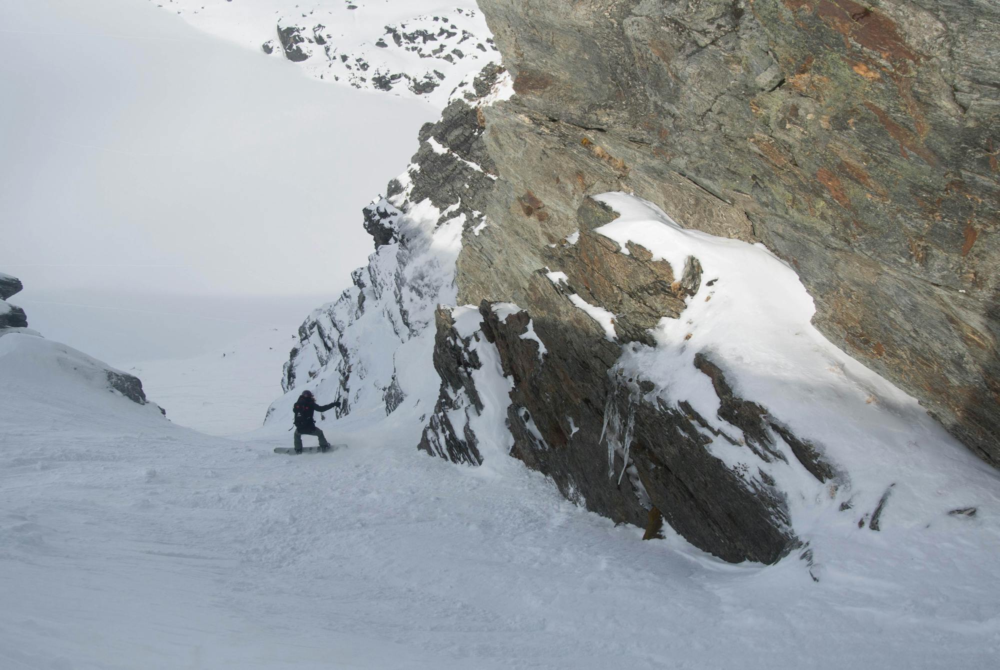
Cloud Nine

A huge, wide open area right in the middle of the saddle
Difficult Freeride Skiing
- Distance
- 740 m
- Ascent
- 0 m
- Descent
- 333 m
Explore Otago with curated guides of the best hiking trails, mountain bike trails, trail running routes, ski routes, and more. With over 76 3D trail maps in FATMAP, you can easily discover and navigate the best trails in Otago.
No matter what your next adventure has in store, you can find a guide on FATMAP to help you plan your next epic trip.
Get a top trail recommendation in Otago from one of our 8 guidebooks, or get inspired by the 76 local adventures uploaded by the FATMAP community. Start exploring now!
A huge, wide open area right in the middle of the saddle
Difficult Freeride Skiing

A natural halfpipe that is great fun for banked slalom
Moderate Freeride Skiing
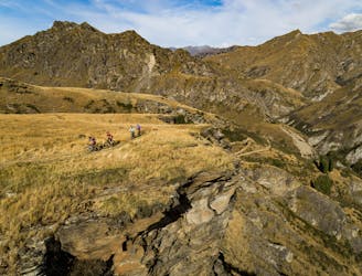
50km Backcountry singletrack
Moderate Mountain Biking

Gentle farm track with some hairy navigation and scrambling thrown in around Mt Burke
Difficult Trail Running

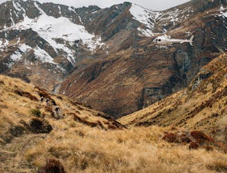
Southern Lakes Heli Bike High Country Classic
Moderate Mountain Biking

Family friendly bike trail
Moderate Mountain Biking

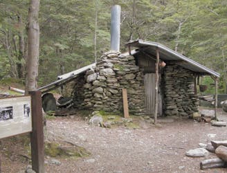
Hike to historic Stone Hut
Difficult Hiking

Take a left turn after the first waterfall from the lodge.
Moderate Hiking

1.5 hours one way - 5km
Moderate Hiking

1.5 hours one way - 5km
Moderate Hiking

2.5 hours one way - 7km
Moderate Hiking

Routeburn Track to górski szlak łączący dwa wyjątkowe parki Narodowe, Fiordland i Mount Aspiring.
Difficult Hiking
This well formed track features rivers, a waterfall, a historic hut/tunnel, native bush and views
Moderate Trail Running
Estuary Burn North East Branch
Moderate Mountain Biking

Lakeside trail surrounded by mountains
Moderate Trail Running

Coronet Peak trails
Difficult Trail Running