2.1 km away
Speicher Durlaßboden & Trissalm
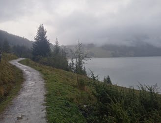
A beautiful loop around 2 gorgeous lakes and a short detour up to a rustic mountain hut.
Moderate Mountain Biking
- Distance
- 17 km
- Ascent
- 436 m
- Descent
- 437 m
A satisfying ride up into a barren valley and then a great, rocky descent.
Mountain Biking Difficult

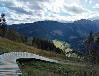
This is a brilliant trip into a desolate valley, which would - in itself - make it a worthwhile trip. The addition of a fun descent down some natural-feeling singletrail only adds to the appeal.
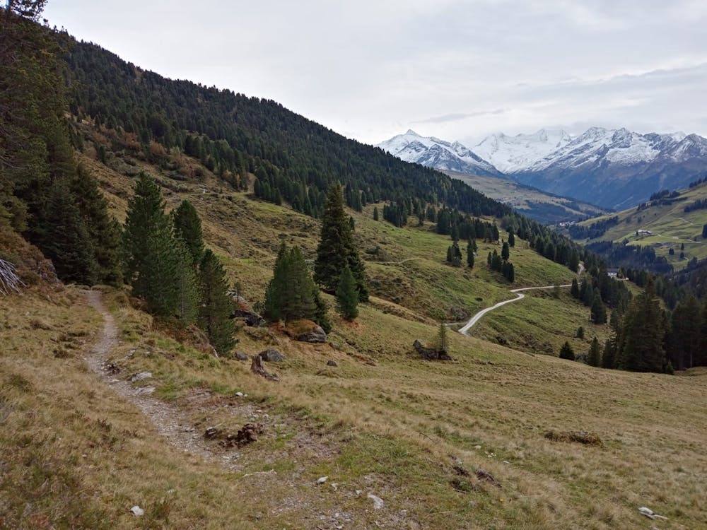
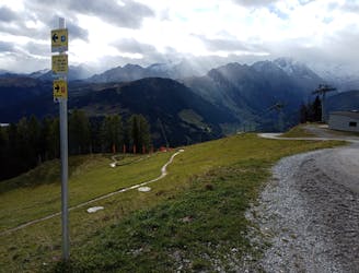
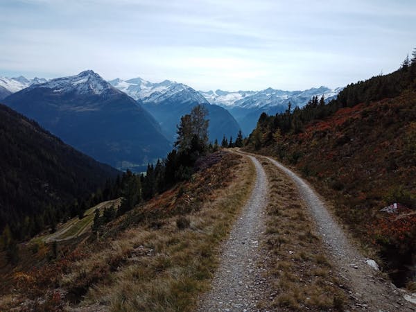
The trip starts on the road which links Königsleiten and Wald im Pinzgau. There is some parking at the start of the route but not that much, so be prepared to park in Königsleiten then put in a little extra effort getting to and from the trip.
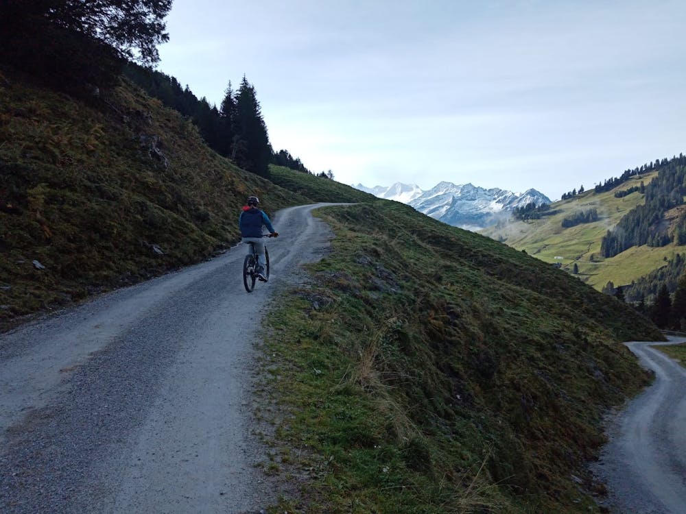
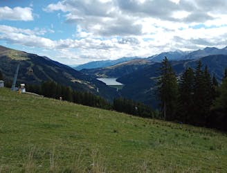
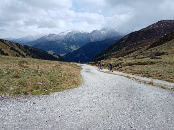
Leave the road behind and head north-west on a good, smooth jeep track. The track is easy to travel up and never gets particularly steep so the height gain feels easy enough, and the views are utterly spectacular throughout. Just when you're finding your rhythm you'll arrive at the Salzachjochhütte, which is a great spot at which to grab a coffee before doing the next part of the ascent.
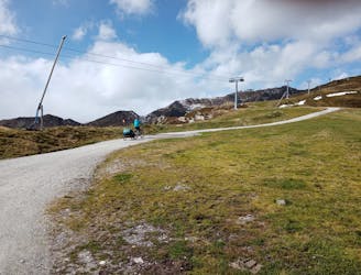
Newly full of caffeine, carry on going up the jeep track as it continues to climb into the upper part of the Salzach valley. The track crosses the river at the foot of the valley and then climbs up to a remote farm, at which point the hard part of the day is done, and the fun bit is about to begin!
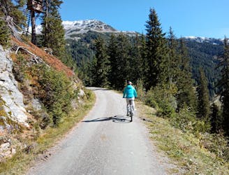
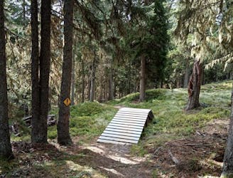
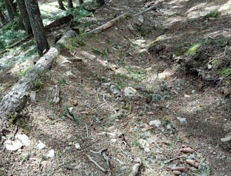
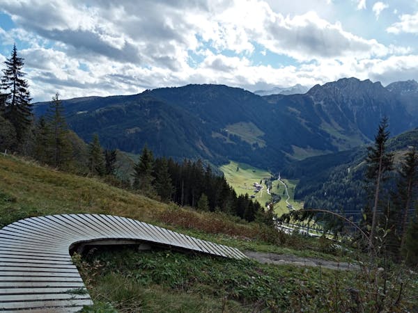
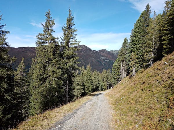
Drop into the (signposted) singletrail immediately south of the farm and follow it as it descends along the Salzach valley's eastern slope. The riding is never difficult, but it's never easy either - the trail has a real natural feel and is rocky throughout, meaning that interest is maintained but there are no significant obstacles. Sooner than you'd like you'll find yourself making the final steep descent to the Salzachjochhütte. Grab another coffee and go for another lap down the trail! Alternatively, roll back down the jeep track to your start point.
Difficult
Mostly stable trail tread with some variability featuring larger and more unavoidable obstacles that may include, but not be limited to: bigger stones, roots, steps, and narrow curves. Compared to lower intermediate, technical difficulty is more advanced and grades of slopes are steeper. Ideal for upper intermediate riders.

The trail contains some obstacles such as outcroppings and rock which could cause injury.

Little chance of being seen or helped in case of an accident.
2.1 km away
A beautiful loop around 2 gorgeous lakes and a short detour up to a rustic mountain hut.
Moderate Mountain Biking
6.9 km away
A beautiful cruise into a peaceful valley.
Moderate Mountain Biking
7.8 km away
One of the most fun runs in the Austrian Alps!
Difficult Mountain Biking
7.8 km away
A short and tricky detour from the ISS Flow trail.
Severe Mountain Biking
7.8 km away
The toughest line at Isskogelbahn!
Extreme Mountain Biking
7.8 km away
A brilliant and technical journey beneath the Isskogelbahn cables.
Severe Mountain Biking
7.8 km away
Smile-inducing riding on a natural, rocky trail.
Difficult Mountain Biking
7.8 km away
A gorgeous ride far from the crowds.
Moderate Mountain Biking
4 routes · Mountain Biking
5 routes · Mountain Biking
5 routes · Mountain Biking · Hiking

24 routes · Mountain Biking
10 routes · Mountain Biking