1.3 km away
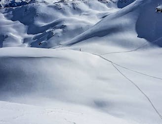
Steep couloirs of Wanglspitz N Face

Steep challenging couloirs for experts only.
Extreme Freeride Skiing
- Distance
- 2.9 km
- Ascent
- 5 m
- Descent
- 712 m
Long and delightful route down the Horberg Valley
Freeride Skiing Difficult

From the top of the Horbergjoch chairlift at 2460m you need to head N through a windy gap between the Horbergjoch on the left and a smaller mountain on the right. Carry straight on until you have a nice view into the small valley. Follow this valley now for about 4.5 kilometres with a mixture of steeper and flatter parts. There are also have some rocks and cliffs which you can use for some air time! At the height of 2200m the valley turns E and you will notice a small river cutting a canyon in it. There are just a few possibilities to get over it. It is advisable to stay on the left side when skiing down, this will be the SW face of Horbergkarspitz. It's very sunny here especially at the early afternoon. When following the valley, you will soon notice a road leading out, stay on this road as soon as you are at 1900 m, before it heads into the woods. This will bring you immediately back to the famous Penken park, where you can do some flips and spins before heading for the next run! For this route you should have a good weather and good visibility, because for the first two kilometres you are well away from the resort otherwise it could be disorientating.
Difficult
Serious gradient of 30-38 degrees where a real risk of slipping exists.

As well as the slope itself, there are some obstacles (such as rock outcrops) which could aggravate injury.

Little chance of being seen or helped in case of an accident.
1.3 km away
Steep challenging couloirs for experts only.
Extreme Freeride Skiing
1.3 km away

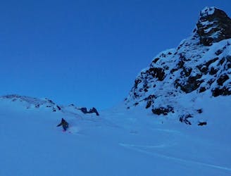
Delightful ride from Wanglspitz onto its' North face into the Hoarbergkar
Difficult Freeride Skiing
1.3 km away

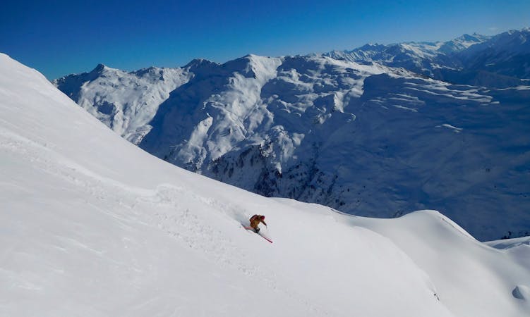
A spectacular run on the E face of Wanglspitz
Severe Freeride Skiing
1.3 km away

Short powder run, easy on sunny days and usually safe on foggy ones.
Moderate Freeride Skiing
2.1 km away

Freeride route with 300m of easily accessible powder,
Difficult Freeride Skiing
5.6 km away
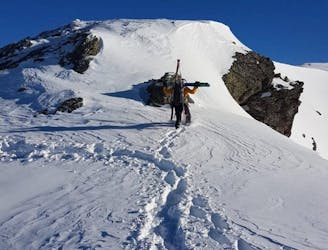
A higher entrance to the famous bowl (if you are happy to hike/climb)
Severe Freeride Skiing
5.6 km away
The Big Mountain Contest face and THE extreme line in Hochfügen
Extreme Freeride Skiing
5.6 km away

Easy accessible steep route. If you hike it is possible to enjoy a longer run.
Severe Freeride Skiing
5.6 km away
True Classic of the Region. Start in Hochfügen itself.
Difficult Freeride Skiing
5.6 km away

Steep and difficult route in a wide couloir of the Pfaffenbühel, good snow conditions required.
Severe Freeride Skiing

7 routes · Freeride Skiing
6 routes · Freeride Skiing
6 routes · Freeride Skiing

50 routes · Freeride Skiing · Ski Touring

10 routes · Freeride Skiing

10 routes · Freeride Skiing