7 m away
Wanglalm to 150er

Short powder run, easy on sunny days and usually safe on foggy ones.
Moderate Freeride Skiing
- Distance
- 2.7 km
- Ascent
- 5 m
- Descent
- 715 m
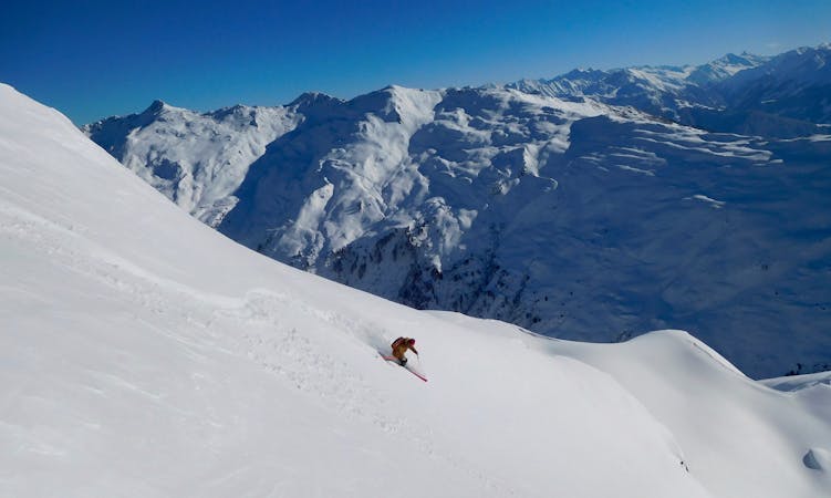
Delightful ride from Wanglspitz onto its' North face into the Hoarbergkar
Freeride Skiing Difficult
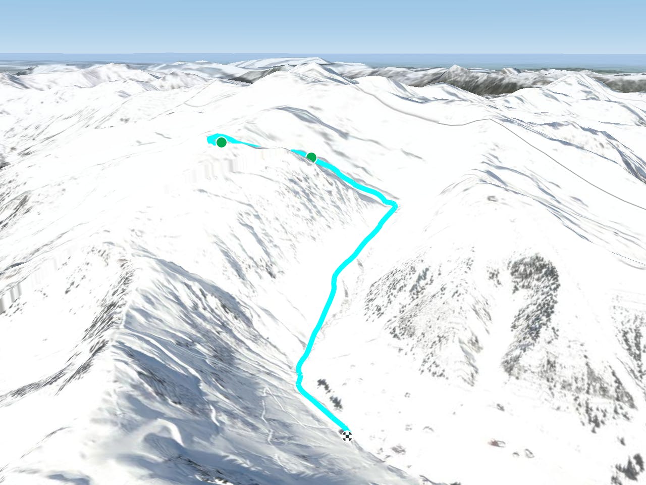
From the top of 150 Tux descend blue slope 6 the exit it to the right when it flattens. Drop into the wide slope here, which is mostly shady in the early winter. The angle here is about 35° and there are some rocks too, some of which you can jump off. After 500 m you will notice a ridge in the middle of the slope, which you can go either side of. If you go left you have a nice slope to ski down, but be aware of the gorge below. You will exit at the bottom of the valley at the same spot as the route of Hoarbergjoch Nord and follow the tracks to the Penken park. if you go right of the ridge the slope is more E facing. There are no difficulties in it, so enjoy the run with long and nice turns in the powder. Before reaching the valley bottom here stay at the right and cross the east exposed hill of the Wanglspitz. Have a look at the nice couloirs, which are described separately, also make sure you check the avalanche safety here while crossing. Especially in March or April it is possible that naturally triggered avalanches come down here. Follow the tracks back to the 150er cablecar. This route can be good for freeriders of limited experience and can give light and fluffy powder in the spring when it is heavy to ski at other spots.
Difficult
Serious gradient of 30-38 degrees where a real risk of slipping exists.

As well as the slope itself, there are some obstacles (such as rock outcrops) which could aggravate injury.

Little chance of being seen or helped in case of an accident.
7 m away
Short powder run, easy on sunny days and usually safe on foggy ones.
Moderate Freeride Skiing
15 m away

Steep challenging couloirs for experts only.
Extreme Freeride Skiing
28 m away

A spectacular run on the E face of Wanglspitz
Severe Freeride Skiing
1.3 km away
Long and delightful route down the Horberg Valley
Difficult Freeride Skiing
1.5 km away

Freeride route with 300m of easily accessible powder,
Difficult Freeride Skiing
6 km away

Beautiful route on the Beilspitz NW face
Difficult Freeride Skiing
6 km away

Hike and Ride Route in the area of Eggalm. Bus ride back required
Difficult Freeride Skiing
6.8 km away
A higher entrance to the famous bowl (if you are happy to hike/climb)
Severe Freeride Skiing
6.8 km away
The Big Mountain Contest face and THE extreme line in Hochfügen
Extreme Freeride Skiing
6.8 km away
True Classic of the Region. Start in Hochfügen itself.
Difficult Freeride Skiing

7 routes · Freeride Skiing
6 routes · Freeride Skiing
6 routes · Freeride Skiing

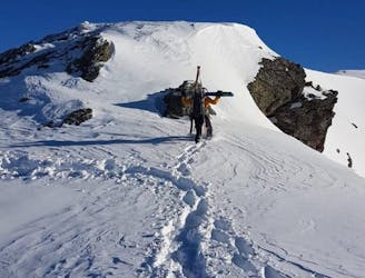
50 routes · Freeride Skiing · Ski Touring

10 routes · Freeride Skiing

10 routes · Freeride Skiing