22 m away
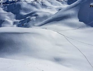
Steep couloirs of Wanglspitz N Face

Steep challenging couloirs for experts only.
Extreme Freeride Skiing
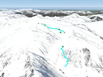
- Distance
- 2.9 km
- Ascent
- 5 m
- Descent
- 712 m
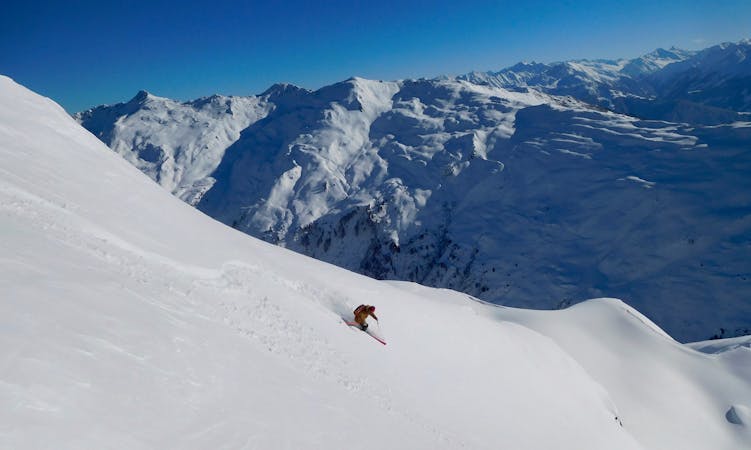
A spectacular run on the E face of Wanglspitz
Freeride Skiing Severe

Take the 150er cable car and from the lift check out the face, where you are going to do your line in a few minutes. From the top of the lift follow the ski track to the west, taking a sharp left turn to get on the red piste number 66. Here you have a great opportunity to take some snapshots of the breathtaking panorama of the surrounding mountains or carve some turns into the snow! Stay on the slope for about 200 m but before reaching the steeper part you need to head off the piste on the left. You can ski straight onto the hill, but keep your eyes peeled because there are some cliffs here which are not so visible from above. In a few places it is also possible to jump over these big cliffs, if you are brave enough! Following the the cliff section after about 300m the hill gets splits in two. The S part on the right is a big 35° slope. It is nice to do some long and fast turns, but especially in spring there is less snow than in other spots and the snow softens really early. The left split on the E contains some steep couloirs and you can ski between some rock ridges. Again there are also some big cliff jumps possible, but be sure of the landing and the snow is safe! All the lines meet in a flat part directly under the 150er and you head easily back to the lift.
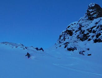
Severe
Steep skiing at 38-45 degrees. This requires very good technique and the risk of falling has serious consequences.

As well as the slope itself, there are some obstacles (such as rock outcrops) which could aggravate injury.
Away from help but easily accessed.
22 m away
Steep challenging couloirs for experts only.
Extreme Freeride Skiing
28 m away

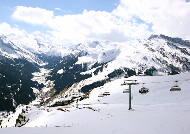
Delightful ride from Wanglspitz onto its' North face into the Hoarbergkar
Difficult Freeride Skiing
29 m away

Short powder run, easy on sunny days and usually safe on foggy ones.
Moderate Freeride Skiing
1.3 km away
Long and delightful route down the Horberg Valley
Difficult Freeride Skiing
1.6 km away

Freeride route with 300m of easily accessible powder,
Difficult Freeride Skiing
6 km away

Beautiful route on the Beilspitz NW face
Difficult Freeride Skiing
6 km away

Hike and Ride Route in the area of Eggalm. Bus ride back required
Difficult Freeride Skiing
6.8 km away
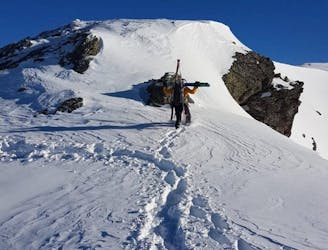
A higher entrance to the famous bowl (if you are happy to hike/climb)
Severe Freeride Skiing
6.8 km away
The Big Mountain Contest face and THE extreme line in Hochfügen
Extreme Freeride Skiing
6.8 km away
True Classic of the Region. Start in Hochfügen itself.
Difficult Freeride Skiing

7 routes · Freeride Skiing
6 routes · Freeride Skiing
6 routes · Freeride Skiing

50 routes · Freeride Skiing · Ski Touring

10 routes · Freeride Skiing

10 routes · Freeride Skiing