1.5 km away
Wanglalm to 150er

Short powder run, easy on sunny days and usually safe on foggy ones.
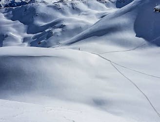
Moderate Freeride Skiing
- Distance
- 2.7 km
- Ascent
- 5 m
- Descent
- 715 m
Freeride route with 300m of easily accessible powder,
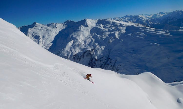
Freeride Skiing Difficult

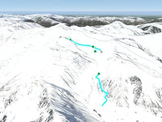
The route from the 2278m high Horbergkarspitz down into the Horberg-Valley offers you more than 300m of powder descent with steep parts, cliffs and ridges at the beginning and a wide hill for big and fast turns at the end. Only do this run in fine weather with good vis. When leaving the Schneekarlift go past the Unterbergalm lift on the left, follow the ski track for about 100 m and stay left. When the track does a turn to the right, then go left in direction of the avalanche barriers on the east hill. Follow this path about 150 m until you can look down into the Horberg Valley. From here there are three couloirs you can drop into. Dropping over cliffs of every size at the top and doing one of the best lines you will ever have at the bottom of the run will make this run unforgettable. If there is not much snow avoid the snowy ridges to the sides of the couloirs as they will have rocks in them. Be aware of avalanches and think of keeping a safety gap when dropping in at the steep parts on top. Ending up on a skiroad leading out of the small valley through the woods, will bring you immediately back to the famous Penken park, where you can do some flips and spins before heading over for the next run!
Difficult
Serious gradient of 30-38 degrees where a real risk of slipping exists.

As well as the slope itself, there are some obstacles (such as rock outcrops) which could aggravate injury.
Away from help but easily accessed.
1.5 km away
Short powder run, easy on sunny days and usually safe on foggy ones.
Moderate Freeride Skiing
1.5 km away

Delightful ride from Wanglspitz onto its' North face into the Hoarbergkar
Difficult Freeride Skiing
1.5 km away

Steep challenging couloirs for experts only.
Extreme Freeride Skiing
1.6 km away

A spectacular run on the E face of Wanglspitz
Severe Freeride Skiing
2.1 km away
Long and delightful route down the Horberg Valley
Difficult Freeride Skiing
6.5 km away
A higher entrance to the famous bowl (if you are happy to hike/climb)
Severe Freeride Skiing
6.6 km away
True Classic of the Region. Start in Hochfügen itself.
Difficult Freeride Skiing
6.6 km away
The Big Mountain Contest face and THE extreme line in Hochfügen
Extreme Freeride Skiing
6.6 km away

Easy accessible steep route. If you hike it is possible to enjoy a longer run.
Severe Freeride Skiing
6.6 km away

Steep and difficult route in a wide couloir of the Pfaffenbühel, good snow conditions required.
Severe Freeride Skiing

7 routes · Freeride Skiing
6 routes · Freeride Skiing
6 routes · Freeride Skiing

50 routes · Freeride Skiing · Ski Touring

10 routes · Freeride Skiing

10 routes · Freeride Skiing