680 m away
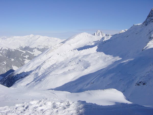
Kaserer

A short but intense line
Difficult Freeride Skiing
- Distance
- 496 m
- Ascent
- 0 m
- Descent
- 224 m
Classic. Limited ascent, not difficult, but fairly remote.
Freeride Skiing Difficult

Classic. Limited ascent, not difficult, but fairly remote. If you want to ascent Kleiner Kaserer, make sure you bring adequate equipment, the climb is a little airy.
Leave the the Kaserer II T-Bar and ascent towards a ridge between the Summit of Kleiner Kaserer and Grosser Kaserer. If you feel like it, leave the skis here and summit Kleiner Kaserer on your right. I do think the north face is skiable, but I never tried, so just to enjoy the scenery.
The real route starts on the ridge over to Schmirn. Route finding is obvious, the run is not technical, but the snow conditions are often mixed. Ski down the flank, once you reach the valley, stay skiers left of the creek. The valley is fairly narrow, with no escape if the snow conditions are sketchy. Especially in spring this route does get tracks, the scenery is nothing short of stunning. The route ends at a parking in Toldern.
Difficult
Serious gradient of 30-38 degrees where a real risk of slipping exists.

As well as the slope itself, there are some obstacles (such as rock outcrops) which could aggravate injury.

Little chance of being seen or helped in case of an accident.
680 m away
A short but intense line
Difficult Freeride Skiing
1.1 km away

A sunny, nice ride with a small channel at the end.
Difficult Freeride Skiing
1.4 km away

A sunny line, recommended in Spring
Difficult Freeride Skiing
1.7 km away

A short but impressive route on a wide glacier hill.
Difficult Freeride Skiing
1.7 km away

A breathtaking route here in Hintertux, the biggest and longest adventure in these parts.
Severe Freeride Skiing
2.1 km away

An easily accessible route down to the Schlegeis chairlift
Difficult Freeride Skiing
2.2 km away

A short route which is easily accessible.
Difficult Freeride Skiing
3.2 km away

An easy route with a short hike which is nice on busy days
Difficult Freeride Skiing
3.7 km away

A short hike for long and joyful descent
Difficult Freeride Skiing
3.7 km away

This route is a classic line here in Hintertux. Easy accessible, there is only a short hike needed.
Difficult Freeride Skiing

7 routes · Freeride Skiing
7 routes · Freeride Skiing

10 routes · Freeride Skiing

10 routes · Freeride Skiing