2.4 km away
The Legendary Zirbenweg
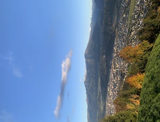
A stunning traverse high above the Inn valley, this is one of the most famous hikes in the Tirol.
Moderate Hiking
- Distance
- 7.5 km
- Ascent
- 257 m
- Descent
- 162 m
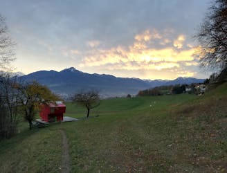
A classic hiking tour with a beautiful view of the impressive Serles northface.
Hiking Moderate

The starting point for this hike is located at the bottom of the Patscherkofel gondela. You can get there by car or with the J bus line straight out of the city centre of Innsbruck.
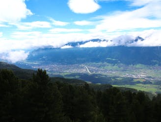
At the beginning of the hike you follow the trail to the Heiligwasser chapel, a place with a strong christian background. Feel free to try if the water of the spring also has an impact on your well-being, while you enjoy the view over the Inn valley.
Now you follow the track further uphill and cross the skiing slope. Back in the shade of the trees you keep hiking until the the Almenweg 1600 is reached and directs you towards the Patscher hut.
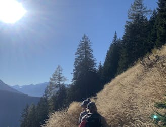
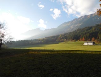
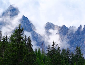
If no clouds block the view, the following trail offers a perfect view of the Serles peak and the higher Stubaier alps, where you can spot the remaining glacier icefields.
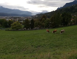
When the open meadows end and the trail reaches the forest again the route follows the edge of the forest and turns left (south) at the parting of the way until a gravel road is reached.
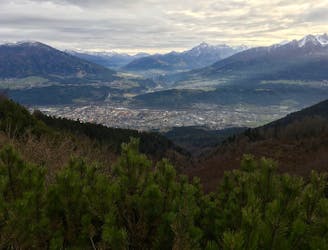
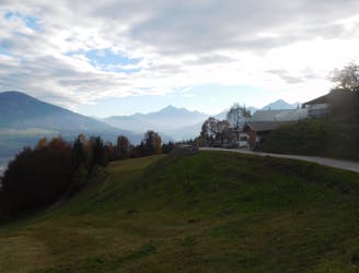
You then have to follow this road for two turns, until the Patscher hut is reached and awaits its guest with a view over Innsbruck and the mighty Nordkette and some good food.
This route follows a slightly different route for the descent. Families with kids might want to descend via the uphill route.
A few meters after the first turn of the gravel road you head onto the hiking trail on the right (east) and until the gravel road is reached. The trail continues onto this road until a crossroad leads to the trail we took uphill. Instead of crossing the slope this time you take the steeper but faster trail down the mountain to the parking lot.
Moderate
Hiking along trails with some uneven terrain and small hills. Small rocks and roots may be present.

The path is on completely flat land and potential injury is limited to falling over.
Close to help in case of emergency.
2.4 km away
A stunning traverse high above the Inn valley, this is one of the most famous hikes in the Tirol.
Moderate Hiking
5.3 km away
A long hiking loop over the Morgenkogel ridge with a stunning view
Severe Hiking
6.4 km away
A steep and strenuous hike to one of the best situated huts in Tirol.
Difficult Hiking
7 km away
A lovely, sunny walk suitable for the whole family.
Moderate Hiking
7.1 km away
A beautiful easy hike to a sunny vantage point above Innsbruck.
Easy Hiking
7.5 km away
Possibly the most popular hike in Innsbruck and for good reason - this is a lovely little trip.
Moderate Hiking
7.5 km away
A lovely, easy traverse to a charming Tirolian town.
Moderate Hiking
7.7 km away
A gorgeous walk between 2 easily-accessed villages.
Moderate Hiking
7.9 km away

Sophisticated alpine hike that offers a great variation of landscapes ending in a ridge with moderate climbing passages.
Severe Hiking
8.3 km away
An ideal trip for families to a truly unique mountain restaurant.
Easy Hiking

8 routes · Hiking

5 routes · Hiking

9 routes · Hiking

6 routes · Hiking

25 routes · Hiking
7 routes · Hiking