178 m away
Escalator

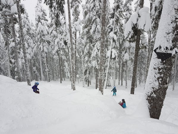
Short and Sweet. A fun steep pitch heading down to Doom & Gloom
Severe Freeride Skiing
- Distance
- 261 m
- Ascent
- 0 m
- Descent
- 112 m
Steep chute. Tight. Quite blind.
Freeride Skiing Severe

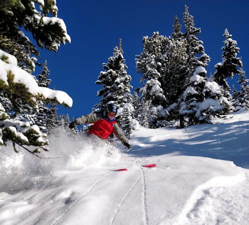
This is a popular freeride skiing route which is generally considered to be severe. It's remote, it features medium exposure (e2) and is typically done between January and March. From a low point of 1.6 km to the maximum altitude of 1.8 km, the route covers 302 m, 0 vertical metres of ascent and 162 vertical metres of descent.
The tightness of the chute turns it into a straightline. It's easy to get cliffed out in the area. A traverse through the branches of tight trees is required. The actual straightline is quite blind. Send it and pray!
Severe
Steep skiing at 38-45 degrees. This requires very good technique and the risk of falling has serious consequences.

As well as the slope itself, there are some obstacles (such as rock outcrops) which could aggravate injury.
Away from help but easily accessed.
178 m away
Short and Sweet. A fun steep pitch heading down to Doom & Gloom
Severe Freeride Skiing
232 m away

Steep chute into Doom & Gloom
Severe Freeride Skiing
360 m away

A steep little chute with a long run out.
Severe Freeride Skiing
451 m away

Fun gladed skiing, often with great snow
Difficult Freeride Skiing
632 m away

A short pitch, often forgotten about on a powder day
Difficult Freeride Skiing
671 m away

Whistler Blackcomb's most famous line. Burley, Insane, Massive, Sketchy, Epic! SEND IT.
Extreme Freeride Skiing
901 m away

Steep line that works its way between the rocks before dropping into West Bowl
Difficult Freeride Skiing
955 m away

You're on West Ridge and gladed skiing isn't your thing...
Difficult Freeride Skiing
1 km away

Provides easier access to West Bowl along the ridge
Difficult Freeride Skiing
1 km away

Hollywood Cliff of Kings
Extreme Freeride Skiing
8 routes · Freeride Skiing
3 routes · Freeride Skiing