710 m away
Tête Rousse Hut
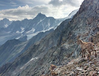
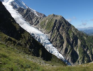
A challenging loop showcasing the diversity of the Mont Blanc mountain range.
Severe Hiking
- Distance
- 23 km
- Ascent
- 2.2 km
- Descent
- 2.2 km
Same day summit push from the valley floor
Hiking Extreme

This is a popular hiking route which is generally considered to be extreme. It's remote, it features extreme exposure and is typically done between June and August. From a low point of 1.1 km to the maximum altitude of 4.8 km, the route covers 38 km, 3797 vertical metres of ascent and 3804 vertical metres of descent.

Incredible landscape from start to finish
Extreme
Scrambling up mountains and along technical trails with moderate fall exposure. Handholds are necessary to navigate the trail in its entirety, although they are not necessary at all times. Some obstacles can be very large and difficult to navigate, and the grades can often be near-vertical. The challenge of the trail and the steepness of the grade results in very strenuous hiking. Hikes of this difficulty blur the lines between "hiking" and "climbing".

Some trail sections are extremely exposed where falling will almost certainly result in serious injury or death.

Away from help but easily accessed.
710 m away
A challenging loop showcasing the diversity of the Mont Blanc mountain range.
Severe Hiking
1.3 km away
Easy hike to the statue du Christ-Roi.
Moderate Hiking
2.2 km away
A pleasant hike with views of the Mont Blanc Massif
Moderate Hiking
2.5 km away
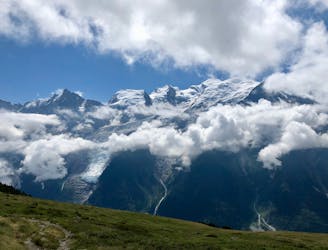
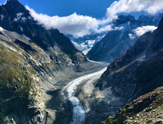
Day 2: An excellent day taking in a huge variety of views, from alpine meadows to hanging glaciers and rocky ridges.
Difficult Hiking
2.8 km away

While one of the less interesting sections of the TMB, this stretch still offers a few hidden trail gems.
Moderate Hiking
3.5 km away
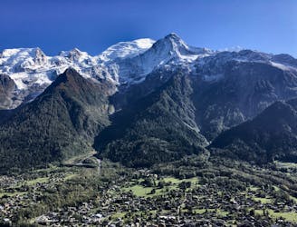
A famous hike which was the starting point for Jacques Balmat and Michel Paccard when they made the first ascent of Mont Blanc in 1786.
Difficult Hiking
5.8 km away

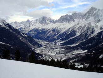
Day 1: A gentle downhill day on the sun-kissed south-facing slopes of the Brévent peak.
Moderate Hiking
5.8 km away

Circumnavigate the iconic Mont Blanc massif on this epic multi-day route.
Severe Hiking
6.4 km away
Packed with incredible views—likely the best bang-for-your-buck hike in Chamonix!
Difficult Hiking
6.6 km away

Escape the crowds at Lac Blanc by hiking to Lac Cornu instead.
Severe Hiking

6 routes · Hiking

14 routes · Hiking

5 routes · Hiking

12 routes · Hiking

10 routes · Hiking