1.5 km away
Passage du Dérochoire
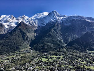
A stunning loop taking in some of the best Mont Blanc views you'll find
Difficult Hiking
- Distance
- 14 km
- Ascent
- 1.2 km
- Descent
- 1.2 km
Discover Europe's largest limestone pavement formation ("désert de Platé")
Hiking Severe

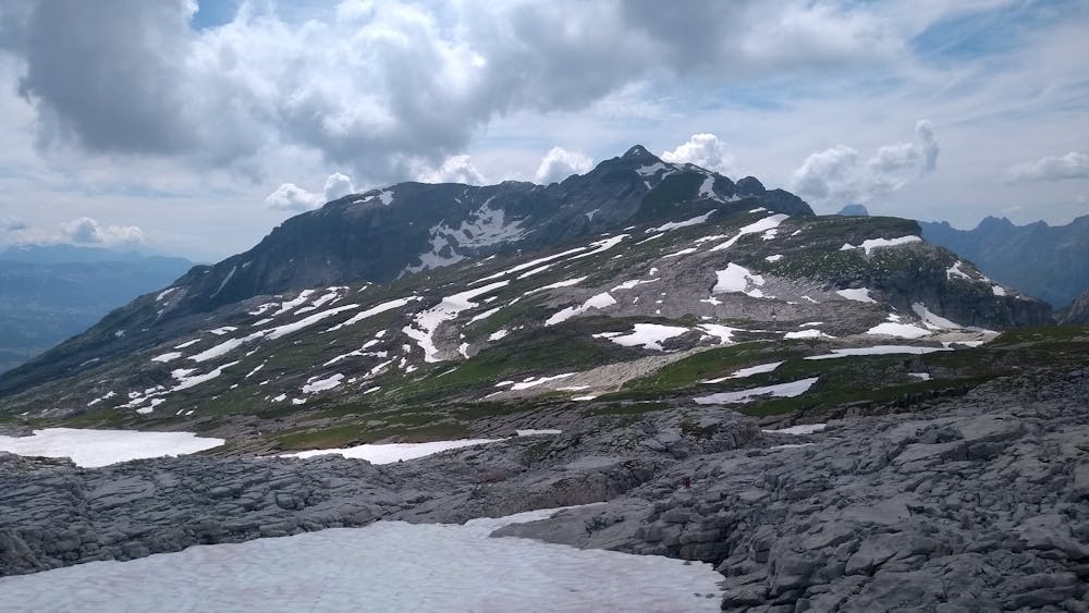
The hike to Tête du Colonney is a challenging one—especially as you reach the summit and the trail is on an exposed ridge. But if your goal is only to visit the limestone pavements, you can safely skip that last bit and stick to the loop around the “désert de Platé” and still enjoy an amazing day out in the mountains. It’s a good idea to start the hike early, as parking space is scarce near the trailhead and there are no water fountains along the trail (excluding refuges), which can make the climb extra hard on warm summer days.
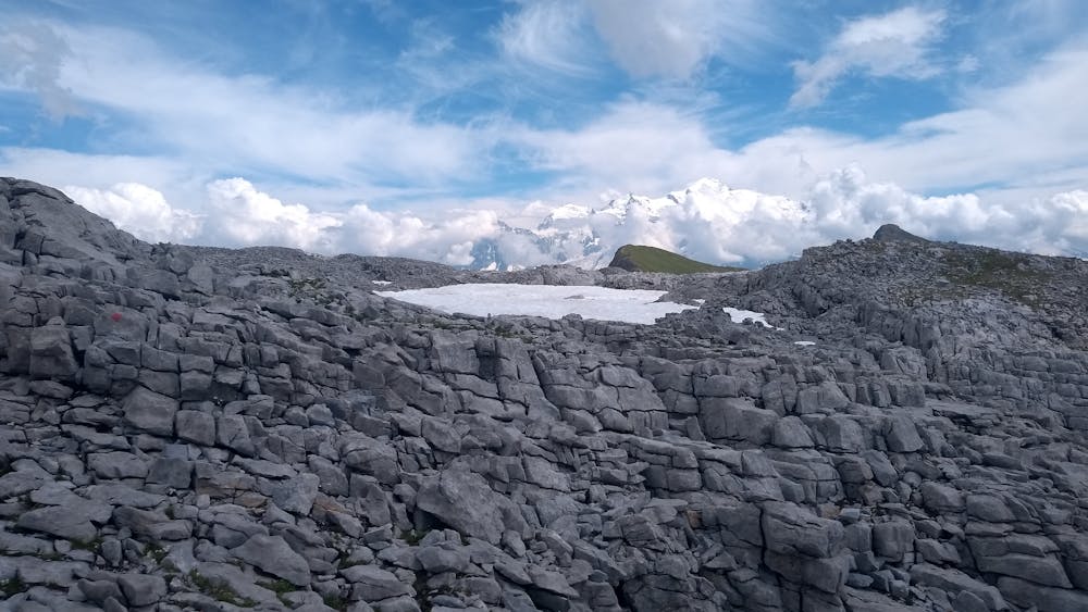
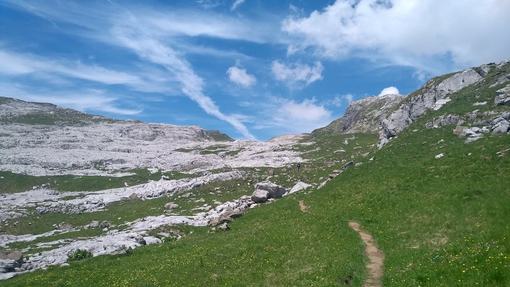
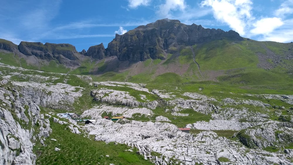
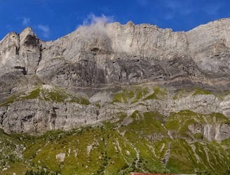
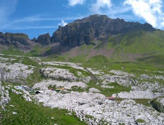
After a brief warm-up on a dirt road, the trail quickly get steeper as you approach the bottom of the désert via a crack in the cliff (les Egratz); this part can be a bit slippery on wet days, but nothing to be too afraid of. Once you’ve passed it, the slope becomes gentler and you’re going to start noticing more and more limestone pavements in all their diversity. By the time you’ve reached the refuge de Platé, you should have a better idea of what to expect for the rest of the day.
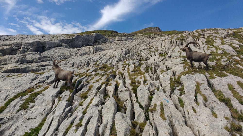
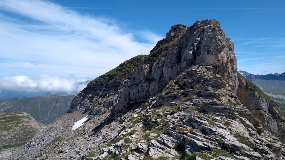
Next, I suggest following a counter-clockwise route to the summit by taking the trail leading to Grandes Platières. The trail can prove elusive at times, especially when you’re hiking on the limestone where markings can be a bit faded, but if you keep climbing, you’ll usually find it again after a few meters. Eventually, you’ll reach col du Colonney, where the trail starts to somewhat follow the ridgeline towards Tête de Monthieu first then Tête des Lindars.
Note that if you don’t feel like going all the way to the top, you can choose to turn right towards Grandes Platières. There’s a restaurant and a lift connecting to Flaine ski resort, great views of the Fiz range, and it’s quite fun to navigate the limestone to reach it.
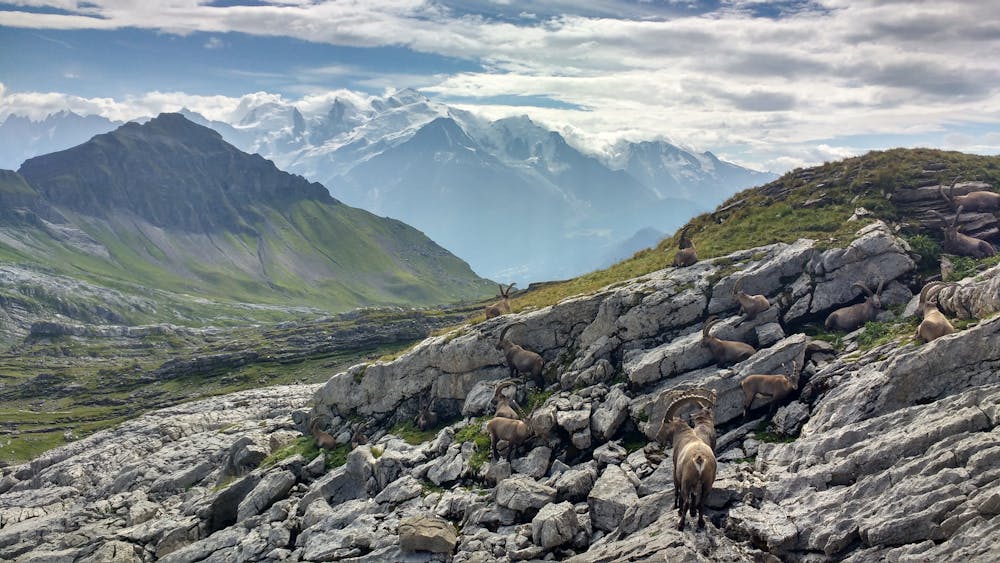
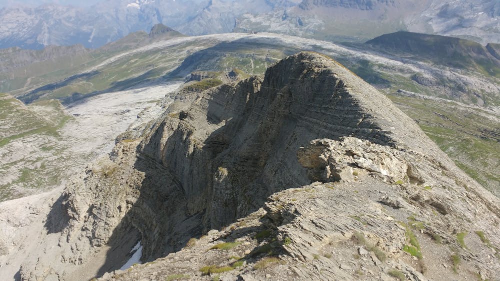
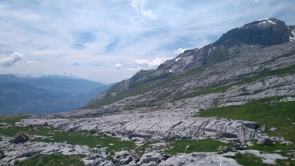
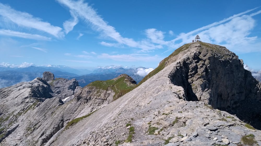
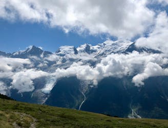
As previously noted, the last section of trail before the summit is rather exposed and can be particularly dangerous on windy/wet days, so don’t overestimate you abilities before making the final push. From the top, you’ll be able to enjoy a panoramic view of the désert but also of the nearby Aravis range.
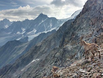
The descent starts off by having you retrace your steps until you reach the ski lift, but then you’ll want to turn right. This trail will take you more quickly to the refuge, but is also less traveled (possibly because it’s a bit more technical) and will give you more opportunities to see ibexes, if you haven’t seen any so far. At the refuge, simply follow the trail that you took on the way up to get back to the car park.
Severe
Hiking challenging trails where simple scrambling, with the occasional use of the hands, is a distinct possibility. The trails are often filled with all manner of obstacles both small and large, and the hills are very steep. Obstacles and challenges are often unexpected and can be unpredictable.

Some trail sections are extremely exposed where falling will almost certainly result in serious injury or death.

Away from help but easily accessed.
1.5 km away
A stunning loop taking in some of the best Mont Blanc views you'll find
Difficult Hiking
1.5 km away
Beautiful loop with enough alternatives to fit any hiker's taste and endurance
Severe Hiking
8.3 km away
Easy hike to the statue du Christ-Roi.
Moderate Hiking
8.3 km away
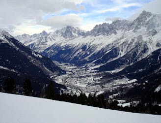
A pleasant hike with views of the Mont Blanc Massif
Moderate Hiking
8.7 km away
A challenging loop showcasing the diversity of the Mont Blanc mountain range.
Severe Hiking
8.8 km away

While one of the less interesting sections of the TMB, this stretch still offers a few hidden trail gems.
Moderate Hiking
9.1 km away

Circumnavigate the iconic Mont Blanc massif on this epic multi-day route.
Severe Hiking
9.1 km away

Day 1: A gentle downhill day on the sun-kissed south-facing slopes of the Brévent peak.
Moderate Hiking
9.2 km away
Day 2: An excellent day taking in a huge variety of views, from alpine meadows to hanging glaciers and rocky ridges.
Difficult Hiking

6 routes · Hiking

14 routes · Hiking

5 routes · Hiking

12 routes · Hiking