8 m away
Tour des Fiz
Beautiful loop with enough alternatives to fit any hiker's taste and endurance
Severe Hiking
- Distance
- 33 km
- Ascent
- 2.3 km
- Descent
- 2.3 km
A stunning loop taking in some of the best Mont Blanc views you'll find
Hiking Difficult

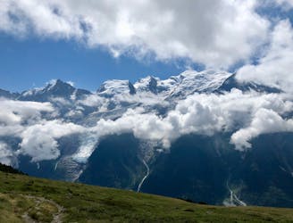
At the height of the summer Chamonix can be overwhelmingly busy, with the lifts and trails of the valley all full to capacity. The area above Plaine Joux, on the other hand, is often quiet to the point of feeling deserted, and this hike seems particularly neglected despite its quality.
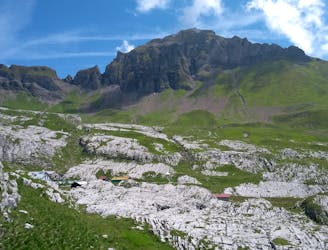
The trip begins and ends in Plaine Joux, a ski area whose parking area enjoys one of the finest views of any carpark in Europe! Begin by hiking out towards the intimidating rocky faces of the Rocher de Fiz either on the high path (drawn here) or on the lower track which pass Lac Vert and the Refuge Le Châtelet d'Ayères.
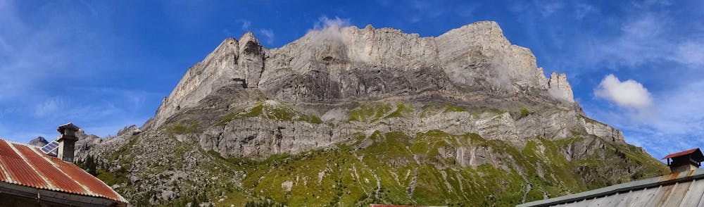
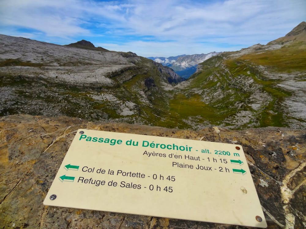
Both options converge at a cluster of tiny chalets (the Ayeres des Pierrieres) from where the steep and rocky ascent to the Passage du Dérochoire begins. The hiking is never technical but it's steep, loose and rocky, and there is a very easy section of scrambling close to the top. Keep on trucking all the way to the Passage itself and then turn back to enjoy a truly magnificent view across the highest mountain in the Alps!
Drop north off the Passage into a wild-feeling valley and descend (initially quite easily but increasingly steeply as you continue) down to the Refuge de Platé, which sits in a beautiful hanging bowl high above the Arve Valley. Get some calories on board and then descend the steep and spectacular path which winds down above, through and then beneath the spectacular cliffs and overhangs known as Les Miots.
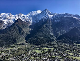
Once below the cliffs it's something of a slog, including a road section, back to Plaine Joux but it's a price well worth paying for such an exceptional hike.
Difficult
Hiking trails where obstacles such as rocks or roots are prevalent. Some obstacles can require care to step over or around. At times, the trail can be worn and eroded. The grade of the trail is generally quite steep, and can often lead to strenuous hiking.

Some trail sections have exposed ledges or steep ascents/descents where falling could cause serious injury.
Little chance of being seen or helped in case of an accident.
8 m away
Beautiful loop with enough alternatives to fit any hiker's taste and endurance
Severe Hiking
1.5 km away
Discover Europe's largest limestone pavement formation ("désert de Platé")
Severe Hiking
7.5 km away
A pleasant hike with views of the Mont Blanc Massif
Moderate Hiking
7.6 km away
Easy hike to the statue du Christ-Roi.
Moderate Hiking
7.8 km away

Circumnavigate the iconic Mont Blanc massif on this epic multi-day route.
Severe Hiking
7.8 km away

Day 1: A gentle downhill day on the sun-kissed south-facing slopes of the Brévent peak.
Moderate Hiking
7.9 km away

While one of the less interesting sections of the TMB, this stretch still offers a few hidden trail gems.
Moderate Hiking
8.2 km away
A challenging loop showcasing the diversity of the Mont Blanc mountain range.
Severe Hiking
8.9 km away

Escape the crowds at Lac Blanc by hiking to Lac Cornu instead.
Severe Hiking
9.1 km away
Day 2: An excellent day taking in a huge variety of views, from alpine meadows to hanging glaciers and rocky ridges.
Difficult Hiking

6 routes · Hiking

14 routes · Hiking

5 routes · Hiking

12 routes · Hiking